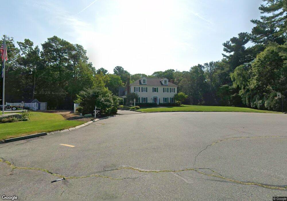
89 Pine Tree Ln Raynham, MA 02767
Estimated Value: $1,019,000 - $1,421,000
3
Beds
7
Baths
4,736
Sq Ft
$254/Sq Ft
Est. Value
About This Home
This home is located at 89 Pine Tree Ln, Raynham, MA 02767 and is currently estimated at $1,204,292, approximately $254 per square foot. 89 Pine Tree Ln is a home located in Bristol County with nearby schools including Merrill Elementary School, LaLiberte Elementary School, and Williams Intermediate School.
Ownership History
Date
Name
Owned For
Owner Type
Purchase Details
Closed on
Mar 14, 2003
Sold by
Bumila Frances S
Bought by
Trautman Susan Bumila
Current Estimated Value
Home Financials for this Owner
Home Financials are based on the most recent Mortgage that was taken out on this home.
Original Mortgage
$284,910
Outstanding Balance
$123,019
Interest Rate
5.94%
Mortgage Type
Purchase Money Mortgage
Estimated Equity
$1,081,273
Create a Home Valuation Report for This Property
The Home Valuation Report is an in-depth analysis detailing your home's value as well as a comparison with similar homes in the area
Home Values in the Area
Average Home Value in this Area
Purchase History
| Date | Buyer | Sale Price | Title Company |
|---|---|---|---|
| Trautman Susan Bumila | -- | -- |
Source: Public Records
Mortgage History
| Date | Status | Borrower | Loan Amount |
|---|---|---|---|
| Open | Trautman Susan Bumila | $284,910 |
Source: Public Records
Tax History
| Year | Tax Paid | Tax Assessment Tax Assessment Total Assessment is a certain percentage of the fair market value that is determined by local assessors to be the total taxable value of land and additions on the property. | Land | Improvement |
|---|---|---|---|---|
| 2025 | $13,848 | $1,144,500 | $212,200 | $932,300 |
| 2024 | $13,509 | $1,087,700 | $204,200 | $883,500 |
| 2023 | $12,420 | $913,200 | $183,600 | $729,600 |
| 2022 | $11,693 | $788,500 | $163,600 | $624,900 |
| 2021 | $11,466 | $780,500 | $155,600 | $624,900 |
| 2020 | $11,247 | $780,500 | $155,600 | $624,900 |
| 2019 | $11,107 | $780,500 | $155,600 | $624,900 |
| 2018 | $10,713 | $719,000 | $155,600 | $563,400 |
| 2017 | $10,369 | $689,900 | $147,600 | $542,300 |
| 2016 | $10,287 | $686,700 | $144,400 | $542,300 |
| 2015 | $8,908 | $584,500 | $144,500 | $440,000 |
Source: Public Records
Map
Nearby Homes
- 51 Tucker Terrace
- 14 Amber Way
- 55 Bally Dr
- 73 Raymond Ave
- 32 Kendall Ct
- 70 Sandy Hill Rd
- 96 Old Colony Ave Unit 212
- 96 Old Colony Ave Unit 222
- 96 Old Colony Ave Unit 231
- 96 Old Colony Ave Unit 215
- 96 Old Colony Ave Unit 558
- 1 Campbell Ct
- 96 Old Colony Ave Unit 264
- 22 Highland Rd Unit 29
- 10 Liberty St
- 9 Liberty St
- 82-2-0 Middleboro Ave
- 0 Oxbow Rd Unit 39-3
- 0 Oxbow Rd Unit 20-3
- 0 Oxbow Rd Unit 5-3 73420102
- 93 Pine Tree Ln
- 73 Pine Tree Ln
- 82 Pine Tree Ln
- 105 Pine Tree Ln
- 105 Pine Tree Ln Unit 1
- 105 Pine Tree Ln Unit 2
- 65 Pine Tree Ln
- 58 Pine Tree Ln
- 104 Pine Tree Ln
- 123 Pine Tree Ln
- 148 Linsay Dr
- 43 Pine Tree Ln
- 36 Tucker Terrace
- 34 Tucker Terrace
- 44 Pine Tree Ln
- 38 Tucker Terrace
- 32 Tucker Terrace
- 120 Pine Tree Ln
- 30 Tucker Terrace
- 139 Pine Tree Ln
Your Personal Tour Guide
Ask me questions while you tour the home.