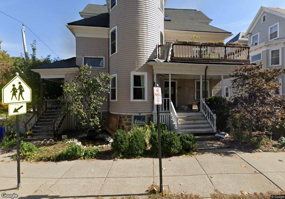
89 St Paul St Unit 1 Brookline, MA 02446
Coolidge Corner NeighborhoodEstimated Value: $1,042,000 - $1,467,000
3
Beds
2
Baths
1,326
Sq Ft
$941/Sq Ft
Est. Value
About This Home
This home is located at 89 St Paul St Unit 1, Brookline, MA 02446 and is currently estimated at $1,247,889, approximately $941 per square foot. 89 St Paul St Unit 1 is a home located in Norfolk County with nearby schools including Amos A. Lawrence School, Brookline High School, and St. Mary of the Assumption Elementary School.
Ownership History
Date
Name
Owned For
Owner Type
Purchase Details
Closed on
Aug 18, 2021
Sold by
89 Saint Paul Street Rt and Mallery
Bought by
Mallery Robert M and Huckfeldt Rachel
Current Estimated Value
Home Financials for this Owner
Home Financials are based on the most recent Mortgage that was taken out on this home.
Original Mortgage
$783,000
Outstanding Balance
$711,990
Interest Rate
2.9%
Mortgage Type
New Conventional
Estimated Equity
$535,899
Purchase Details
Closed on
Aug 19, 2020
Sold by
Mallery Robert M and Huckfeldt Rachel M
Bought by
89 Saint Paul Street Rt and Mallery
Purchase Details
Closed on
May 13, 2016
Sold by
Hulten Edward and Petrilo Sara
Bought by
Mallery Robert and Huckfeldt Rachel
Home Financials for this Owner
Home Financials are based on the most recent Mortgage that was taken out on this home.
Original Mortgage
$850,000
Interest Rate
4%
Mortgage Type
Purchase Money Mortgage
Purchase Details
Closed on
Apr 26, 2011
Sold by
Zeilinger Larisa
Bought by
Hulten Edward and Petrilo Sara
Home Financials for this Owner
Home Financials are based on the most recent Mortgage that was taken out on this home.
Original Mortgage
$417,000
Interest Rate
4.9%
Mortgage Type
Purchase Money Mortgage
Create a Home Valuation Report for This Property
The Home Valuation Report is an in-depth analysis detailing your home's value as well as a comparison with similar homes in the area
Home Values in the Area
Average Home Value in this Area
Purchase History
| Date | Buyer | Sale Price | Title Company |
|---|---|---|---|
| Mallery Robert M | -- | None Available | |
| Mallery Robert M | -- | None Available | |
| Mallery Robert M | -- | None Available | |
| 89 Saint Paul Street Rt | -- | None Available | |
| 89 Saint Paul Street Rt | -- | None Available | |
| 89 Saint Paul Street Rt | -- | None Available | |
| Mallery Robert | $915,000 | -- | |
| Mallery Robert | $915,000 | -- | |
| Hulten Edward | $574,000 | -- | |
| Hulten Edward | $574,000 | -- | |
| Hulten Edward | $574,000 | -- |
Source: Public Records
Mortgage History
| Date | Status | Borrower | Loan Amount |
|---|---|---|---|
| Open | Mallery Robert M | $783,000 | |
| Closed | Mallery Robert M | $783,000 | |
| Previous Owner | Mallery Robert | $850,000 | |
| Previous Owner | Hulten Edward | $417,000 | |
| Previous Owner | Hulten Edward | $13,500 |
Source: Public Records
Tax History Compared to Growth
Tax History
| Year | Tax Paid | Tax Assessment Tax Assessment Total Assessment is a certain percentage of the fair market value that is determined by local assessors to be the total taxable value of land and additions on the property. | Land | Improvement |
|---|---|---|---|---|
| 2025 | $9,424 | $954,800 | $0 | $954,800 |
| 2024 | $9,145 | $936,000 | $0 | $936,000 |
| 2023 | $8,177 | $820,200 | $0 | $820,200 |
| 2022 | $8,114 | $796,300 | $0 | $796,300 |
| 2021 | $7,726 | $788,400 | $0 | $788,400 |
| 2020 | $7,377 | $780,600 | $0 | $780,600 |
| 2019 | $6,967 | $743,500 | $0 | $743,500 |
| 2018 | $6,699 | $708,100 | $0 | $708,100 |
| 2017 | $6,477 | $655,600 | $0 | $655,600 |
| 2016 | $6,210 | $596,000 | $0 | $596,000 |
| 2015 | $5,786 | $541,800 | $0 | $541,800 |
| 2014 | $5,764 | $506,100 | $0 | $506,100 |
Source: Public Records
Map
Nearby Homes
- 98 Saint Paul St Unit A1
- 114 Saint Paul St Unit 5
- 57 Saint Paul St Unit 19
- 45 Longwood Ave Unit 812
- 45 Longwood Ave Unit PHA
- 45 Longwood Ave Unit 212
- 60 Longwood Ave Unit 403
- 60 Longwood Ave Unit 802
- 60 Longwood Ave Unit 301
- 65 Francis St Unit 65
- 37 Saint Paul St Unit 3
- 50 Longwood Ave Unit 712
- 50 Longwood Ave Unit 611
- 50 Longwood Ave Unit 518
- 56-58 Perry St Unit 4
- 123 Sewall Ave Unit LC
- 181 Harvard St
- 55 Harrison St Unit 2
- 1265 Beacon St Unit 404
- 1265 Beacon St Unit 601
- 89 Saint Paul St
- 89 Saint Paul St Unit 3F
- 89 Saint Paul St Unit 89
- 89 Saint Paul St Unit 1
- 91 Saint Paul St Unit 3
- 71 Stearns Rd Unit 73
- 73 Stearns Rd Unit 2
- 85 Saint Paul St Unit 1
- 85 Saint Paul St Unit 84-1
- 85 Saint Paul St Unit 82-6
- 85 Saint Paul St Unit 86-2
- 85 Saint Paul St Unit 85
- 91 St Paul St Unit 3
- 83 Saint Paul St Unit 85
- 83 Saint Paul St Unit 85
- 83 Saint Paul St Unit 84 1
- 83 Saint Paul St Unit 2
- 83 Saint Paul St Unit 83 1
- 83 Saint Paul St Unit 83
- 79 Stearns Rd Unit 81