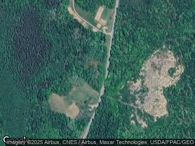
89 Upper Cross Rd Pembroke, ME 04666
Estimated Value: $247,000 - $326,000
3
Beds
3
Baths
2,494
Sq Ft
$115/Sq Ft
Est. Value
About This Home
This home is located at 89 Upper Cross Rd, Pembroke, ME 04666 and is currently estimated at $286,839, approximately $115 per square foot. 89 Upper Cross Rd is a home located in Washington County with nearby schools including Pembroke Elementary School.
Ownership History
Date
Name
Owned For
Owner Type
Purchase Details
Closed on
Aug 3, 2015
Sold by
Simonsen Linda C
Bought by
Carver Matthew O and Carver Monique L
Current Estimated Value
Home Financials for this Owner
Home Financials are based on the most recent Mortgage that was taken out on this home.
Original Mortgage
$189,000
Interest Rate
3.97%
Mortgage Type
Commercial
Create a Home Valuation Report for This Property
The Home Valuation Report is an in-depth analysis detailing your home's value as well as a comparison with similar homes in the area
Home Values in the Area
Average Home Value in this Area
Purchase History
| Date | Buyer | Sale Price | Title Company |
|---|---|---|---|
| Carver Matthew O | -- | -- |
Source: Public Records
Mortgage History
| Date | Status | Borrower | Loan Amount |
|---|---|---|---|
| Open | Carver Matthew | $150,000 | |
| Closed | Carver Matthew O | $168,000 | |
| Closed | Carver Matthew O | $189,000 | |
| Closed | Carver Matthew O | $189,000 | |
| Previous Owner | Simonsen Linda C | $75,000 | |
| Previous Owner | Simonsen Linda C | $50,100 |
Source: Public Records
Tax History Compared to Growth
Tax History
| Year | Tax Paid | Tax Assessment Tax Assessment Total Assessment is a certain percentage of the fair market value that is determined by local assessors to be the total taxable value of land and additions on the property. | Land | Improvement |
|---|---|---|---|---|
| 2024 | $3,746 | $157,400 | $27,800 | $129,600 |
| 2023 | $3,305 | $157,400 | $27,800 | $129,600 |
| 2022 | $3,368 | $157,400 | $27,800 | $129,600 |
| 2021 | $3,368 | $157,400 | $27,800 | $129,600 |
| 2020 | $3,510 | $157,400 | $27,800 | $129,600 |
| 2019 | $3,833 | $157,400 | $27,800 | $129,600 |
| 2018 | $3,833 | $157,400 | $27,800 | $129,600 |
| 2017 | $3,809 | $157,400 | $27,800 | $129,600 |
| 2016 | $3,557 | $157,400 | $27,800 | $129,600 |
| 2015 | $3,321 | $157,400 | $27,800 | $129,600 |
| 2014 | $3,148 | $157,400 | $27,800 | $129,600 |
| 2013 | $2,833 | $157,400 | $27,800 | $129,600 |
Source: Public Records
Map
Nearby Homes
- M11L27 Cross Rd
- M12L1 Ayers Junction Rd
- 16 Dairy Ln
- 265 Us Route 1
- 25 Little Falls Rd
- 58 Hersey Ln
- 93 Garnet Head Rd
- Lot 20 Garnet Head Rd
- 166 Kingfisher Trail
- Lot 8 S Meadow Rd
- 139 Lake Rd
- M4 L25-1 Smith Ridge Rd
- 451 Ac Smith Ridge Rd
- Lot 1 Foster Ln
- 27 King St
- 70 Bunker Hill Rd
- 167 Golding Rd
- 30 Harrision Rd
- 64 Harrison Rd
- 1 Daggett Rd
- 89 Upper Cross Rd
- 200 Cross Rd
- TBD Cross Rd
- 29 Upper Cross Rd
- Lot 15 Ayers Junction Rd
- Lot 27 Upper Cross Rd
- 403 Ayers Jct Rd
- 182 Upper Cross Rd
- lot#026 Ayers Junction Rd
- 547 Ayers Jct Rd
- 547 Ayers Jct Rd
- Lot 1 Ayers Junction Rd
- 402 Little Falls Rd
- 321 Ayers Jct Rd
- 410 Little Falls Rd
- 369 Little Falls Rd
- 591 Ayers Jct Rd
- 597 Ayers Jct Rd
- 353 Little Falls Rd
- 291 Ayers Jct Rd
