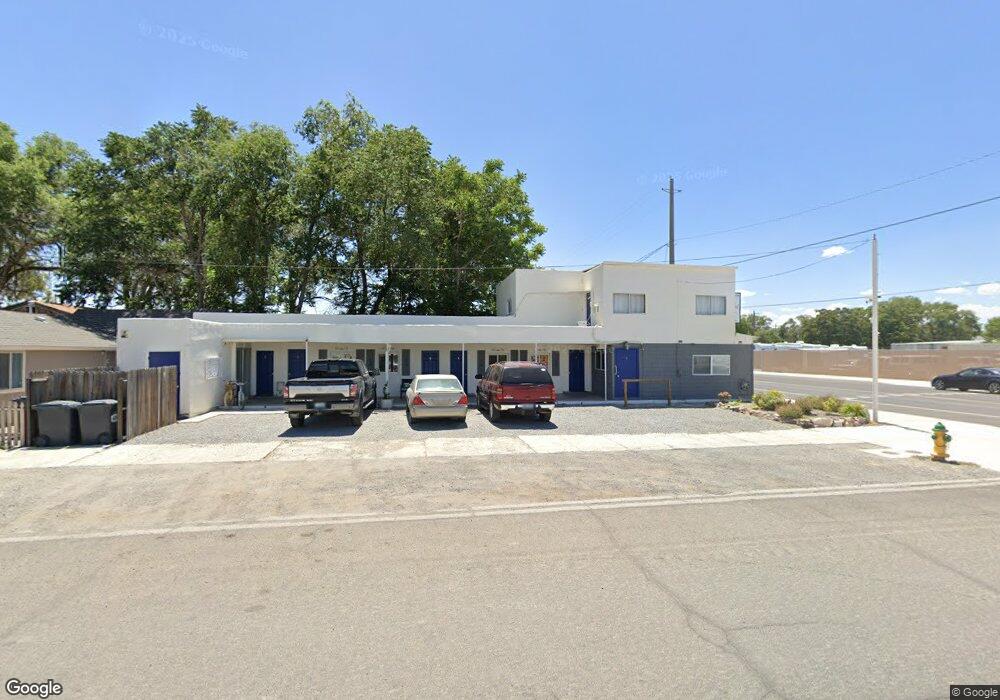
890 9th St Lovelock, NV 89419
Estimated Value: $202,034
2
Beds
--
Bath
2,583
Sq Ft
$78/Sq Ft
Est. Value
About This Home
This home is located at 890 9th St, Lovelock, NV 89419 and is currently estimated at $202,034, approximately $78 per square foot. 890 9th St is a home located in Pershing County with nearby schools including Pershing County Middle School and Pershing County High School.
Ownership History
Date
Name
Owned For
Owner Type
Purchase Details
Closed on
Jul 12, 2023
Sold by
Malloy Thomas and Malloy Geraldine
Bought by
Cornell Investments Llc
Current Estimated Value
Purchase Details
Closed on
Aug 18, 2020
Sold by
Holt Living Trust
Bought by
Malloy Thomas and Malloy Geraldine
Home Financials for this Owner
Home Financials are based on the most recent Mortgage that was taken out on this home.
Original Mortgage
$93,925
Interest Rate
3%
Mortgage Type
New Conventional
Purchase Details
Closed on
Feb 28, 2014
Sold by
Diocelina Herrera
Bought by
Deleeuw Larry Ray and Deleeuw Carol Ann
Create a Home Valuation Report for This Property
The Home Valuation Report is an in-depth analysis detailing your home's value as well as a comparison with similar homes in the area
Purchase History
| Date | Buyer | Sale Price | Title Company |
|---|---|---|---|
| Cornell Investments Llc | $68,210 | None Listed On Document | |
| Malloy Thomas | $144,500 | Ticor Title | |
| Deleeuw Larry Ray | $40,000 | -- |
Source: Public Records
Mortgage History
| Date | Status | Borrower | Loan Amount |
|---|---|---|---|
| Previous Owner | Malloy Thomas | $93,925 |
Source: Public Records
Tax History
| Year | Tax Paid | Tax Assessment Tax Assessment Total Assessment is a certain percentage of the fair market value that is determined by local assessors to be the total taxable value of land and additions on the property. | Land | Improvement |
|---|---|---|---|---|
| 2025 | $1,249 | $28,185 | $4,528 | $23,657 |
| 2024 | $1,249 | $26,902 | $3,019 | $23,883 |
| 2023 | $1,249 | $23,874 | $3,019 | $20,855 |
| 2022 | $1,123 | $20,791 | $3,019 | $17,772 |
| 2021 | $852 | $19,460 | $3,019 | $16,441 |
| 2020 | $896 | $20,670 | $4,070 | $16,600 |
| 2019 | $937 | $21,780 | $4,070 | $17,710 |
| 2018 | $872 | $20,550 | $4,070 | $16,480 |
| 2017 | $860 | $20,226 | $4,070 | $16,156 |
| 2016 | $1,719 | $19,752 | $4,070 | $15,682 |
| 2015 | $1,653 | $19,831 | $4,070 | $15,761 |
| 2014 | $1,653 | $18,658 | $4,070 | $14,588 |
Source: Public Records
Map
Nearby Homes
- Unionville Rd
- T28 R31 Sec 27
- T33 R37 Sec 3
- 1070 Cornell Ave
- 960 Franklin Ave
- 750 Grinnel Ave
- 635 Grinnel Ave
- 615 Grinnel Ave
- APN 14th St
- 1465 Central Ave
- 495 Camellia Way
- 470 Camellia Way
- 480 Camellia Way
- 750 16th St
- 485 Camellia Way
- 475 Camellia Way
- 1605 Central Ave
- 1645 Central Ave
- 5105 N Meridian Rd
- 815 16th St
- 880 Cornell Ave
- 920 Cornell Ave
- 915 W Broadway
- 875 W Broadway
- 825 Cornell Ave
- 925 W Broadway Ave
- 925 Cornell Ave
- 05 Cornell Ave
- 0 Cornell Ave
- 790 Cornell Ave
- 990 Cornell Ave
- 960 Dartmouth Ave
- 215 8th St
- 315 Main St
- 795 Cornell Ave
- 1385 W Broadway
- 765 W Broadway Ave
- 775 Cornell Ave
- 395 Main St
- 775 W Broadway Ave
Your Personal Tour Guide
Ask me questions while you tour the home.