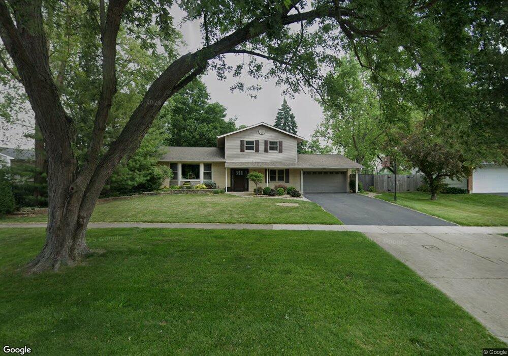
890 Freeman Rd Unit 2 Hoffman Estates, IL 60192
South Ridge NeighborhoodEstimated Value: $520,000 - $809,000
4
Beds
3
Baths
2,200
Sq Ft
$279/Sq Ft
Est. Value
About This Home
This home is located at 890 Freeman Rd Unit 2, Hoffman Estates, IL 60192 and is currently estimated at $613,758, approximately $278 per square foot. 890 Freeman Rd Unit 2 is a home located in Cook County with nearby schools including Thomas Jefferson Elementary School, Frank C. Whiteley Elementary School, and William Fremd High School.
Ownership History
Date
Name
Owned For
Owner Type
Purchase Details
Closed on
Feb 25, 2011
Sold by
Naumes John and Naumes Joan
Bought by
Wier Kenneth L and Wier Lynn M
Current Estimated Value
Home Financials for this Owner
Home Financials are based on the most recent Mortgage that was taken out on this home.
Original Mortgage
$300,800
Outstanding Balance
$204,541
Interest Rate
4.88%
Mortgage Type
New Conventional
Estimated Equity
$409,218
Create a Home Valuation Report for This Property
The Home Valuation Report is an in-depth analysis detailing your home's value as well as a comparison with similar homes in the area
Home Values in the Area
Average Home Value in this Area
Purchase History
| Date | Buyer | Sale Price | Title Company |
|---|---|---|---|
| Wier Kenneth L | $376,000 | Cti |
Source: Public Records
Mortgage History
| Date | Status | Borrower | Loan Amount |
|---|---|---|---|
| Open | Wier Kenneth L | $300,800 |
Source: Public Records
Tax History
| Year | Tax Paid | Tax Assessment Tax Assessment Total Assessment is a certain percentage of the fair market value that is determined by local assessors to be the total taxable value of land and additions on the property. | Land | Improvement |
|---|---|---|---|---|
| 2025 | $11,250 | $46,001 | $20,476 | $25,525 |
| 2024 | $11,250 | $40,013 | $20,013 | $20,000 |
| 2023 | $10,843 | $40,013 | $20,013 | $20,000 |
| 2022 | $10,843 | $40,013 | $20,013 | $20,000 |
| 2021 | $8,524 | $28,787 | $16,076 | $12,711 |
| 2020 | $8,412 | $28,787 | $16,076 | $12,711 |
| 2019 | $8,326 | $31,915 | $16,076 | $15,839 |
| 2018 | $9,208 | $32,498 | $14,790 | $17,708 |
| 2017 | $9,054 | $32,498 | $14,790 | $17,708 |
| 2016 | $8,657 | $32,498 | $14,790 | $17,708 |
| 2015 | $9,818 | $34,214 | $13,504 | $20,710 |
| 2014 | $9,650 | $34,214 | $13,504 | $20,710 |
| 2013 | $9,388 | $34,214 | $13,504 | $20,710 |
Source: Public Records
Map
Nearby Homes
- 940 Freeman Rd
- 4175 Victoria Dr
- 825 Concord Ln
- 4480 Thornbark Dr
- 765 Concord Ln
- 1210 Downing Dr
- 10 Carnoustie Ln
- 3881 Bordeaux Dr
- 1281 Old Timber Ct
- 4620 Olmstead Dr
- 1280 Clover Ln
- 1404 W Sapphire Dr
- 4475 Olmstead Dr
- 1886 Clover Dr
- 545 Windsor Rd
- 2113 Greenock
- 568 Plymouth Dr
- 4485 Bayside Cir
- 1620 Pheasant Trail
- 4791 Amber Cir
- 880 Freeman Rd
- 4275 Eisenhower Cir
- 4285 Eisenhower Cir
- 870 Freeman Rd
- 4265 Eisenhower Cir
- 895 Freeman Rd Unit 2
- 860 Freeman Rd
- 4295 Eisenhower Cir
- 4280 Eisenhower Cir
- 4255 Eisenhower Cir
- 885 Freeman Rd
- 4290 Eisenhower Cir
- 865 Freeman Rd
- 4260 Eisenhower Cir
- 840 Freeman Rd
- 4305 Eisenhower Cir
- 845 Freeman Rd
- 930 Freeman Rd
- 4245 Eisenhower Cir
- 4250 Eisenhower Cir
Your Personal Tour Guide
Ask me questions while you tour the home.