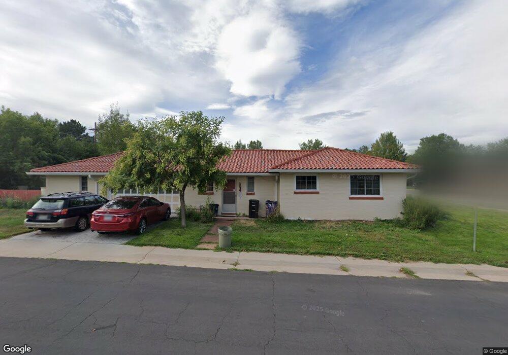
890 Grape St Denver, CO 80220
Hale NeighborhoodEstimated Value: $755,697 - $916,000
3
Beds
3
Baths
1,848
Sq Ft
$439/Sq Ft
Est. Value
About This Home
This home is located at 890 Grape St, Denver, CO 80220 and is currently estimated at $812,174, approximately $439 per square foot. 890 Grape St is a home located in Denver County with nearby schools including Palmer Elementary School, Hill Campus of Arts & Sciences, and George Washington High School.
Ownership History
Date
Name
Owned For
Owner Type
Purchase Details
Closed on
May 22, 2020
Sold by
Mussett Michael Moore and Mussett Marie E
Bought by
Mussett Michael Moore and Mussett Ella Marie
Current Estimated Value
Home Financials for this Owner
Home Financials are based on the most recent Mortgage that was taken out on this home.
Original Mortgage
$825,000
Interest Rate
3%
Mortgage Type
FHA
Purchase Details
Closed on
Mar 26, 2001
Sold by
Mussett Michael Moore
Bought by
Mussett Michael Moore and Marie Mussett E
Purchase Details
Closed on
Dec 31, 1997
Sold by
Porter Mussett Eugene and Kathryn Mussett Mary
Bought by
Mussett Mary Kathryn
Create a Home Valuation Report for This Property
The Home Valuation Report is an in-depth analysis detailing your home's value as well as a comparison with similar homes in the area
Home Values in the Area
Average Home Value in this Area
Purchase History
| Date | Buyer | Sale Price | Title Company |
|---|---|---|---|
| Mussett Michael Moore | -- | Heritage Title Company | |
| Mussett Michael Moore | -- | -- | |
| Mussett Mary Kathryn | -- | -- |
Source: Public Records
Mortgage History
| Date | Status | Borrower | Loan Amount |
|---|---|---|---|
| Closed | Mussett Michael Moore | $825,000 |
Source: Public Records
Tax History
| Year | Tax Paid | Tax Assessment Tax Assessment Total Assessment is a certain percentage of the fair market value that is determined by local assessors to be the total taxable value of land and additions on the property. | Land | Improvement |
|---|---|---|---|---|
| 2025 | $3,379 | $56,250 | $40,270 | $40,270 |
| 2024 | $3,379 | $49,360 | $32,190 | $17,170 |
| 2023 | $3,306 | $49,360 | $32,190 | $17,170 |
| 2022 | $2,394 | $37,050 | $29,770 | $7,280 |
| 2021 | $2,311 | $38,120 | $30,630 | $7,490 |
| 2020 | $2,195 | $36,740 | $30,630 | $6,110 |
| 2019 | $2,134 | $36,740 | $30,630 | $6,110 |
| 2018 | $1,987 | $32,880 | $20,560 | $12,320 |
| 2017 | $1,981 | $32,880 | $20,560 | $12,320 |
| 2016 | $1,791 | $29,920 | $21,317 | $8,603 |
| 2015 | $2,338 | $29,920 | $21,317 | $8,603 |
| 2014 | $1,915 | $23,060 | $17,050 | $6,010 |
Source: Public Records
Map
Nearby Homes
- 780 Grape St
- 865 Holly St
- 940 Grape St
- 844 1/2 Forest St
- 778 Hudson St
- 1300 N Glencoe St
- 918 Ivanhoe St
- 775 Glencoe St Unit 779
- 1100 Hudson St
- 1120 Grape St
- 1121 Hudson St
- 944 Ivanhoe St
- 5101 E 8th Ave Unit 5105
- 777 Forest St
- 781 Forest St
- 783 Forest St
- 943 Jersey St
- 737 Glencoe St
- 763 Ivy St
- 712 Forest St
Your Personal Tour Guide
Ask me questions while you tour the home.