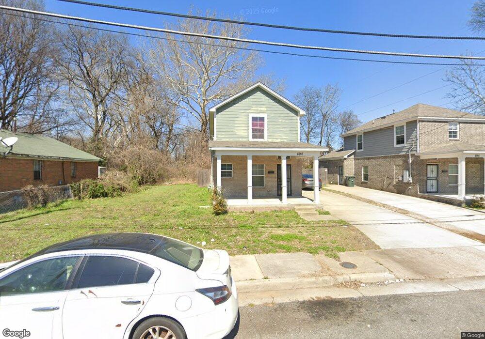
890 Mosby Ave Memphis, TN 38105
Crosstown NeighborhoodEstimated Value: $163,000 - $251,000
4
Beds
2
Baths
1,790
Sq Ft
$108/Sq Ft
Est. Value
About This Home
This home is located at 890 Mosby Ave, Memphis, TN 38105 and is currently estimated at $193,037, approximately $107 per square foot. 890 Mosby Ave is a home with nearby schools including Bruce Elementary School, Central High School, and Memphis Scholars Caldwell-Guthrie.
Ownership History
Date
Name
Owned For
Owner Type
Purchase Details
Closed on
Jan 24, 2019
Sold by
Habitat For Humanity Of Greater Memphis
Bought by
Ali Burhan A and Ali Sahro I
Current Estimated Value
Home Financials for this Owner
Home Financials are based on the most recent Mortgage that was taken out on this home.
Original Mortgage
$110,000
Outstanding Balance
$96,905
Interest Rate
4.6%
Mortgage Type
New Conventional
Estimated Equity
$96,132
Purchase Details
Closed on
Feb 17, 2003
Sold by
Robinson Margaret
Bought by
Habitat For Humanity Of Greater Memphis
Create a Home Valuation Report for This Property
The Home Valuation Report is an in-depth analysis detailing your home's value as well as a comparison with similar homes in the area
Home Values in the Area
Average Home Value in this Area
Purchase History
| Date | Buyer | Sale Price | Title Company |
|---|---|---|---|
| Ali Burhan A | $110,000 | None Available | |
| Habitat For Humanity Of Greater Memphis | $30,516 | -- |
Source: Public Records
Mortgage History
| Date | Status | Borrower | Loan Amount |
|---|---|---|---|
| Open | Ali Burhan A | $110,000 |
Source: Public Records
Tax History Compared to Growth
Tax History
| Year | Tax Paid | Tax Assessment Tax Assessment Total Assessment is a certain percentage of the fair market value that is determined by local assessors to be the total taxable value of land and additions on the property. | Land | Improvement |
|---|---|---|---|---|
| 2025 | $899 | $39,625 | $1,875 | $37,750 |
| 2024 | $899 | $26,525 | $750 | $25,775 |
| 2023 | $1,616 | $26,525 | $750 | $25,775 |
| 2022 | $1,616 | $26,525 | $750 | $25,775 |
| 2021 | $1,635 | $26,525 | $750 | $25,775 |
| 2020 | $1,418 | $19,575 | $750 | $18,825 |
| 2019 | $626 | $19,575 | $750 | $18,825 |
| 2018 | $24 | $750 | $750 | $0 |
| 2017 | $25 | $750 | $750 | $0 |
| 2016 | $33 | $750 | $0 | $0 |
| 2014 | $33 | $750 | $0 | $0 |
Source: Public Records
Map
Nearby Homes
- 304 N Dunlap St
- 374 N Dunlap St
- 317 N Manassas St
- 301 N Manassas St
- 236 Decatur St
- 998 J W Williams Ln
- 1086 Merriwether Ave
- 510 Leath St
- 1010 Galloway Ave
- 515 N Dunlap St
- 1023 Forrest Ave
- 200 N Waldran Blvd Unit 17
- 0 N Orleans St
- 1060 Forrest Ave
- 556 N Manassas St
- 930 Faxon Ave
- 671 Jefferson Ave
- 230 Decatur St
- 1052 Faxon Ave
- 420-B N Bellevue Blvd Unit B