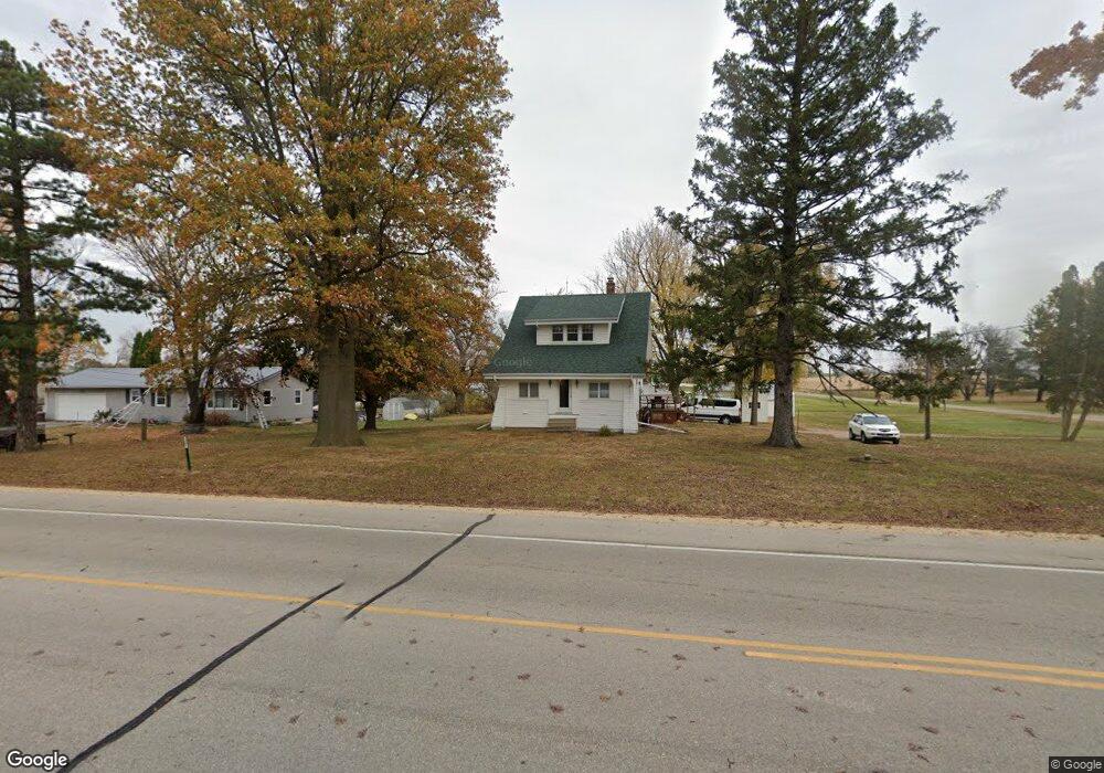
891 Dows Rd Cedar Rapids, IA 52403
Estimated Value: $241,871 - $299,000
2
Beds
1
Bath
1,384
Sq Ft
$201/Sq Ft
Est. Value
About This Home
This home is located at 891 Dows Rd, Cedar Rapids, IA 52403 and is currently estimated at $277,968, approximately $200 per square foot. 891 Dows Rd is a home located in Linn County with nearby schools including Erskine Elementary School, McKinley STEAM Academy, and George Washington High School.
Ownership History
Date
Name
Owned For
Owner Type
Purchase Details
Closed on
Mar 28, 2003
Sold by
Anderson Gerald L and Anderson Althea L
Bought by
Errington Charles H and Errington Amy E
Current Estimated Value
Home Financials for this Owner
Home Financials are based on the most recent Mortgage that was taken out on this home.
Original Mortgage
$104,000
Outstanding Balance
$45,333
Interest Rate
5.95%
Mortgage Type
Purchase Money Mortgage
Estimated Equity
$232,635
Purchase Details
Closed on
Mar 21, 2003
Sold by
Hagstrom David Gerald and Hagstrom Dana K
Bought by
Meyer Peter N and Meyer Doris L
Home Financials for this Owner
Home Financials are based on the most recent Mortgage that was taken out on this home.
Original Mortgage
$104,000
Outstanding Balance
$45,333
Interest Rate
5.95%
Mortgage Type
Purchase Money Mortgage
Estimated Equity
$232,635
Create a Home Valuation Report for This Property
The Home Valuation Report is an in-depth analysis detailing your home's value as well as a comparison with similar homes in the area
Purchase History
| Date | Buyer | Sale Price | Title Company |
|---|---|---|---|
| Errington Charles H | $129,500 | -- | |
| Meyer Peter N | $151,500 | -- |
Source: Public Records
Mortgage History
| Date | Status | Borrower | Loan Amount |
|---|---|---|---|
| Open | Errington Charles H | $104,000 |
Source: Public Records
Tax History
| Year | Tax Paid | Tax Assessment Tax Assessment Total Assessment is a certain percentage of the fair market value that is determined by local assessors to be the total taxable value of land and additions on the property. | Land | Improvement |
|---|---|---|---|---|
| 2025 | $2,744 | $260,900 | $81,600 | $179,300 |
| 2024 | $2,688 | $245,600 | $81,600 | $164,000 |
| 2023 | $2,688 | $245,600 | $81,600 | $164,000 |
| 2022 | $2,644 | $199,400 | $81,600 | $117,800 |
| 2021 | $2,566 | $199,400 | $81,600 | $117,800 |
| 2020 | $2,566 | $179,400 | $65,600 | $113,800 |
| 2019 | $2,420 | $172,900 | $65,600 | $107,300 |
Source: Public Records
Map
Nearby Homes
- 6832 Bottom Land Ln
- 6826 Bottom Land Ln
- 6851 Cabbage Patch Ln
- 6870 Cabbage Patch Ln
- 6850 Pumpkin Patch Blvd
- 5997 Meadow Grass Cir SE
- 827 Tumble Grass Ct SE
- 819 Tumble Grass Ct SE
- 5638 Meadow Grass Cir SE
- 5750 Meadow Grass Cir SE
- 5700 Meadow Grass Cir SE
- 5658 Meadow Grass Cir SE
- Lot 8 Kestrel Heights 2nd Addition
- Lot 16 Kestrel Heights 2nd Addition
- Lot 9 Kestrel Heights 2nd Addition
- Lot 7 Kestrel Heights 2nd Addition
- Lot 17 Kestrel Heights 2nd Addition
- Lot 4 Kestrel Heights 2nd Addition
- Lot 10 Kestrel Heights 2nd Addition
- Lot 13 Kestrel Heights 2nd Addition Heights
- 6640 Mount Vernon Rd SE
- 1001 Eastern Dr SE
- 995 Eastern Dr SE
- 6651 Mount Vernon Rd SE
- 1005 Eastern Dr SE
- 1007 Eastern Dr SE
- 6665 Mount Vernon Rd SE
- 1002 Eastern Dr SE
- 6580 Mount Vernon Rd SE
- 1004 Eastern Dr SE
- 1006 Eastern Dr SE
- 818 Dows Rd SE
- 6657 Mount Vernon Rd SE
- 818 Dows Rd Unit 1
- 818 Dows Rd
- 818 Dows Rd Unit 1000
- 818 Dows Rd Unit 8000
- 1008 Eastern Dr SE
- 818 Dows Rd Unit 5
- 818 Dows Rd Unit 4
Your Personal Tour Guide
Ask me questions while you tour the home.