8917 E Sail Away Ln Unionville, IN 47468
Estimated Value: $402,000 - $429,000
2
Beds
1
Bath
888
Sq Ft
$469/Sq Ft
Est. Value
About This Home
This home is located at 8917 E Sail Away Ln, Unionville, IN 47468 and is currently estimated at $416,745, approximately $469 per square foot. 8917 E Sail Away Ln is a home with nearby schools including Unionville Elementary School, Tri-North Middle School, and Bloomington High School North.
Ownership History
Date
Name
Owned For
Owner Type
Purchase Details
Closed on
Nov 24, 2020
Sold by
Lebeau David A
Bought by
Campbell Tyler and Campbell Danielle L
Current Estimated Value
Home Financials for this Owner
Home Financials are based on the most recent Mortgage that was taken out on this home.
Original Mortgage
$256,000
Outstanding Balance
$233,620
Interest Rate
2.7%
Mortgage Type
New Conventional
Purchase Details
Closed on
Jun 20, 2006
Sold by
Lebeau Robert C and Lebeau Vivian I
Bought by
Lebeau David A
Create a Home Valuation Report for This Property
The Home Valuation Report is an in-depth analysis detailing your home's value as well as a comparison with similar homes in the area
Home Values in the Area
Average Home Value in this Area
Purchase History
| Date | Buyer | Sale Price | Title Company |
|---|---|---|---|
| Campbell Tyler | -- | Quality Title Insurance | |
| Lebeau David A | $115,000 | None Available |
Source: Public Records
Mortgage History
| Date | Status | Borrower | Loan Amount |
|---|---|---|---|
| Open | Campbell Tyler | $256,000 |
Source: Public Records
Tax History Compared to Growth
Tax History
| Year | Tax Paid | Tax Assessment Tax Assessment Total Assessment is a certain percentage of the fair market value that is determined by local assessors to be the total taxable value of land and additions on the property. | Land | Improvement |
|---|---|---|---|---|
| 2023 | $7,510 | $377,200 | $297,900 | $79,300 |
| 2022 | $5,316 | $368,900 | $297,900 | $71,000 |
| 2021 | $5,176 | $295,000 | $216,700 | $78,300 |
| 2020 | $4,365 | $280,200 | $216,700 | $63,500 |
| 2019 | $4,245 | $277,600 | $216,700 | $60,900 |
| 2018 | $3,676 | $236,200 | $205,100 | $31,100 |
| 2017 | $3,587 | $235,900 | $205,100 | $30,800 |
| 2016 | $3,557 | $235,900 | $205,100 | $30,800 |
| 2014 | $3,079 | $235,700 | $205,100 | $30,600 |
Source: Public Records
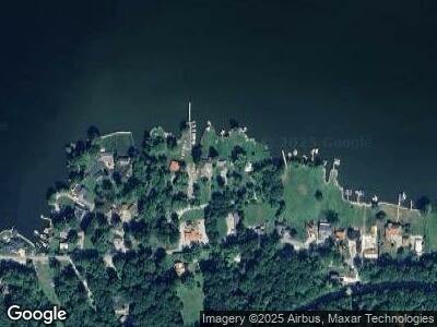
Map
Nearby Homes
- 8899 E Southshore Dr
- 6900 N Richardson Rd
- 8781 E Southshore Dr
- 8713 Midview Dr
- 8597 E Wilderness Trail
- 8015 N Lakeview Dr
- 8027 N Lakeview Dr
- 7550 N Lakewood Dr
- 0 N Hilltop Dr Unit 202516944
- 9378 Derrett Rd
- 9235 Gray Ave
- 9408 Derrett Rd
- 9550 E Northshore Dr
- 9548 E Northshore Dr
- 9504 E Northshore Dr
- 7600 N Blue Heron Dr
- 9494 E Northshore Dr
- 9300 Derrett Rd
- 9578 E State Road 45
- 6517 Snug Harbour Ln
- 8917 E Sail Away Ln
- 8915 E Sail Away Ln
- 8921 E Sail Away Ln
- 8923 E Sail Away Ln
- 8929 E Sail Away Ln
- 8975 E Southshore Dr Unit 8
- 8975 E Southshore Dr
- 8905 E Sail Away Ln
- 8939 E Southshore Dr
- 9001 E Southshore Dr
- 9045 E South Shore Dr
- 8970 E Southshore Dr
- 8885 E Southshore Dr
- 8885 E South Shore Dr
- 8851 E Southshore Dr
- 8893 E Southshore Dr
- 9049 E Southshore Dr
- 9006 E Southshore Dr
- 8949 E Southshore Dr
- 8920 E Southshore Dr