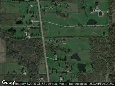
8919 Clay St Montville, OH 44064
Estimated Value: $388,627 - $467,000
3
Beds
2
Baths
2,030
Sq Ft
$210/Sq Ft
Est. Value
About This Home
This home is located at 8919 Clay St, Montville, OH 44064 and is currently estimated at $425,542, approximately $209 per square foot. 8919 Clay St is a home located in Geauga County.
Ownership History
Date
Name
Owned For
Owner Type
Purchase Details
Closed on
Dec 16, 2011
Sold by
Mccaffrey Elizabeth A and Mc Caffrey Thomas M
Bought by
Mccaffrey Elizabeth A and Mc Caffrey Thomas M
Current Estimated Value
Home Financials for this Owner
Home Financials are based on the most recent Mortgage that was taken out on this home.
Original Mortgage
$173,500
Interest Rate
4.11%
Mortgage Type
New Conventional
Purchase Details
Closed on
Dec 6, 2011
Sold by
Hamilton Elizabeth A
Bought by
Mccaterey Elizabeth A and Mc Caterey Thomas M
Home Financials for this Owner
Home Financials are based on the most recent Mortgage that was taken out on this home.
Original Mortgage
$173,500
Interest Rate
4.11%
Mortgage Type
New Conventional
Purchase Details
Closed on
May 8, 1999
Sold by
Franco Michael T
Bought by
Hamilton Elizabeth A
Create a Home Valuation Report for This Property
The Home Valuation Report is an in-depth analysis detailing your home's value as well as a comparison with similar homes in the area
Home Values in the Area
Average Home Value in this Area
Purchase History
| Date | Buyer | Sale Price | Title Company |
|---|---|---|---|
| Hamilton Elizabeth A | $38,700 | Continental Title Agency Cor |
Source: Public Records
Mortgage History
| Date | Status | Borrower | Loan Amount |
|---|---|---|---|
| Open | Mccaffrey Elizabeth A | $179,000 | |
| Closed | Mccaffrey Elizabeth A | $17,000 | |
| Closed | Mccaffrey Elizabeth A | $30,000 | |
| Closed | Mccaterey Elizabeth A | $173,500 | |
| Previous Owner | Hamilton Elizabeth A | $30,000 | |
| Previous Owner | Mccaffrey Elizabeth A | $20,000 | |
| Previous Owner | Hamilton Elizabeth A | $171,000 | |
| Previous Owner | Hamilton Elizabeth A | $129,000 |
Source: Public Records
Tax History Compared to Growth
Tax History
| Year | Tax Paid | Tax Assessment Tax Assessment Total Assessment is a certain percentage of the fair market value that is determined by local assessors to be the total taxable value of land and additions on the property. | Land | Improvement |
|---|---|---|---|---|
| 2024 | $4,711 | $122,680 | $18,480 | $104,200 |
| 2023 | $4,711 | $122,680 | $18,480 | $104,200 |
| 2022 | $3,963 | $91,080 | $15,580 | $75,500 |
| 2021 | $3,979 | $91,080 | $15,580 | $75,500 |
| 2020 | $3,927 | $88,030 | $15,580 | $72,450 |
| 2019 | $3,256 | $78,580 | $15,580 | $63,000 |
| 2018 | $1,628 | $78,580 | $15,580 | $63,000 |
| 2017 | $3,256 | $78,580 | $15,580 | $63,000 |
| 2016 | $1,529 | $76,060 | $15,580 | $60,480 |
| 2015 | $2,919 | $76,060 | $15,580 | $60,480 |
| 2014 | $2,919 | $76,060 | $15,580 | $60,480 |
| 2013 | $2,961 | $76,060 | $15,580 | $60,480 |
Source: Public Records
Map
Nearby Homes
- 16696 Hart Rd
- 9625 Plank Rd
- 16301 Gar Hwy
- 15689 Gar Hwy
- 15048 Gar Hwy
- 16969 Gar Hwy
- 0 Rock Creek Rd
- 17485 Burrows Rd
- 14161 Rock Creek Rd
- 17650 Leggett Rd
- 10795 Clay St
- 17866 Leggett Rd
- 16165 Thompson Rd
- 17729 Rock Creek Rd
- 72 Wayne Ln
- 13 Lois Ln
- 10085 Locust Grove Dr
- 0 Clay St Unit 5117656
- TBD Brockway Rd
- 0 Chardon Windsor Rd Unit 5112115
