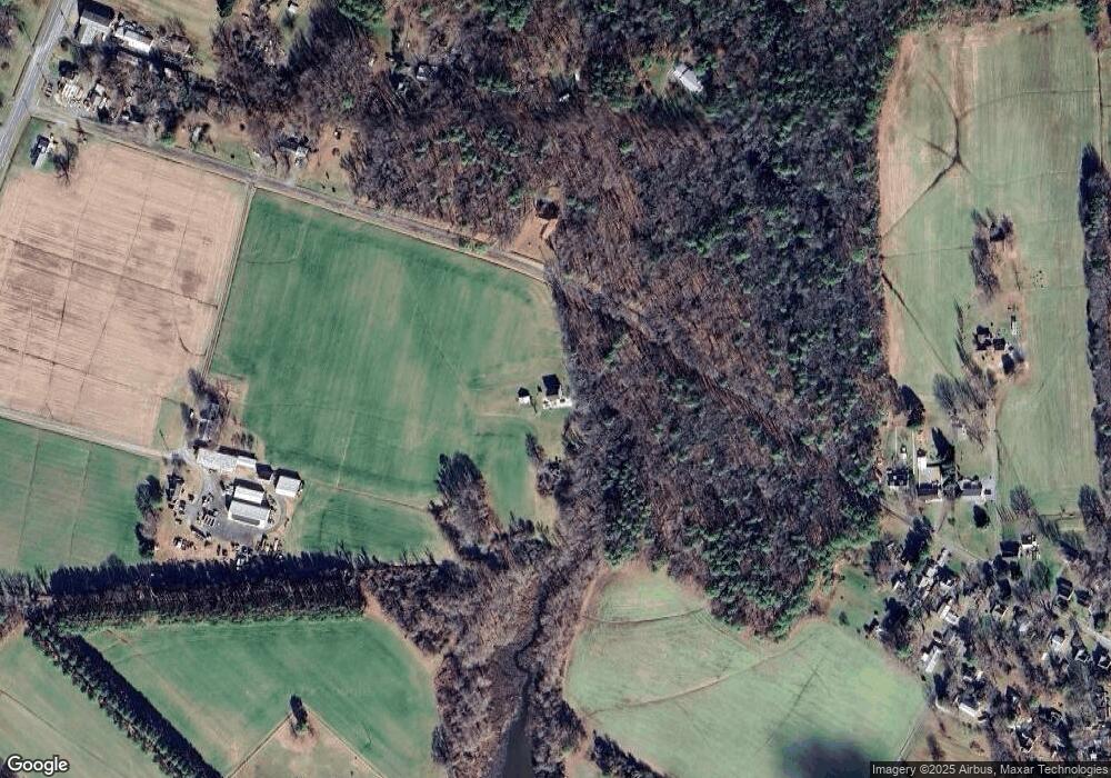
8924 Palmer Rd Wittman, MD 21676
Estimated Value: $395,723 - $463,000
--
Bed
--
Bath
1,440
Sq Ft
$291/Sq Ft
Est. Value
About This Home
This home is located at 8924 Palmer Rd, Wittman, MD 21676 and is currently estimated at $418,681, approximately $290 per square foot. 8924 Palmer Rd is a home located in Talbot County with nearby schools including Tilghman Elementary School, St. Michaels Middle/High School, and Easton High School.
Ownership History
Date
Name
Owned For
Owner Type
Purchase Details
Closed on
Mar 22, 2021
Sold by
Davis Kathryn S
Bought by
Suppin Brian P
Current Estimated Value
Home Financials for this Owner
Home Financials are based on the most recent Mortgage that was taken out on this home.
Original Mortgage
$302,000
Outstanding Balance
$270,859
Interest Rate
2.73%
Mortgage Type
New Conventional
Estimated Equity
$147,822
Purchase Details
Closed on
Jul 17, 2019
Sold by
Death Michael and Death Beverly M
Bought by
Davis Kathryn S
Purchase Details
Closed on
Sep 3, 1996
Sold by
Savinski Kenneth R
Bought by
Death Michael and Death Beverly M
Purchase Details
Closed on
Jul 6, 1992
Sold by
Burton Samuel R and Burton Rodie M
Bought by
Savinski Kenneth R
Create a Home Valuation Report for This Property
The Home Valuation Report is an in-depth analysis detailing your home's value as well as a comparison with similar homes in the area
Home Values in the Area
Average Home Value in this Area
Purchase History
| Date | Buyer | Sale Price | Title Company |
|---|---|---|---|
| Suppin Brian P | $330,000 | Eastern Shore Title Co | |
| Davis Kathryn S | $20,000 | Eastern Shore Title Company | |
| Death Michael | $25,000 | -- | |
| Savinski Kenneth R | $22,000 | -- |
Source: Public Records
Mortgage History
| Date | Status | Borrower | Loan Amount |
|---|---|---|---|
| Open | Suppin Brian P | $302,000 |
Source: Public Records
Tax History Compared to Growth
Tax History
| Year | Tax Paid | Tax Assessment Tax Assessment Total Assessment is a certain percentage of the fair market value that is determined by local assessors to be the total taxable value of land and additions on the property. | Land | Improvement |
|---|---|---|---|---|
| 2025 | $2,050 | $246,500 | $25,400 | $221,100 |
| 2024 | $2,050 | $222,300 | $0 | $0 |
| 2023 | $1,740 | $198,100 | $0 | $0 |
| 2022 | $1,369 | $173,900 | $25,400 | $148,500 |
| 2021 | $2,650 | $173,900 | $25,400 | $148,500 |
| 2020 | $156 | $20,800 | $19,500 | $1,300 |
| 2019 | $225 | $30,300 | $28,900 | $1,400 |
| 2018 | $771 | $99,833 | $0 | $0 |
| 2017 | $708 | $99,067 | $0 | $0 |
| 2016 | $692 | $98,300 | $0 | $0 |
| 2015 | $719 | $98,300 | $0 | $0 |
| 2014 | $719 | $98,300 | $0 | $0 |
Source: Public Records
Map
Nearby Homes
- 22381 Cooper Ln
- 22349 Cooper Ln
- 8698 Cummings Rd
- 8781 Tilghman Island Rd
- 22571 Crescendo Cir
- 9262 Macks Ln
- 00 New Rd
- 8620 Bozman Neavitt Rd
- 9681 Macks Ln
- 0 Bozman Neavitt Rd Unit MDTA2011976
- 8013 Ruby Harrison Rd
- 8000 Bozman Neavitt Rd
- 8034 Bozman Neavitt Rd
- 7983 Bozman Neavitt Rd
- 21869 Albie Rd
- 22540 Hardcastle Ln
- 7651 Main St
- 7683 Tilghman Island Rd
- 23854 Mount Misery Rd
- 7649 Cooper Point Rd
- 8915 Palmer Rd
- 8886 Pot Pie Rd
- 22423 Cooper Ln
- 0 Sewell Pt Rd Unit TA9616693
- PARCEL A Sewell Point Rd
- 22540 Pot Pie Rd
- 8913 Tilghman Island Rd
- 22470 Pot Pie Rd
- 22380 Pot Pie Rd
- 8915 Tilghman Island Rd
- 22419 Cooper Ln
- 22558 Pot Pie Rd
- 22555 Pot Pie Rd
- 22561 Pot Pie Rd
- 22572 Pot Pie Rd
- 22574 Pot Pie Rd
- 22569 Pot Pie Rd
- 22350 Pot Pie Rd
- 22385 Cooper Ln
- 8844 Howeth Rd
