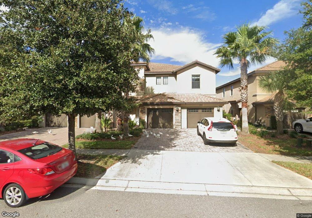
8935 Azalea Sands Ln Unit 8935 Davenport, FL 33896
Champions Gate NeighborhoodEstimated Value: $275,117 - $296,000
3
Beds
2
Baths
1,998
Sq Ft
$144/Sq Ft
Est. Value
About This Home
This home is located at 8935 Azalea Sands Ln Unit 8935, Davenport, FL 33896 and is currently estimated at $288,529, approximately $144 per square foot. 8935 Azalea Sands Ln Unit 8935 is a home located in Osceola County with nearby schools including Westside K-8 School, Poinciana High School, and Ridgeview Global Studies Academy.
Ownership History
Date
Name
Owned For
Owner Type
Purchase Details
Closed on
Oct 28, 2021
Sold by
Raymond Gregory D
Bought by
Euston Dr Llc
Current Estimated Value
Purchase Details
Closed on
Jul 29, 2019
Sold by
New Quay Llc
Bought by
Raymond Gregory D
Home Financials for this Owner
Home Financials are based on the most recent Mortgage that was taken out on this home.
Original Mortgage
$185,000
Interest Rate
3.82%
Mortgage Type
New Conventional
Purchase Details
Closed on
Apr 22, 2015
Sold by
Lennar Homes Llc
Bought by
New Quay Llc
Purchase Details
Closed on
Jan 14, 2014
Sold by
Len Cg South Llc
Bought by
Lennar Homes Llc
Create a Home Valuation Report for This Property
The Home Valuation Report is an in-depth analysis detailing your home's value as well as a comparison with similar homes in the area
Home Values in the Area
Average Home Value in this Area
Purchase History
| Date | Buyer | Sale Price | Title Company |
|---|---|---|---|
| Euston Dr Llc | $240,000 | Stewart Title Company | |
| Raymond Gregory D | $215,000 | Stewart Title Company | |
| New Quay Llc | $205,000 | North American Title Company | |
| Lennar Homes Llc | -- | None Available |
Source: Public Records
Mortgage History
| Date | Status | Borrower | Loan Amount |
|---|---|---|---|
| Previous Owner | Raymond Gregory D | $185,000 |
Source: Public Records
Tax History Compared to Growth
Tax History
| Year | Tax Paid | Tax Assessment Tax Assessment Total Assessment is a certain percentage of the fair market value that is determined by local assessors to be the total taxable value of land and additions on the property. | Land | Improvement |
|---|---|---|---|---|
| 2025 | $5,101 | $236,400 | -- | $236,400 |
| 2024 | $5,111 | $243,400 | -- | $243,400 |
| 2023 | $5,111 | $242,000 | $0 | $242,000 |
| 2022 | $5,008 | $222,000 | $0 | $222,000 |
| 2021 | $3,991 | $185,600 | $0 | $185,600 |
| 2020 | $4,042 | $190,000 | $0 | $190,000 |
| 2019 | $4,658 | $192,000 | $0 | $192,000 |
| 2018 | $4,131 | $172,800 | $0 | $172,800 |
| 2017 | $4,359 | $183,600 | $0 | $183,600 |
| 2016 | $4,502 | $190,800 | $0 | $190,800 |
| 2015 | $460 | $28,900 | $28,900 | $0 |
Source: Public Records
Map
Nearby Homes
- 8923 Azalea Sands Ln
- 8925 Azalea Sands Ln Unit 602
- 8916 Azalea Sands Ln
- 8940 Azalea Sands Ln Unit 8940
- 8970 Azalea Sands Ln Unit 2302
- 1369 Palmetto Dunes St
- 8979 Azalea Sands Ln
- 8984 Azalea Sands Ln Unit 8984
- 8996 Azalea Sands Ln Unit 3301
- 9012 Sommerset Hills Dr
- 1379 Dolphin Head St
- 1092 Leader St
- 1386 Palmetto Dunes St
- 9024 Sommerset Hills Dr
- 9032 Sommerset Hills Dr
- 1389 Dolphin Head St
- 1392 Palmetto Dunes St
- 1395 Dolphin Head St
- 9038 Azalea Sands Ln Unit 1
- 1398 Palmetto Dunes St
- 8933 Azalea Sands Ln
- 8935 Azalea Sands Ln
- 8933 Azalea Sands Ln Unit 8933
- 8939 Azalea Sands Ln
- 8937 Azalea Sands Ln
- 8929 Azalea Sands Ln
- 8929 Azalea Sands Ln Unit 1
- 8927 Azalea Sands Ln
- 8927 Azalea Sands Ln Unit 604
- 8927 Azalea Sands Ln Unit 8927
- 8925 Azalea Sands Ln Unit 8925
- 8941 Azalea Sands Ln
- 8941 Azalea Sands Ln
- 8938 Azalea Sands Ln Unit 8938
- 8938 Azalea Sands Ln Unit 1702
- 8934 Azalea Sands Ln Unit 1
- 8934 Azalea Sands Ln
- 8942 Azalea Sands Ln Unit Champions Gate
- 8942 Azalea Sands Ln Unit 8942
- 8942 Azalea Sands Ln Unit 8948