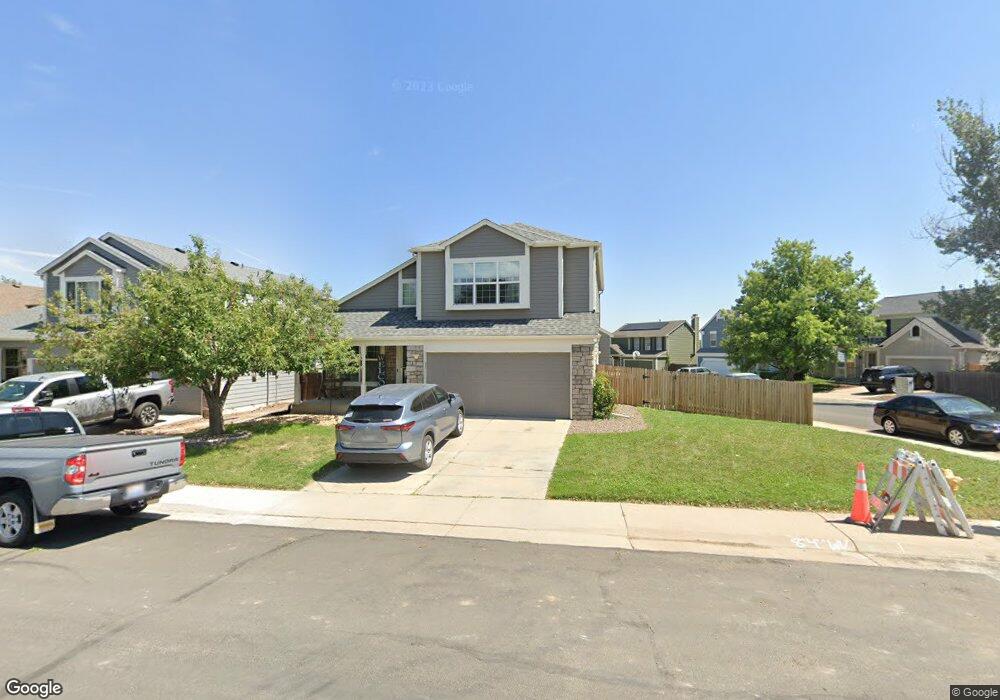
894 S Lindsey St Castle Rock, CO 80104
Founders Village NeighborhoodEstimated Value: $574,000 - $614,000
5
Beds
4
Baths
2,719
Sq Ft
$218/Sq Ft
Est. Value
About This Home
This home is located at 894 S Lindsey St, Castle Rock, CO 80104 and is currently estimated at $593,703, approximately $218 per square foot. 894 S Lindsey St is a home located in Douglas County with nearby schools including Rock Ridge Elementary School, Mesa Middle School, and Douglas County High School.
Ownership History
Date
Name
Owned For
Owner Type
Purchase Details
Closed on
Jul 16, 2020
Sold by
Fordham Alan L and Fordham Debbra A
Bought by
Louis Chad W and Louis Starr Lynn
Current Estimated Value
Home Financials for this Owner
Home Financials are based on the most recent Mortgage that was taken out on this home.
Original Mortgage
$449,000
Outstanding Balance
$398,143
Interest Rate
3.1%
Mortgage Type
VA
Estimated Equity
$195,560
Purchase Details
Closed on
Mar 31, 1995
Sold by
Griffiths Randall K and Griffiths Linda D
Bought by
Fordham Alan L and Fordham Debbra A
Home Financials for this Owner
Home Financials are based on the most recent Mortgage that was taken out on this home.
Original Mortgage
$136,800
Interest Rate
8.48%
Purchase Details
Closed on
Jan 26, 1993
Sold by
Pulte Home Corp
Bought by
Griffiths Randall K and Griffiths Linda D
Create a Home Valuation Report for This Property
The Home Valuation Report is an in-depth analysis detailing your home's value as well as a comparison with similar homes in the area
Home Values in the Area
Average Home Value in this Area
Purchase History
| Date | Buyer | Sale Price | Title Company |
|---|---|---|---|
| Louis Chad W | $449,000 | Chicago Title Co | |
| Fordham Alan L | -- | -- | |
| Griffiths Randall K | $123,400 | -- |
Source: Public Records
Mortgage History
| Date | Status | Borrower | Loan Amount |
|---|---|---|---|
| Open | Louis Chad W | $449,000 | |
| Previous Owner | Fordham Alan L | $136,800 |
Source: Public Records
Tax History Compared to Growth
Tax History
| Year | Tax Paid | Tax Assessment Tax Assessment Total Assessment is a certain percentage of the fair market value that is determined by local assessors to be the total taxable value of land and additions on the property. | Land | Improvement |
|---|---|---|---|---|
| 2024 | $6,226 | $41,580 | $8,640 | $32,940 |
| 2023 | $6,262 | $41,580 | $8,640 | $32,940 |
| 2022 | $4,495 | $28,390 | $6,350 | $22,040 |
| 2021 | $4,578 | $28,390 | $6,350 | $22,040 |
| 2020 | $4,182 | $26,690 | $5,400 | $21,290 |
| 2019 | $4,184 | $26,690 | $5,400 | $21,290 |
| 2018 | $3,653 | $23,130 | $4,160 | $18,970 |
| 2017 | $3,517 | $23,130 | $4,160 | $18,970 |
| 2016 | $2,966 | $20,370 | $4,010 | $16,360 |
| 2015 | $3,004 | $20,370 | $4,010 | $16,360 |
| 2014 | $2,602 | $16,940 | $3,420 | $13,520 |
Source: Public Records
Map
Nearby Homes
- 1025 S Lindsey St
- 596 S Lindsey St
- 576 S Lindsey St
- 4947 Stoneham Ave
- 5133 E Essex Ave
- 5428 Suffolk Ave
- 4937 Parsons Way
- 1005 Parsons Ave
- 510 Fairhaven St
- 5181 Devon Ave
- 5282 Devon Ave
- NA Ridge Rd
- 1243 Parsons Ave
- 475 Hampstead Ave
- 1037 Rosedale Ct
- 359 S Cherry St
- 5258 Lost Meadow Trail
- 378 Benton St
- 4590 Wakefield Ave
- 5839 Raleigh Cir
- 884 S Lindsey St
- 5161 E Kensington Ave
- 874 S Lindsey St
- 936 S Lindsey St
- 895 S Lindsey St
- 5173 E Kensington Ave
- 885 S Lindsey St
- 5160 E Kensington Ave
- 875 S Lindsey St
- 864 S Lindsey St
- 5170 E Kensington Ave
- 966 S Lindsey St
- 935 S Lindsey St
- 5146 E Hamilton Ave
- 5185 E Kensington Ave
- 865 S Lindsey St
- 5180 E Kensington Ave
- 965 S Lindsey St
- 1016 S Lindsey St
- 5197 E Kensington Ave