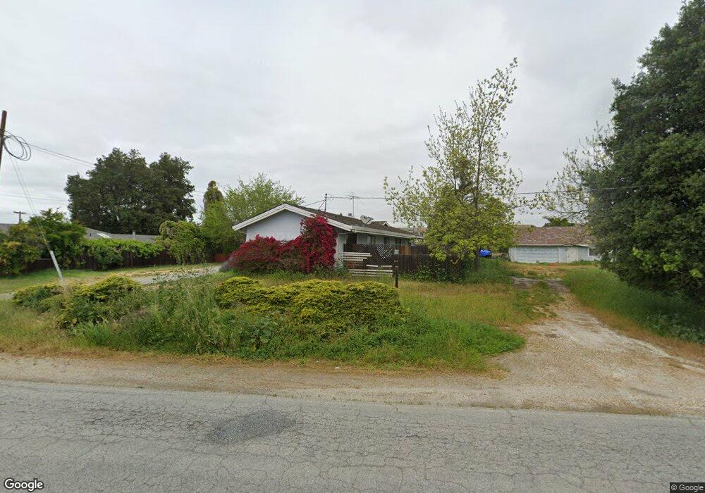
895 Enterprise Rd Hollister, CA 95023
Ridgemark NeighborhoodEstimated Value: $735,000 - $1,334,000
3
Beds
2
Baths
1,545
Sq Ft
$622/Sq Ft
Est. Value
About This Home
This home is located at 895 Enterprise Rd, Hollister, CA 95023 and is currently estimated at $960,660, approximately $621 per square foot. 895 Enterprise Rd is a home located in San Benito County with nearby schools including Ladd Lane Elementary School, Rancho San Justo School, and San Benito High School.
Ownership History
Date
Name
Owned For
Owner Type
Purchase Details
Closed on
Jun 29, 2016
Sold by
Mchenry Shari Trumbo and Mchenry Stephen
Bought by
Mchnery Family Trust and Mchenry
Current Estimated Value
Purchase Details
Closed on
Nov 19, 2011
Sold by
U S Bank National Association
Bought by
Mchenry Shari Trumbo and Mchenry Stephen
Home Financials for this Owner
Home Financials are based on the most recent Mortgage that was taken out on this home.
Original Mortgage
$204,000
Interest Rate
3.96%
Mortgage Type
New Conventional
Purchase Details
Closed on
Aug 21, 2010
Sold by
Amarillas Arthur C and Amarillas Elena G
Bought by
U S Bank National Association
Purchase Details
Closed on
Aug 4, 2005
Sold by
Kimball William J and Kimball Acacia J
Bought by
Amarillas Arthur C and Amarillas Elena G
Home Financials for this Owner
Home Financials are based on the most recent Mortgage that was taken out on this home.
Original Mortgage
$667,200
Interest Rate
5.56%
Mortgage Type
Purchase Money Mortgage
Purchase Details
Closed on
Aug 10, 2004
Sold by
Kimball William J and Kimball Acacia J
Bought by
Kimball William J and Kimball Acacia J
Home Financials for this Owner
Home Financials are based on the most recent Mortgage that was taken out on this home.
Original Mortgage
$350,000
Interest Rate
4.65%
Mortgage Type
New Conventional
Purchase Details
Closed on
Sep 6, 2001
Sold by
Kimball William J and Kimball Acacia
Bought by
Kimball William J and Kimball Acacia J
Home Financials for this Owner
Home Financials are based on the most recent Mortgage that was taken out on this home.
Original Mortgage
$245,000
Interest Rate
7.09%
Purchase Details
Closed on
Aug 24, 2001
Sold by
Ingerson Larry and Ingerson Trudy
Bought by
Kimball William J and Kimball Acacia
Home Financials for this Owner
Home Financials are based on the most recent Mortgage that was taken out on this home.
Original Mortgage
$245,000
Interest Rate
7.09%
Purchase Details
Closed on
Aug 10, 2000
Sold by
Pennington Audrey P
Bought by
Pennington Audrey and A A Pennington Family Trust
Create a Home Valuation Report for This Property
The Home Valuation Report is an in-depth analysis detailing your home's value as well as a comparison with similar homes in the area
Home Values in the Area
Average Home Value in this Area
Purchase History
| Date | Buyer | Sale Price | Title Company |
|---|---|---|---|
| Mchnery Family Trust | -- | None Listed On Document | |
| Mchenry Shari Trumbo | $280,500 | Orange Coast Title | |
| U S Bank National Association | $345,752 | Accommodation | |
| Amarillas Arthur C | $834,000 | Multiple | |
| Kimball William J | -- | -- | |
| Kimball William J | -- | Chicago Title Co | |
| Kimball William J | -- | -- | |
| Kimball William J | $545,000 | Stewart Title | |
| Pennington Audrey | -- | -- |
Source: Public Records
Mortgage History
| Date | Status | Borrower | Loan Amount |
|---|---|---|---|
| Previous Owner | Mchenry Shari Trumbo | $204,000 | |
| Previous Owner | Amarillas Arthur C | $667,200 | |
| Previous Owner | Kimball William J | $350,000 | |
| Previous Owner | Kimball William J | $245,000 | |
| Closed | Kimball William J | $150,000 |
Source: Public Records
Tax History Compared to Growth
Tax History
| Year | Tax Paid | Tax Assessment Tax Assessment Total Assessment is a certain percentage of the fair market value that is determined by local assessors to be the total taxable value of land and additions on the property. | Land | Improvement |
|---|---|---|---|---|
| 2025 | $4,325 | $352,309 | $156,999 | $195,310 |
| 2023 | $4,325 | $338,630 | $150,903 | $187,727 |
| 2022 | $4,187 | $331,992 | $147,945 | $184,047 |
| 2021 | $4,130 | $325,484 | $145,045 | $180,439 |
| 2020 | $4,147 | $322,147 | $143,558 | $178,589 |
| 2019 | $4,028 | $315,832 | $140,744 | $175,088 |
| 2018 | $3,931 | $309,640 | $137,985 | $171,655 |
| 2017 | $3,878 | $303,570 | $135,280 | $168,290 |
| 2016 | $3,651 | $297,619 | $132,628 | $164,991 |
| 2015 | $3,615 | $293,149 | $130,636 | $162,513 |
| 2014 | $3,403 | $287,408 | $128,078 | $159,330 |
Source: Public Records
Map
Nearby Homes
- 861 Enterprise Rd
- 1770 Brentwood Ct
- 1740 Brentwood Ct
- 2741 Grayson St
- 215 Rays Cir
- 2711 Valley View Rd
- 441 Tierra Del Sol
- 15 Carol Anns Ct
- 1751 Brighton Dr
- 1531 Brighton Dr
- 96 Caryl Ct
- 1900 Lotus Ct
- 1600 Panorama Dr
- 280 Joes Ln
- 1991 Rosemary Dr
- 270 Joes Ln
- 2421 Valley View Rd
- 2041 Camden St
- 2260 Ventana Ct
- 60 Dots Cir
- 3160 Airline Hwy
- 905 Valley Oak Dr
- 895 Valley Oak Dr
- 915 Valley Oak Dr
- 885 Valley Oak Dr
- 851 Enterprise Rd
- 875 Valley Oak Dr
- 925 Valley Oak Dr
- 935 Valley Oak Dr
- 3151 Airline Hwy
- 2616 Glenview Dr
- 3140 Airline Hwy
- 2618 Glenview Dr
- 945 Valley Oak Dr
- 2614 Glenview Dr
- 841 Enterprise Rd
- 2620 Glenview Dr
- 2612 Glenview Dr
- 855 Valley Oak Dr
- 2610 Glenview Dr