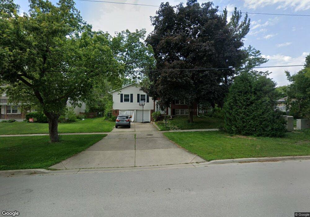
895 Freeman Rd Unit 2 Hoffman Estates, IL 60192
South Ridge NeighborhoodEstimated Value: $428,000 - $497,916
4
Beds
3
Baths
1,695
Sq Ft
$276/Sq Ft
Est. Value
About This Home
This home is located at 895 Freeman Rd Unit 2, Hoffman Estates, IL 60192 and is currently estimated at $467,479, approximately $275 per square foot. 895 Freeman Rd Unit 2 is a home located in Cook County with nearby schools including Thomas Jefferson Elementary School, Frank C. Whiteley Elementary School, and William Fremd High School.
Ownership History
Date
Name
Owned For
Owner Type
Purchase Details
Closed on
Mar 6, 2015
Sold by
Agassandian Khristofor and Agassandian Marianna
Bought by
Mikhailova Veronika
Current Estimated Value
Purchase Details
Closed on
Dec 9, 2010
Sold by
Declaration Mccarty Carolynn J
Bought by
Agassandian Khristofor and Agassandian Marianna
Home Financials for this Owner
Home Financials are based on the most recent Mortgage that was taken out on this home.
Original Mortgage
$172,000
Interest Rate
4.5%
Mortgage Type
New Conventional
Purchase Details
Closed on
May 24, 1999
Sold by
Mccarty Carolynn J and Mccarty Carolyn J
Bought by
Declaration Mccarty Carolynn J and Carolynn J Mccarty Declaration Of Trust
Create a Home Valuation Report for This Property
The Home Valuation Report is an in-depth analysis detailing your home's value as well as a comparison with similar homes in the area
Home Values in the Area
Average Home Value in this Area
Purchase History
| Date | Buyer | Sale Price | Title Company |
|---|---|---|---|
| Mikhailova Veronika | -- | None Available | |
| Agassandian Khristofor | $215,000 | First American Title | |
| Declaration Mccarty Carolynn J | -- | -- |
Source: Public Records
Mortgage History
| Date | Status | Borrower | Loan Amount |
|---|---|---|---|
| Previous Owner | Agassandian Khristofor | $172,000 |
Source: Public Records
Tax History
| Year | Tax Paid | Tax Assessment Tax Assessment Total Assessment is a certain percentage of the fair market value that is determined by local assessors to be the total taxable value of land and additions on the property. | Land | Improvement |
|---|---|---|---|---|
| 2025 | $10,327 | $41,000 | $13,167 | $27,833 |
| 2024 | $10,327 | $37,000 | $11,286 | $25,714 |
| 2023 | $9,950 | $37,000 | $11,286 | $25,714 |
| 2022 | $9,950 | $37,000 | $11,286 | $25,714 |
| 2021 | $7,775 | $26,549 | $7,837 | $18,712 |
| 2020 | $7,679 | $26,549 | $7,837 | $18,712 |
| 2019 | $7,600 | $29,434 | $7,837 | $21,597 |
| 2018 | $7,081 | $25,787 | $7,210 | $18,577 |
| 2017 | $8,017 | $25,787 | $7,210 | $18,577 |
| 2016 | $8,522 | $29,533 | $7,210 | $22,323 |
| 2015 | $6,682 | $21,500 | $6,583 | $14,917 |
| 2014 | $6,556 | $21,500 | $6,583 | $14,917 |
| 2013 | $6,390 | $21,500 | $6,583 | $14,917 |
Source: Public Records
Map
Nearby Homes
- 4100 N Victoria Dr
- 4480 Thornbark Dr
- 10 Carnoustie Ln
- 3881 Bordeaux Dr
- 1281 Old Timber Ct
- 4475 Olmstead Dr
- 1280 Clover Ln
- 1886 Clover Dr
- 3830 Anjou Ln
- 1213 Silver Pine Dr
- 688 Thompsons Way
- 1478 W Sapphire Dr
- 1620 Pheasant Trail
- 3539 Elsie Ln
- 1690 Cape Breton Ct
- 1842 Thomas Atkinson Rd
- 4990 Rochester Dr
- 4950 Tarrington Dr
- 5190 Chambers Dr
- 4490 Capstan Dr
- 885 Freeman Rd
- 4255 Eisenhower Cir
- 4265 Eisenhower Cir
- 4245 Eisenhower Cir
- 865 Freeman Rd
- 4235 Eisenhower Cir Unit 3
- 845 Freeman Rd
- 880 W Firestone Dr
- 890 Freeman Rd Unit 2
- 870 W Firestone Dr
- 880 Freeman Rd
- 4275 Eisenhower Cir
- 900 W Firestone Dr
- 4250 Eisenhower Cir
- 4230 Eisenhower Cir
- 4260 Eisenhower Cir
- 4240 Eisenhower Cir
- 860 W Firestone Dr
- 910 W Firestone Dr
- 835 Freeman Rd
Your Personal Tour Guide
Ask me questions while you tour the home.