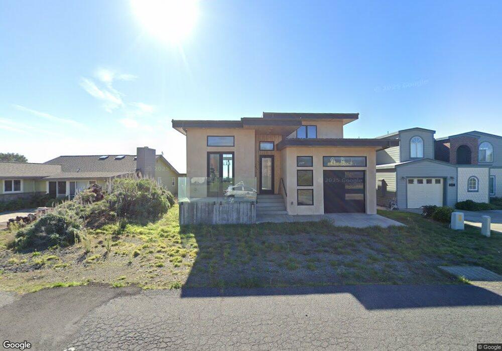
895 Lower Pacific Dr Whitethorn, CA 95589
Shelter Cove NeighborhoodEstimated Value: $571,000 - $703,000
--
Bed
--
Bath
--
Sq Ft
5,663
Sq Ft Lot
About This Home
This home is located at 895 Lower Pacific Dr, Whitethorn, CA 95589 and is currently estimated at $630,929. 895 Lower Pacific Dr is a home located in Humboldt County.
Ownership History
Date
Name
Owned For
Owner Type
Purchase Details
Closed on
Feb 12, 2018
Sold by
Epstein Bradley John
Bought by
Epstein Bradley John and Bradley John Epstein Living Tr
Current Estimated Value
Purchase Details
Closed on
Aug 22, 2017
Sold by
Epstein Leslie Suzanne
Bought by
Epstein Bradley John
Purchase Details
Closed on
Feb 11, 2004
Sold by
Tripoli Jerome Peter
Bought by
Epstein Bradley John and Epstein Leslie Suzanne
Home Financials for this Owner
Home Financials are based on the most recent Mortgage that was taken out on this home.
Original Mortgage
$153,000
Interest Rate
5.61%
Mortgage Type
Purchase Money Mortgage
Purchase Details
Closed on
Oct 3, 2000
Sold by
Vonderahe Gerald and Vonderahe Kathleen N
Bought by
Tripoli Jerome Peter
Home Financials for this Owner
Home Financials are based on the most recent Mortgage that was taken out on this home.
Original Mortgage
$100,000
Interest Rate
7.9%
Mortgage Type
Seller Take Back
Create a Home Valuation Report for This Property
The Home Valuation Report is an in-depth analysis detailing your home's value as well as a comparison with similar homes in the area
Home Values in the Area
Average Home Value in this Area
Purchase History
| Date | Buyer | Sale Price | Title Company |
|---|---|---|---|
| Epstein Bradley John | -- | None Available | |
| Epstein Bradley John | -- | None Available | |
| Epstein Bradley John | $295,000 | First American Title Ins Co | |
| Tripoli Jerome Peter | -- | Humboldt Land Title Company |
Source: Public Records
Mortgage History
| Date | Status | Borrower | Loan Amount |
|---|---|---|---|
| Closed | Epstein Bradley John | $153,000 | |
| Previous Owner | Tripoli Jerome Peter | $100,000 |
Source: Public Records
Tax History Compared to Growth
Tax History
| Year | Tax Paid | Tax Assessment Tax Assessment Total Assessment is a certain percentage of the fair market value that is determined by local assessors to be the total taxable value of land and additions on the property. | Land | Improvement |
|---|---|---|---|---|
| 2025 | $6,140 | $543,000 | $196,000 | $347,000 |
| 2024 | $6,140 | $543,000 | $196,000 | $347,000 |
| 2023 | $6,281 | $543,000 | $196,000 | $347,000 |
| 2022 | $6,303 | $543,000 | $196,000 | $347,000 |
| 2021 | $1,624 | $120,000 | $120,000 | $0 |
| 2020 | $1,645 | $120,000 | $120,000 | $0 |
| 2019 | $2,716 | $220,000 | $220,000 | $0 |
| 2018 | $2,720 | $220,000 | $220,000 | $0 |
| 2017 | $2,646 | $220,000 | $220,000 | $0 |
| 2016 | $2,679 | $220,000 | $220,000 | $0 |
| 2015 | $2,703 | $220,000 | $220,000 | $0 |
| 2014 | $2,657 | $220,000 | $220,000 | $0 |
Source: Public Records
Map
Nearby Homes
- 86 Steelhead Ct
- 23 Steelhead Ct
- 794 & 806 Lower Pacific Dr
- 126 Neptune Dr
- 93 Neptune Rd
- 6 Coral Point
- 81 Neptune Rd
- 1054 Lower Pacific Dr
- 806 Lower Pacific Dr
- 58 Lower Pacific Dr
- 15 Seal Ct
- 680 Lower Pacific Dr
- 36 Bambi Dr
- 1325&1335 Upper Pacific Dr
- 16 Bambi Dr
- 1630 Upper Pacific Dr
- 82 Fawn Dr
- 142 Oceanview Rd
- 81 Fawn Dr
- 554 Lower Pacific Dr
- 887 Lower Pacific Dr
- 905 Lower Pacific Dr
- 917 Lower Pacific Dr
- 929 Lower Pacific Dr
- 877 Lower Pacific Dr
- 906 Lower Pacific Dr
- 941 Lower Pacific Dr
- 871 Lower Pacific Dr
- 872 Lower Pacific Dr
- 30 Steelhead Ct
- 40 Steelhead Ct
- 883 Lower Pacific Dr
- 6 Steelhead Ct
- 74 Steelhead Ct
- 94 Steelhead Ct
- 849 Lower Pacific Dr
- 60 Steelhead Ct
- 18 Gull Point
- 19 Gull Point
- 15 Gull Point