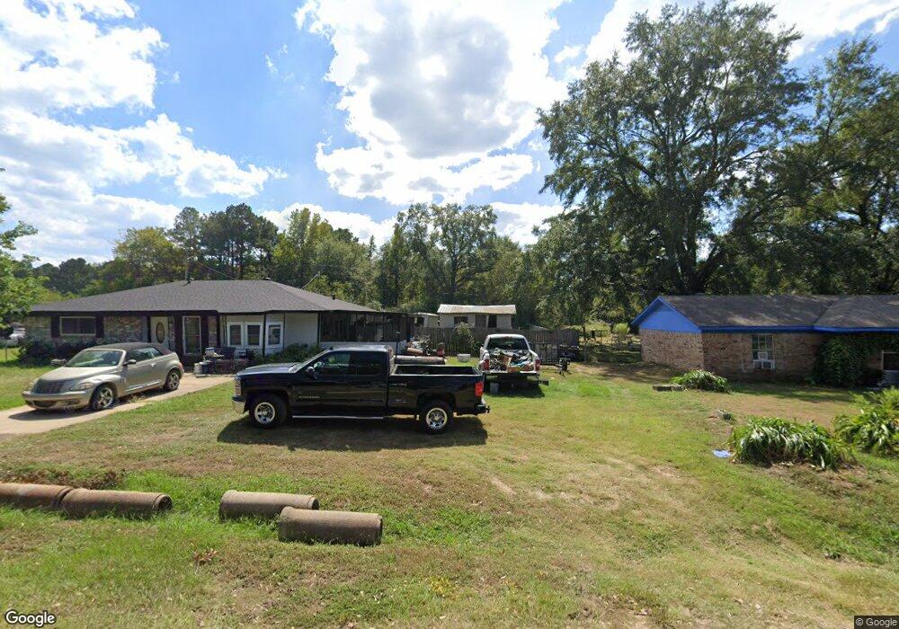
8959 Rolling Ridge Dr Shreveport, LA 71129
Estimated Value: $52,000 - $96,000
4
Beds
3
Baths
1,984
Sq Ft
$36/Sq Ft
Est. Value
About This Home
This home is located at 8959 Rolling Ridge Dr, Shreveport, LA 71129 and is currently estimated at $71,415, approximately $35 per square foot. 8959 Rolling Ridge Dr is a home located in Caddo Parish with nearby schools including Judson Fundamental Elementary School, Fairfield Magnet School, and Claiborne Fundamental Elementary School.
Ownership History
Date
Name
Owned For
Owner Type
Purchase Details
Closed on
Dec 8, 2021
Sold by
Derick Willis
Bought by
Mitchell Monica Evette
Current Estimated Value
Purchase Details
Closed on
Jul 3, 2018
Sold by
Caddo Parish Sheriff
Bought by
White Oak Title Llc
Purchase Details
Closed on
May 18, 2018
Sold by
Caddo County Collector
Bought by
White Oak Title Llc
Purchase Details
Closed on
Jun 20, 2014
Sold by
Orion 2013 Llc
Bought by
Boardwalk Investors
Create a Home Valuation Report for This Property
The Home Valuation Report is an in-depth analysis detailing your home's value as well as a comparison with similar homes in the area
Home Values in the Area
Average Home Value in this Area
Purchase History
| Date | Buyer | Sale Price | Title Company |
|---|---|---|---|
| Mitchell Monica Evette | -- | None Listed On Document | |
| White Oak Title Llc | $641 | None Available | |
| White Oak Title Llc | $367 | None Available | |
| Boardwalk Investors | $620 | None Available |
Source: Public Records
Tax History Compared to Growth
Tax History
| Year | Tax Paid | Tax Assessment Tax Assessment Total Assessment is a certain percentage of the fair market value that is determined by local assessors to be the total taxable value of land and additions on the property. | Land | Improvement |
|---|---|---|---|---|
| 2024 | $405 | $2,597 | $382 | $2,215 |
| 2023 | $411 | $2,579 | $364 | $2,215 |
| 2022 | $411 | $2,579 | $364 | $2,215 |
| 2021 | $405 | $2,579 | $364 | $2,215 |
| 2020 | $381 | $2,426 | $364 | $2,062 |
| 2019 | $392 | $2,426 | $364 | $2,062 |
| 2018 | $312 | $2,426 | $364 | $2,062 |
| 2017 | $399 | $2,426 | $364 | $2,062 |
| 2015 | $363 | $2,799 | $364 | $2,435 |
| 2014 | $393 | $3,010 | $360 | $2,650 |
| 2013 | -- | $3,010 | $360 | $2,650 |
Source: Public Records
Map
Nearby Homes
- 0 Beavers Nest Unit 20759265
- 00 Beavers Nest
- 8802 Beavers Nest Dr
- 61 Brookstone Dr
- Lot 49 Stillwater Cir
- 0 (Lot 78) Autumn Creek Cir
- 0 (lot 77) Autumn Creek Cir
- 0 (Lot 76) Autumn Creek Cir
- 0 (Lot 75) Autumn Creek Cir
- 0 (Lot 72) Autumn Creek Cir
- 0 (Lot 71) Autumn Creek Cir
- 0 (lot70) Autumn Creek Cir
- 0 (Lot 69) Autumn Creek Cir
- 0 (Lot 68) Autumn Creek Cir
- 8185 Fleetwood Dr
- 00 Teri Ln
- 9304 Simpson Rd
- 0 Simpson Rd Unit 20837681
- 8146 Myrtlewood Rd
- 8142 Myrtlewood Dr
- 8959 Rolling Ridge Dr
- 8959 Rolling Ridge Dr
- 8955 Rolling Ridge Dr
- 8963 Rolling Ridge Dr
- 8958 Rolling Ridge Dr
- 8951 Rolling Ridge Dr
- 8967 Rolling Ridge Dr
- 8954 Rolling Ridge Dr
- 8947 Rolling Ridge Dr
- 8971 Rolling Ridge Dr
- 8950 Rolling Ridge Dr
- 8966 Rolling Ridge Dr
- 8970 Rolling Ridge Dr
- 8946 Rolling Ridge Dr
- 8943 Rolling Ridge Dr
- 9037 Greenwood Springridge Rd
- 8939 Rolling Ridge Dr
- 8938 Rolling Ridge Dr
- 8937 Rolling Ridge Dr
- 8959 Bolo Rd