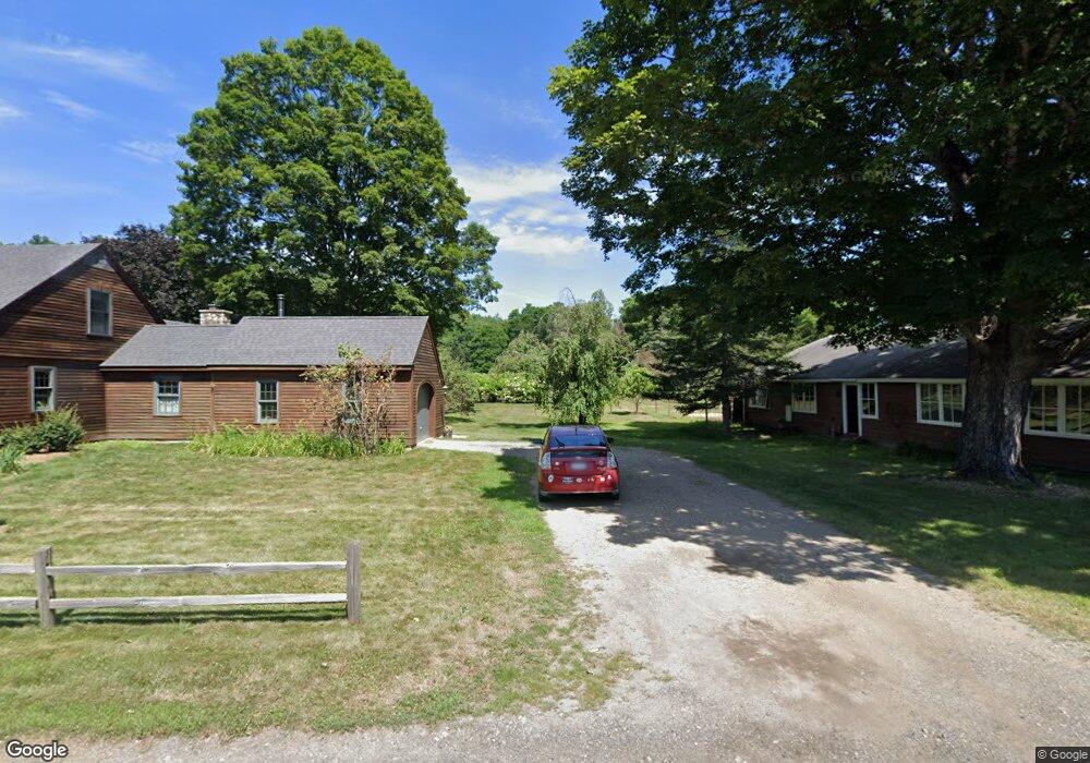
896 Graves Rd Conway, MA 01341
Estimated Value: $515,293 - $575,000
3
Beds
2
Baths
1,996
Sq Ft
$269/Sq Ft
Est. Value
About This Home
This home is located at 896 Graves Rd, Conway, MA 01341 and is currently estimated at $537,323, approximately $269 per square foot. 896 Graves Rd is a home located in Franklin County with nearby schools including Frontier Regional School.
Ownership History
Date
Name
Owned For
Owner Type
Purchase Details
Closed on
Dec 19, 2023
Sold by
Lewis Marcia P
Bought by
Marcia P Lewis Ret and Lewis
Current Estimated Value
Purchase Details
Closed on
Oct 4, 2013
Sold by
Prudden Peter G
Bought by
Lewis Marcia P
Purchase Details
Closed on
Jun 25, 2012
Sold by
Bank Of America Na
Bought by
Lewis Marcia P and Prudden Peter G
Purchase Details
Closed on
Nov 15, 2000
Sold by
Dorval Ralph G and Dorval Kathleen
Bought by
Prudden Peter D and Prudden Betsy P
Create a Home Valuation Report for This Property
The Home Valuation Report is an in-depth analysis detailing your home's value as well as a comparison with similar homes in the area
Home Values in the Area
Average Home Value in this Area
Purchase History
| Date | Buyer | Sale Price | Title Company |
|---|---|---|---|
| Marcia P Lewis Ret | -- | None Available | |
| Lewis Marcia P | $150,000 | -- | |
| Lewis Marcia P | -- | -- | |
| Bank Of America Na | -- | -- | |
| Prudden Peter D | $235,000 | -- |
Source: Public Records
Mortgage History
| Date | Status | Borrower | Loan Amount |
|---|---|---|---|
| Previous Owner | Prudden Peter D | $19,000 | |
| Previous Owner | Prudden Peter D | $110,000 | |
| Previous Owner | Prudden Peter D | $123,750 |
Source: Public Records
Tax History
| Year | Tax Paid | Tax Assessment Tax Assessment Total Assessment is a certain percentage of the fair market value that is determined by local assessors to be the total taxable value of land and additions on the property. | Land | Improvement |
|---|---|---|---|---|
| 2025 | $6,756 | $467,900 | $84,100 | $383,800 |
| 2024 | $6,258 | $381,600 | $76,400 | $305,200 |
| 2023 | $6,544 | $381,600 | $76,400 | $305,200 |
| 2022 | $6,349 | $353,700 | $71,100 | $282,600 |
| 2021 | $1,351 | $333,300 | $67,700 | $265,600 |
| 2020 | $1,241 | $311,700 | $67,600 | $244,100 |
| 2019 | $5,813 | $311,700 | $67,600 | $244,100 |
| 2018 | $5,757 | $311,200 | $67,600 | $243,600 |
| 2017 | $5,524 | $311,200 | $67,600 | $243,600 |
| 2016 | $5,022 | $301,100 | $59,000 | $242,100 |
| 2015 | $4,869 | $301,100 | $59,000 | $242,100 |
Source: Public Records
Map
Nearby Homes
- lot 1 Shelburne Falls Rd
- 85 Dacey Rd
- 71 Mathews Rd
- 3 Adams Ct Unit A
- 345 Greenfield Rd
- 240 Beldingville Rd
- 208 Greenfield Rd
- 259 Wisdom Way
- 355 Greenfield Rd
- 163 S Shelburne Rd
- 130 Laurel St
- 102 Elm St
- 23 Robbins Rd
- 83 Newton St
- 414 Mohawk Trail
- 527 Main St
- 58A Laurel St
- 59 N Hillside Rd
- 24 Elm St
- 32 Homestead Ave
- 858 Graves Rd
- Lot 15 Graves Rd
- 565 Reeds Bridge Rd
- 861 Graves Rd
- 615 Reeds Bridge Rd
- 765 Graves Rd
- 734 Reeds Bridge Rd
- 826 Graves Rd
- 800 Graves Rd
- 655 Reeds Bridge Rd
- 733 Graves Rd
- 776 Reeds Bridge Rd
- 661 Graves Rd
- 433 Reeds Bridge Rd
- 651 Graves Rd
- 364 Reeds Bridge Rd
- 362 Reeds Bridge Rd
- 84 Leukhardt Rd
- 876 Reeds Bridge Rd
- 360 Reeds Bridge Rd
Your Personal Tour Guide
Ask me questions while you tour the home.