Estimated Value: $507,000 - $581,052
3
Beds
3
Baths
1,098
Sq Ft
$504/Sq Ft
Est. Value
About This Home
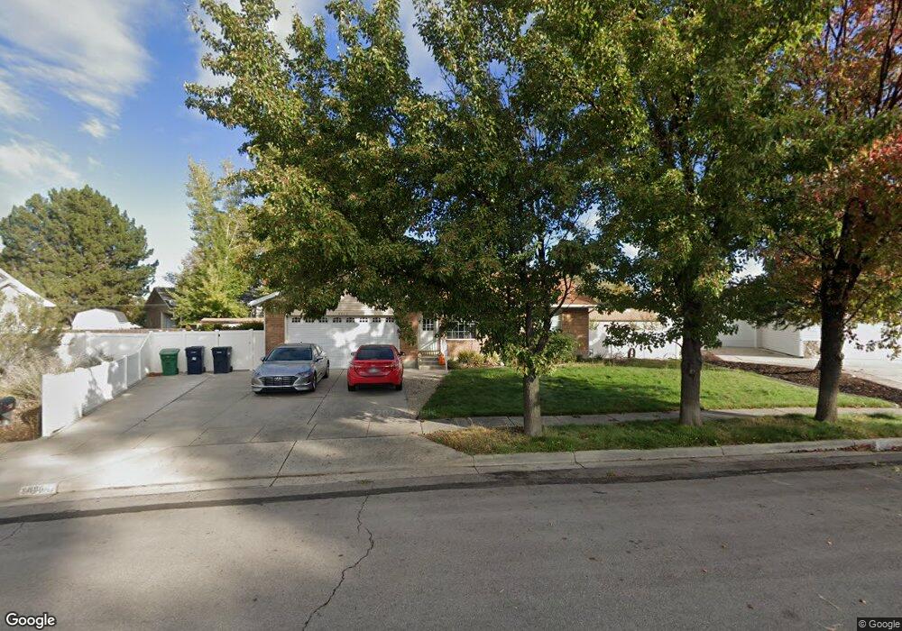
This home is located at 8960 Brentmar Cir, Sandy, UT 84070 and is currently estimated at $553,013, approximately $503 per square foot. 8960 Brentmar Cir is a home located in Salt Lake County with nearby schools including Sandy Elementary School, Mount Jordan Middle School, and Jordan High.
Ownership History
Date
Name
Owned For
Owner Type
Purchase Details
Closed on
Jan 19, 2021
Sold by
Forrest James
Bought by
Forrest James and Forrest Alesa
Current Estimated Value
Purchase Details
Closed on
Jun 13, 2017
Sold by
Crane Miller R and Crane Mamie L
Bought by
Forrest James
Home Financials for this Owner
Home Financials are based on the most recent Mortgage that was taken out on this home.
Original Mortgage
$319,014
Outstanding Balance
$267,007
Interest Rate
4.25%
Mortgage Type
FHA
Estimated Equity
$286,006
Create a Home Valuation Report for This Property
The Home Valuation Report is an in-depth analysis detailing your home's value as well as a comparison with similar homes in the area
Home Values in the Area
Average Home Value in this Area
Purchase History
| Date | Buyer | Sale Price | Title Company |
|---|---|---|---|
| Forrest James | -- | Us Title | |
| Forrest James | -- | Security Title Of Davis Co I |
Source: Public Records
Mortgage History
| Date | Status | Borrower | Loan Amount |
|---|---|---|---|
| Open | Forrest James | $319,014 |
Source: Public Records
Tax History Compared to Growth
Tax History
| Year | Tax Paid | Tax Assessment Tax Assessment Total Assessment is a certain percentage of the fair market value that is determined by local assessors to be the total taxable value of land and additions on the property. | Land | Improvement |
|---|---|---|---|---|
| 2025 | $2,929 | $550,600 | $127,100 | $423,500 |
| 2024 | $2,929 | $541,700 | $119,500 | $422,200 |
| 2023 | $2,703 | $498,400 | $101,600 | $396,800 |
| 2022 | $2,812 | $506,500 | $99,600 | $406,900 |
| 2021 | $2,528 | $387,600 | $86,600 | $301,000 |
| 2020 | $2,413 | $348,900 | $70,200 | $278,700 |
| 2019 | $2,336 | $329,200 | $70,200 | $259,000 |
| 2018 | $2,229 | $327,000 | $70,200 | $256,800 |
| 2017 | $1,776 | $248,900 | $62,400 | $186,500 |
| 2016 | $1,776 | $240,600 | $62,400 | $178,200 |
| 2015 | $1,768 | $221,600 | $64,900 | $156,700 |
| 2014 | $1,730 | $212,600 | $63,000 | $149,600 |
Source: Public Records
Map
Nearby Homes
- 608 E 8800 S
- 8823 S 300 E
- 8915 S 660 E Unit 103
- 8732 S 620 E
- 354 E 8620 S
- 627 E 8680 S
- 775 E Autumn Field Dr
- 9055 Jason K Cir Unit 4A
- 9191 S 220 E
- 8729 S Leafwood Ln
- 9203 S 220 E
- 8722 S Oakwood Park Cir Unit 8722
- 8550 S 570 E
- 807 E Whisper Cove Rd
- 386 Pioneer Ave
- 8953 S 90 E
- 547 E Pioneer Ave
- 8544 S 300 E
- 8772 S 120 E
- 110 E Main St
- 8960 S Brentmar Cir
- 8965 Brentmar Cir
- 8965 S Brentmar Cir
- 8966 S Brentmar Cir Unit 1
- 8966 S Brentmar Cir
- 8966 Brentmar Cir
- 444 E Laurel Dr
- 444 Laurel Dr
- 476 E Mingo Park Dr
- 8973 Brentmar Cir
- 8973 S Brentmar Cir
- 476 Mingo Park Dr
- 8974 Brentmar Cir
- 8974 S Brentmar Cir
- 440 Laurel Dr
- 440 E Laurel Dr
- 482 E Mingo Park Dr
- 482 Mingo Park Dr
- 8919 S Laurel Dr
- 8919 Laurel Dr