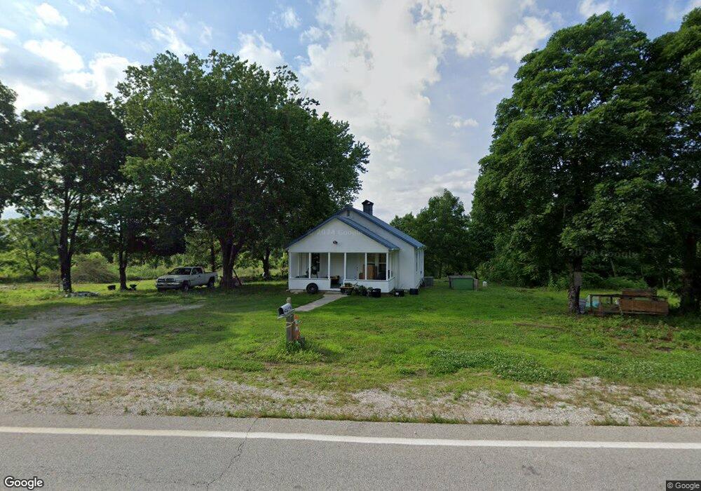
8965 E State Highway 76 Anderson, MO 64831
Estimated Value: $78,000 - $165,812
Studio
--
Bath
1,008
Sq Ft
$132/Sq Ft
Est. Value
About This Home
This home is located at 8965 E State Highway 76, Anderson, MO 64831 and is currently estimated at $133,271, approximately $132 per square foot. 8965 E State Highway 76 is a home with nearby schools including McDonald County High School.
Ownership History
Date
Name
Owned For
Owner Type
Purchase Details
Closed on
May 17, 2024
Sold by
Clark Jennifer Joann and Clark Chad Edward
Bought by
Mifsud Neil John and Mifsud Julie Marie
Current Estimated Value
Home Financials for this Owner
Home Financials are based on the most recent Mortgage that was taken out on this home.
Original Mortgage
$160,000
Outstanding Balance
$157,432
Interest Rate
6.82%
Mortgage Type
VA
Estimated Equity
-$24,161
Purchase Details
Closed on
Oct 17, 2023
Sold by
Branch Banking And Trust Company
Bought by
Single Jennifer Joann Clark and Clark Chad Edward
Purchase Details
Closed on
Jan 4, 2023
Sold by
Reinier Jason
Bought by
Brown Murrell
Purchase Details
Closed on
Dec 9, 2022
Sold by
Millsap & Singer Pc
Bought by
Branch Banking And Trust Company
Purchase Details
Closed on
Oct 28, 2005
Sold by
Gideon Oddie and Gideon Erlene
Bought by
Swadley Raymond Paul and Swadley Jacqueline
Home Financials for this Owner
Home Financials are based on the most recent Mortgage that was taken out on this home.
Original Mortgage
$67,000
Interest Rate
9%
Mortgage Type
Seller Take Back
Create a Home Valuation Report for This Property
The Home Valuation Report is an in-depth analysis detailing your home's value as well as a comparison with similar homes in the area
Purchase History
| Date | Buyer | Sale Price | Title Company |
|---|---|---|---|
| Mifsud Neil John | -- | Waco Title Company | |
| Single Jennifer Joann Clark | $66,999 | None Listed On Document | |
| Single Jennifer Joann Clark | $66,999 | None Listed On Document | |
| Brown Murrell | -- | -- | |
| Branch Banking And Trust Company | $69,742 | -- | |
| Swadley Raymond Paul | -- | None Available |
Source: Public Records
Mortgage History
| Date | Status | Borrower | Loan Amount |
|---|---|---|---|
| Open | Mifsud Neil John | $160,000 | |
| Previous Owner | Swadley Raymond Paul | $67,000 |
Source: Public Records
Tax History
| Year | Tax Paid | Tax Assessment Tax Assessment Total Assessment is a certain percentage of the fair market value that is determined by local assessors to be the total taxable value of land and additions on the property. | Land | Improvement |
|---|---|---|---|---|
| 2025 | $341 | $8,630 | $0 | $0 |
| 2024 | $341 | $8,020 | $0 | $0 |
| 2023 | $341 | $8,020 | $0 | $0 |
| 2022 | $341 | $8,020 | $0 | $0 |
| 2021 | $341 | $8,020 | $0 | $0 |
| 2020 | $312 | $7,300 | $0 | $0 |
| 2019 | $290 | $7,300 | $0 | $0 |
| 2018 | $291 | $7,300 | $0 | $0 |
| 2017 | $291 | $7,300 | $0 | $0 |
| 2016 | $267 | $6,700 | $0 | $0 |
| 2015 | -- | $6,700 | $0 | $0 |
| 2014 | -- | $6,700 | $0 | $0 |
Source: Public Records
Map
Nearby Homes
- 144 Serenity Ln
- 10 +/- Acres Atkins Rd
- 16 +/- Acres Atkins Rd
- 26 +/- Acr Atkins Rd
- 383 Atkins Rd
- 65 Acres Plainview Rd
- 110 & 128 Mackenzie Ln
- 116 Hambrich Hollow Rd
- 000 Buckeye Ln
- 3535 Peach Orchard Rd
- 2332 Packet Hollow Rd
- 7257 Route Cc
- 7257 State Highway Cc
- 3150 Route Hwy W
- 949 E Route Hwy
- 340 Mcnatt Rd
- 756 Cyclone Rd
- 1633 Jessie James Rd
- 5641 State Highway K
- 9 +/- Anthony Ln
- 8965 E State Highway 76
- 8887 E State Highway 76
- 28 Garden Ln
- 9136 E State Highway 76
- 8866 E State Highway 76
- 9149 E State Highway 76
- 9164 E State Highway 76
- 290 N Plainview Rd
- 313 Plainview Rd
- 113 N Plainview Rd
- 289 N Plainview Rd
- 450 N Plainview Rd
- 185 Plainview Rd
- 117 Plainview Rd
- 8532 E State Highway 76
- 9 Herd Rd
- 75 Plainview Rd
- 255 Plainview Rd
- 260 Bone Ln
- 125 Herd Rd
Your Personal Tour Guide
Ask me questions while you tour the home.