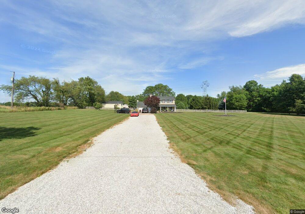
8975 Allen Dr NE Alliance, OH 44601
Estimated Value: $343,501 - $407,000
1
Bed
3
Baths
2,056
Sq Ft
$177/Sq Ft
Est. Value
About This Home
This home is located at 8975 Allen Dr NE, Alliance, OH 44601 and is currently estimated at $364,125, approximately $177 per square foot. 8975 Allen Dr NE is a home located in Stark County with nearby schools including Marlington High School.
Ownership History
Date
Name
Owned For
Owner Type
Purchase Details
Closed on
May 27, 2025
Sold by
Shaffer Mark and Shaffer Michelle
Bought by
Shaffer Kenneth and Shaffer Paige
Current Estimated Value
Purchase Details
Closed on
Apr 4, 1997
Sold by
Wizard Property Investme
Bought by
Shaffer Mark E and Shaffer Michelle C
Home Financials for this Owner
Home Financials are based on the most recent Mortgage that was taken out on this home.
Original Mortgage
$109,000
Outstanding Balance
$13,798
Interest Rate
7.65%
Mortgage Type
New Conventional
Estimated Equity
$350,327
Purchase Details
Closed on
Jun 24, 1996
Sold by
Johnson Terry
Bought by
Wizard Property Inv Inc
Create a Home Valuation Report for This Property
The Home Valuation Report is an in-depth analysis detailing your home's value as well as a comparison with similar homes in the area
Home Values in the Area
Average Home Value in this Area
Purchase History
| Date | Buyer | Sale Price | Title Company |
|---|---|---|---|
| Shaffer Kenneth | $266,000 | None Listed On Document | |
| Shaffer Mark E | $139,000 | -- | |
| Wizard Property Inv Inc | $113,000 | -- |
Source: Public Records
Mortgage History
| Date | Status | Borrower | Loan Amount |
|---|---|---|---|
| Open | Shaffer Mark E | $109,000 |
Source: Public Records
Tax History Compared to Growth
Tax History
| Year | Tax Paid | Tax Assessment Tax Assessment Total Assessment is a certain percentage of the fair market value that is determined by local assessors to be the total taxable value of land and additions on the property. | Land | Improvement |
|---|---|---|---|---|
| 2025 | -- | $99,510 | $19,150 | $80,360 |
| 2024 | -- | $99,510 | $19,150 | $80,360 |
| 2023 | $2,897 | $77,080 | $15,370 | $61,710 |
| 2022 | $2,907 | $77,080 | $15,370 | $61,710 |
| 2021 | $2,917 | $77,080 | $15,370 | $61,710 |
| 2020 | $2,683 | $64,830 | $12,920 | $51,910 |
| 2019 | $2,666 | $64,830 | $12,920 | $51,910 |
| 2018 | $2,548 | $64,830 | $12,920 | $51,910 |
| 2017 | $2,382 | $56,080 | $11,240 | $44,840 |
| 2016 | $2,407 | $56,640 | $11,240 | $45,400 |
| 2015 | $2,411 | $56,640 | $11,240 | $45,400 |
| 2014 | $273 | $49,330 | $9,810 | $39,520 |
| 2013 | $1,113 | $49,330 | $9,810 | $39,520 |
Source: Public Records
Map
Nearby Homes
- 8736 Lynn Park St NE
- 14265 Reeder Ave NE
- 0 New Milford Rd Unit 5119787
- 7377 Pontius St NE
- 167 State Route 44
- 4829 Laubert Rd
- 3952 Laubert Rd
- 6180 Edison St NE
- 5615 Laubert Rd
- 0 Pontius St NE
- 14920 Mccallum Ave NE
- 12415 Snode St NE
- 12355 Edison St NE
- 5296 Eberly Rd
- 12561 Duquette Ave NE
- 3990 Edison St NE
- 11960 Freshley Ave NE
- 1291 State Route 44
- 1026 Hartville Rd N
- 13109 Edison St NE
- 8974 Allen Dr NE
- 8886 Allen Dr NE
- 8954 Allen Dr NE
- 9127 Allen Dr NE
- 9015 Allen Dr NE
- 9001 Allen Dr NE
- 8970 Allen Dr NE
- 9070 Allen Dr NE
- 8946 Allen Dr NE
- 9173 Allen Dr NE
- 8940 Allen Dr NE
- 9002 Allen Dr NE
- 9010 Allen Dr NE
- 9177 Allen Dr NE
- 9168 Allen Dr NE
- 9193 Allen Dr NE
- 9176 Allen Dr NE
- 9176 Allen Dr NE
- 8852 Allen Dr NE
- 8776 Allen Dr NE