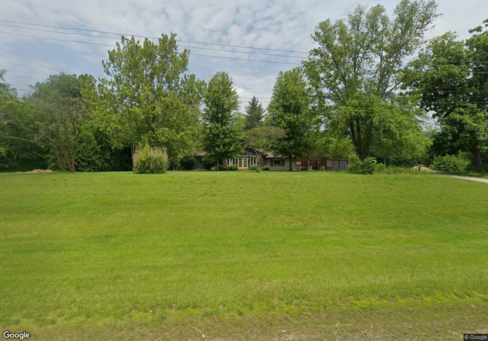
8975 E 2500 Rd N Cornell, IL 61319
Estimated Value: $239,000 - $336,000
4
Beds
2
Baths
2,920
Sq Ft
$98/Sq Ft
Est. Value
About This Home
This home is located at 8975 E 2500 Rd N, Cornell, IL 61319 and is currently estimated at $287,379, approximately $98 per square foot. 8975 E 2500 Rd N is a home located in Livingston County with nearby schools including Flanagan Elementary School and Flanagan-Cornell High School.
Ownership History
Date
Name
Owned For
Owner Type
Purchase Details
Closed on
Aug 27, 2010
Sold by
Fortner Bruce B and Fortner Beth
Bought by
Fortner Nicholas and Fortner Kate E
Current Estimated Value
Home Financials for this Owner
Home Financials are based on the most recent Mortgage that was taken out on this home.
Original Mortgage
$27,000
Interest Rate
4.42%
Create a Home Valuation Report for This Property
The Home Valuation Report is an in-depth analysis detailing your home's value as well as a comparison with similar homes in the area
Purchase History
| Date | Buyer | Sale Price | Title Company |
|---|---|---|---|
| Fortner Nicholas | $173,500 | -- |
Source: Public Records
Mortgage History
| Date | Status | Borrower | Loan Amount |
|---|---|---|---|
| Closed | Fortner Nicholas | $27,000 | |
| Open | Fortner Nicholas | $144,000 |
Source: Public Records
Tax History
| Year | Tax Paid | Tax Assessment Tax Assessment Total Assessment is a certain percentage of the fair market value that is determined by local assessors to be the total taxable value of land and additions on the property. | Land | Improvement |
|---|---|---|---|---|
| 2024 | $4,099 | $82,740 | $4,670 | $78,070 |
| 2023 | $3,935 | $75,218 | $4,245 | $70,973 |
| 2022 | $5,067 | $69,709 | $4,245 | $65,464 |
| 2021 | $5,416 | $69,539 | $3,990 | $65,549 |
| 2020 | $5,329 | $65,603 | $3,764 | $61,839 |
| 2019 | $5,330 | $64,003 | $3,672 | $60,331 |
| 2018 | $4,994 | $57,928 | $3,264 | $54,664 |
| 2017 | $4,945 | $55,700 | $3,138 | $52,562 |
| 2016 | $4,979 | $55,700 | $3,138 | $52,562 |
| 2015 | $5,310 | $61,208 | $3,448 | $57,760 |
| 2013 | $5,260 | $59,904 | $3,542 | $56,362 |
Source: Public Records
Map
Nearby Homes
- 23750 N 800 Rd E
- 23750 N 800 Rd E
- 10617 E 2950 Rd N
- 502 S Main St
- 201 S Carson St
- 32415 N 600 East Rd
- 418 Carriage Lane Estates Unit 418
- 1840 S Jacobs St
- 23601 N 1700 East Rd
- 10735 E 1700 Rd N
- 1911 S Church St
- 1812 S Bloomington St
- 1404 S Monroe St
- 1107 Arthur St
- 921 Maple St
- 1013 Hoyne St
- 408 E Ririe Place
- 1012 Cable St
- 1907 Coalville Rd
- 920 Hall St
- 8975 E 2500 North Rd
- 8974 E 2500 North Rd
- 8808 E 2500 North Rd
- 8991 E 2500 North Rd
- 8730 E 2500 North Rd
- 8730 E 2500 North Rd
- 8731 E 2500 North Rd
- 9092 E 2500 North Rd
- 9092 E 2500 North Rd
- 8415 E 2500 North Rd
- 8771 E 2450 North Rd
- 9993 E 2500 North Rd
- 23796 N 915 East Rd
- 23958 N 915 East Rd
- 8190 E 2500 North Rd
- 29213 N 848 East Rd
- 29213 N 848 East Rd
- 24170 N 875 East Rd
- 25590 N 950 East Rd
- 24194 N 820 East Rd
Your Personal Tour Guide
Ask me questions while you tour the home.