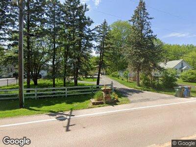
8S494 Barnes Rd Aurora, IL 60506
Blackberry Countryside NeighborhoodEstimated Value: $272,308 - $362,000
2
Beds
--
Bath
850
Sq Ft
$385/Sq Ft
Est. Value
About This Home
This home is located at 8S494 Barnes Rd, Aurora, IL 60506 and is currently estimated at $326,827, approximately $384 per square foot. 8S494 Barnes Rd is a home located in Kane County with nearby schools including Kaneland Mcdole Elementary School, Harter Middle School, and Kaneland Senior High School.
Ownership History
Date
Name
Owned For
Owner Type
Purchase Details
Closed on
Nov 3, 2015
Sold by
Thornton George L and Countrywide Home Loans Servici
Bought by
Us Bank Trust National Association
Current Estimated Value
Create a Home Valuation Report for This Property
The Home Valuation Report is an in-depth analysis detailing your home's value as well as a comparison with similar homes in the area
Home Values in the Area
Average Home Value in this Area
Purchase History
| Date | Buyer | Sale Price | Title Company |
|---|---|---|---|
| Us Bank Trust National Association | -- | Attorney |
Source: Public Records
Mortgage History
| Date | Status | Borrower | Loan Amount |
|---|---|---|---|
| Open | Becker Lawrence W | $153,000 | |
| Closed | Becker Lawrence W | $120,000 | |
| Previous Owner | Becker Lawrence W | $49,000 | |
| Previous Owner | Becker Lawrence W | $76,484 | |
| Previous Owner | Becker Lawrence W | $23,000 | |
| Previous Owner | Becker Lawrence W | $121,000 | |
| Previous Owner | Becker Lawrence W | $128,000 |
Source: Public Records
Tax History Compared to Growth
Tax History
| Year | Tax Paid | Tax Assessment Tax Assessment Total Assessment is a certain percentage of the fair market value that is determined by local assessors to be the total taxable value of land and additions on the property. | Land | Improvement |
|---|---|---|---|---|
| 2023 | $5,040 | $74,199 | $29,158 | $45,041 |
| 2022 | $5,118 | $68,499 | $26,918 | $41,581 |
| 2021 | $5,349 | $65,188 | $25,617 | $39,571 |
| 2020 | $5,269 | $63,797 | $25,070 | $38,727 |
| 2019 | $5,184 | $61,711 | $24,250 | $37,461 |
| 2018 | $4,822 | $56,542 | $23,311 | $33,231 |
| 2017 | $4,662 | $53,998 | $22,262 | $31,736 |
| 2016 | $4,538 | $51,618 | $21,281 | $30,337 |
| 2015 | -- | $48,026 | $19,800 | $28,226 |
| 2014 | -- | $45,923 | $18,933 | $26,990 |
| 2013 | -- | $46,406 | $19,132 | $27,274 |
Source: Public Records
Map
Nearby Homes
- 644 Sumac Dr Unit 5
- 2091 Jericho Rd
- 390 Cottrell Ln
- 399 S Constitution Dr
- 393 S Constitution Dr
- 2449 Cambridge Dr
- 1740 Wick Way
- 336 S Constitution Dr
- 342 S Constitution Dr
- 2080 Carolyn Rd
- 230 S Constitution Dr
- 2060 Carolyn Rd
- 2090 Sand Hill Ct
- 319 Carole St
- 3108 Trillium Ct W
- 2121 Kathleen Cir
- 2160 Rebecca Cir
- 2668 Jenna Cir Unit 1
- 2639 Jenna Cir
- 115 Clover Dr
- 8S494 Barnes Rd
- 8S522 Barnes Rd
- 8S500 Barnes Rd
- 8S488 Barnes Rd
- 8S466 Barnes Rd
- 8S532 Barnes Rd
- 8S558 Barnes Rd
- 8S436 Barnes Rd
- 8S414 Barnes Rd
- 8S390 Barnes Rd
- 8S380 Barnes Rd
- 8S360 Barnes Rd
- 8S343 Barnes Rd
- 8S564 Barnes Rd
- 8S321 Barnes Rd
- 8S299 Barnes Rd
- 799 Sumac Dr Unit 5
- 811 Sumac Dr
- 8S289 Barnes Rd
- 787 Sumac Dr
