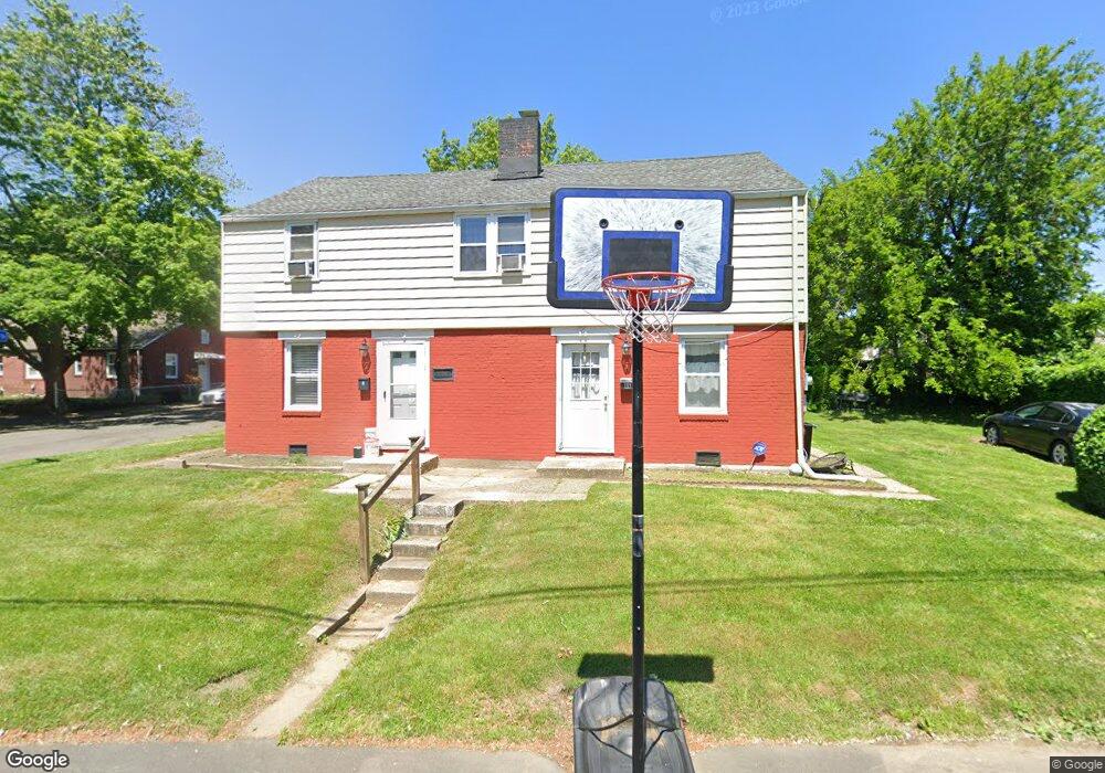
9-11 High Ridge Dr Bridge Port, CT 06606
Brooklawn-Saint Vincent NeighborhoodEstimated Value: $408,719 - $508,000
5
Beds
2
Baths
1,900
Sq Ft
$251/Sq Ft
Est. Value
About This Home
This home is located at 9-11 High Ridge Dr, Bridge Port, CT 06606 and is currently estimated at $476,680, approximately $250 per square foot. 9-11 High Ridge Dr is a home located in Fairfield County with nearby schools including Blackham School, Central High School, and Assumption Catholic School.
Ownership History
Date
Name
Owned For
Owner Type
Purchase Details
Closed on
Jul 16, 2012
Sold by
Lax Daniel
Bought by
9-11 Highridge Llc
Current Estimated Value
Purchase Details
Closed on
Mar 31, 2005
Sold by
Diaz Wigberto and Diaz Julie
Bought by
Reis Luzia
Home Financials for this Owner
Home Financials are based on the most recent Mortgage that was taken out on this home.
Original Mortgage
$240,000
Interest Rate
7.9%
Purchase Details
Closed on
Jul 21, 1995
Sold by
Traiforis George
Bought by
Diaz Wigberto and Diaz Julie
Create a Home Valuation Report for This Property
The Home Valuation Report is an in-depth analysis detailing your home's value as well as a comparison with similar homes in the area
Home Values in the Area
Average Home Value in this Area
Purchase History
| Date | Buyer | Sale Price | Title Company |
|---|---|---|---|
| 9-11 Highridge Llc | -- | -- | |
| Lax Daniel | $135,000 | -- | |
| 9-11 Highridge Llc | -- | -- | |
| Reis Luzia | $300,000 | -- | |
| Reis Luzia | $300,000 | -- | |
| Diaz Wigberto | $96,500 | -- | |
| Diaz Wigberto | $96,500 | -- |
Source: Public Records
Mortgage History
| Date | Status | Borrower | Loan Amount |
|---|---|---|---|
| Previous Owner | Diaz Wigberto | $240,000 | |
| Previous Owner | Diaz Wigberto | $127,950 |
Source: Public Records
Tax History Compared to Growth
Tax History
| Year | Tax Paid | Tax Assessment Tax Assessment Total Assessment is a certain percentage of the fair market value that is determined by local assessors to be the total taxable value of land and additions on the property. | Land | Improvement |
|---|---|---|---|---|
| 2025 | $7,422 | $170,810 | $75,500 | $95,310 |
| 2024 | $7,422 | $170,810 | $75,500 | $95,310 |
| 2023 | $7,422 | $170,810 | $75,500 | $95,310 |
| 2022 | $7,422 | $170,810 | $75,500 | $95,310 |
| 2021 | $7,422 | $170,810 | $75,500 | $95,310 |
| 2020 | $5,654 | $104,725 | $31,550 | $73,175 |
| 2019 | $7,068 | $130,910 | $39,440 | $91,470 |
| 2018 | $7,118 | $130,910 | $39,440 | $91,470 |
| 2017 | $7,118 | $130,910 | $39,440 | $91,470 |
| 2016 | $7,118 | $130,910 | $39,440 | $91,470 |
| 2015 | $6,791 | $160,930 | $47,720 | $113,210 |
| 2014 | $6,791 | $160,930 | $47,720 | $113,210 |
Source: Public Records
Map
Nearby Homes
- 150 Alexander Dr
- 125 Alexander Dr
- 11 Myron Ave
- 241 Sampson St
- 201 High Ridge Dr
- 2625 Park Ave Unit 12L
- 2625 Park Ave Unit 5N
- 76 Suburban Ave
- 2675 Park Ave Unit 3
- 2675 Park Ave Unit 22
- 2445 Park Ave Unit 23
- 1275 Capitol Ave
- 2345 Park Ave
- 203 Wayne St
- 119 Madison Terrace
- 105 Tremont Ave Unit E
- 105 Tremont Ave Unit B
- 1480 Capitol Ave Unit 811
- 252 Harlem Ave Unit B6
- 252 Harlem Ave Unit B5
- 11 High Ridge Dr
- 11 High Ridge Dr Unit 11
- 152 Alexander Dr
- 5 Lawn St
- 10 High Ridge Dr
- 8 High Ridge Dr Unit 10
- 8-10 High Ridge Dr Unit 10
- 8-10 High Ridge Dr Unit 8
- 145 Alexander Dr Unit 147
- 117 Alexander Dr
- 164 Alexander Dr
- 19 Lawn St Unit 25
- 115 Alexander Dr
- 163 Alexander Dr
- 370 High Ridge Dr
- 37 Lawn St Unit 43
- 99 Alexander Dr
- 90 Alexander Dr
- 97-99 Alexander Dr Unit 99