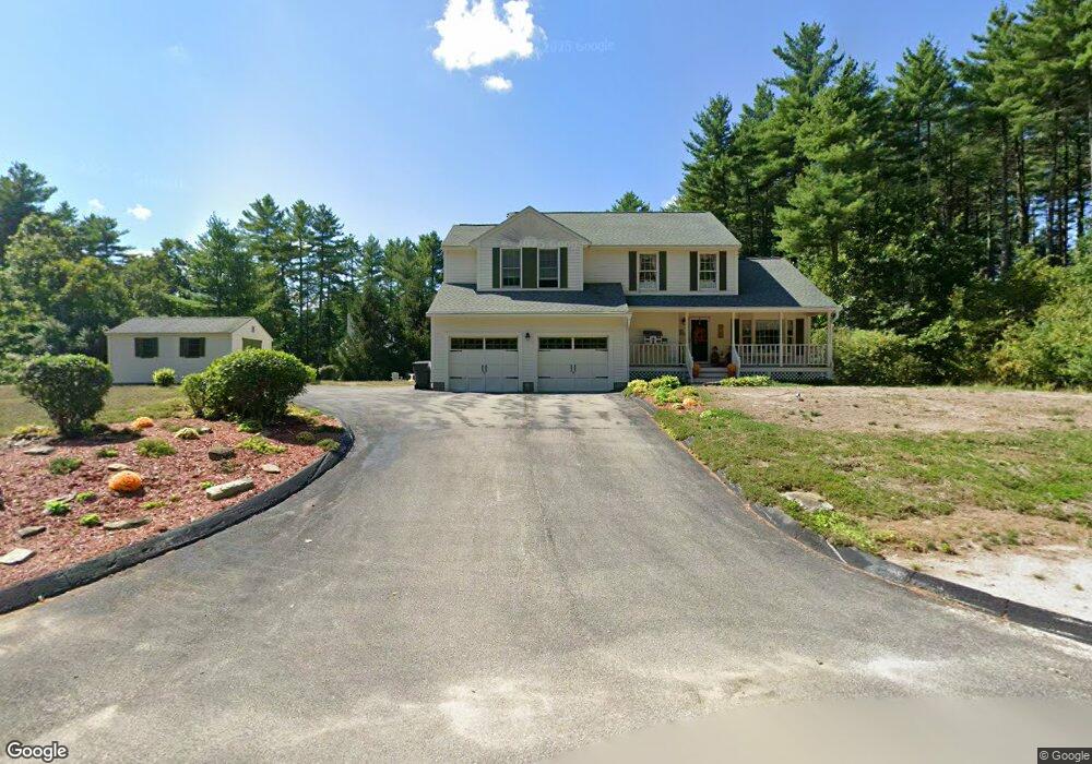
9 Adams St Dunstable, MA 01827
Estimated Value: $630,149 - $748,000
3
Beds
3
Baths
2,100
Sq Ft
$333/Sq Ft
Est. Value
About This Home
This home is located at 9 Adams St, Dunstable, MA 01827 and is currently estimated at $698,537, approximately $332 per square foot. 9 Adams St is a home located in Middlesex County with nearby schools including Groton Dunstable Regional High School, Pepperell Christian Academy, and Maple Dene & Moppet School.
Ownership History
Date
Name
Owned For
Owner Type
Purchase Details
Closed on
Jun 14, 1991
Sold by
Bentley Bldg Corp
Bought by
Lapointe Victor P and Lapointe Mary Louise
Current Estimated Value
Create a Home Valuation Report for This Property
The Home Valuation Report is an in-depth analysis detailing your home's value as well as a comparison with similar homes in the area
Home Values in the Area
Average Home Value in this Area
Purchase History
| Date | Buyer | Sale Price | Title Company |
|---|---|---|---|
| Lapointe Victor P | $159,900 | -- | |
| Bentley Building Corp | $60,000 | -- |
Source: Public Records
Mortgage History
| Date | Status | Borrower | Loan Amount |
|---|---|---|---|
| Open | Bentley Building Corp | $183,000 | |
| Closed | Bentley Building Corp | $35,000 | |
| Closed | Bentley Building Corp | $25,000 |
Source: Public Records
Tax History
| Year | Tax Paid | Tax Assessment Tax Assessment Total Assessment is a certain percentage of the fair market value that is determined by local assessors to be the total taxable value of land and additions on the property. | Land | Improvement |
|---|---|---|---|---|
| 2025 | $7,367 | $535,800 | $202,500 | $333,300 |
| 2024 | $7,027 | $503,400 | $186,900 | $316,500 |
| 2023 | $7,057 | $471,400 | $186,900 | $284,500 |
| 2022 | $6,561 | $430,200 | $186,900 | $243,300 |
| 2021 | $31,253 | $393,700 | $171,300 | $222,400 |
| 2020 | $11,602 | $379,100 | $163,500 | $215,600 |
| 2019 | $7,872 | $367,000 | $163,500 | $203,500 |
| 2018 | $7,467 | $352,800 | $163,500 | $189,300 |
| 2017 | $5,930 | $348,400 | $163,500 | $184,900 |
| 2016 | $5,776 | $349,000 | $163,500 | $185,500 |
| 2015 | $5,447 | $325,600 | $137,100 | $188,500 |
| 2014 | $5,135 | $325,600 | $137,100 | $188,500 |
Source: Public Records
Map
Nearby Homes
- 235 Kemp St
- 179 Wyman Rd
- 208 North St
- 11 Unkety Brook Way
- 12 Unkety Brook Way
- 319 Pleasant St
- 27 Merrimac Dr
- 38 Tarbell St Unit 5B
- 38 Tarbell St Unit 1D
- 29 Tarbell St
- 114 Groton St
- 153 Off Pond St
- 8 Casie Ln
- 200 Nashua Rd
- 28-30 Groton St
- 53 Mclains Woods Rd
- 147 Nashua Rd
- 113-115 Main St
- 39 Hollis St Unit A
- 91 Chicopee Row
- 7 Kimberly Ln
- 11 Kimberly Ln
- 4 Kimberly Ln
- 157 Lowell Rd
- 159 Lowell Rd
- 161 Lowell Rd
- 155 Lowell Rd
- 153 Lowell Rd
- 6 Kimberly Ln
- 15 Kimberly Ln
- 12 Kimberly Ln
- 25 Adams St
- 142 Lowell Rd
- 140 Lowell Rd
- 140-1/2 Lowell Rd
- 144 Lowell Rd
- 140 1/2 Lowell Rd
- 149 Lowell Rd Unit 1
- 149 Lowell Rd
- 149 Lowell Rd Unit A
Your Personal Tour Guide
Ask me questions while you tour the home.