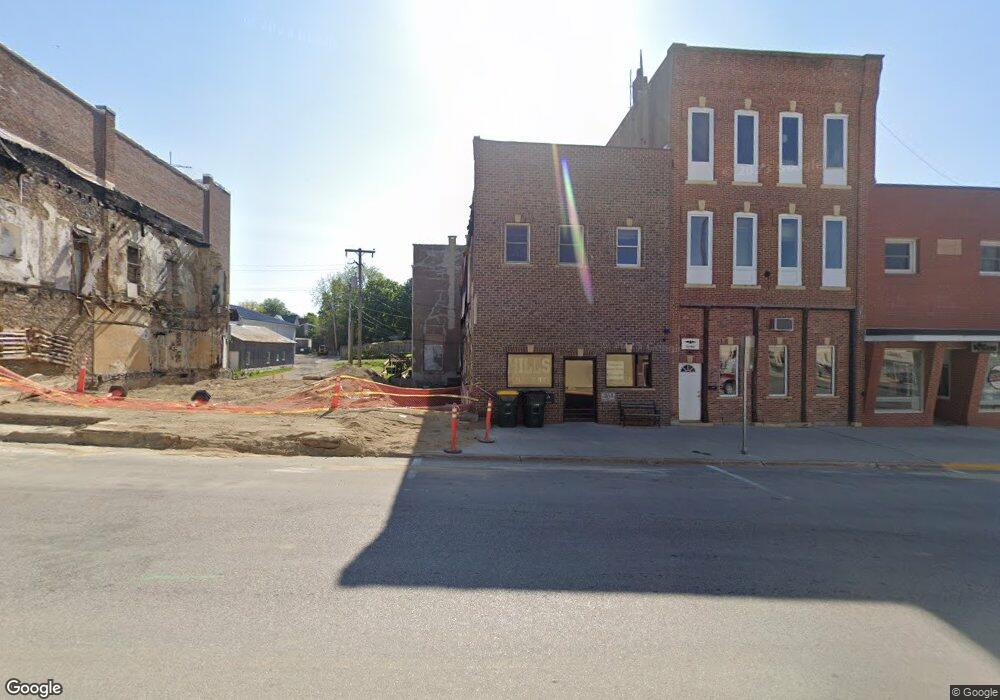
9 Allamakee St Waukon, IA 52172
--
Bed
2
Baths
2,960
Sq Ft
2,614
Sq Ft Lot
About This Home
This home is located at 9 Allamakee St, Waukon, IA 52172. 9 Allamakee St is a home located in Allamakee County with nearby schools including West Campus Elementary School, East Campus Elementary School, and Waukon Middle School.
Ownership History
Date
Name
Owned For
Owner Type
Purchase Details
Closed on
Dec 17, 2021
Sold by
Building Opportunities Llc
Bought by
Jones Mindy J
Home Financials for this Owner
Home Financials are based on the most recent Mortgage that was taken out on this home.
Original Mortgage
$181,418
Outstanding Balance
$48,029
Interest Rate
3.11%
Mortgage Type
Credit Line Revolving
Create a Home Valuation Report for This Property
The Home Valuation Report is an in-depth analysis detailing your home's value as well as a comparison with similar homes in the area
Home Values in the Area
Average Home Value in this Area
Purchase History
| Date | Buyer | Sale Price | Title Company |
|---|---|---|---|
| Jones Mindy J | $62,000 | None Listed On Document |
Source: Public Records
Mortgage History
| Date | Status | Borrower | Loan Amount |
|---|---|---|---|
| Open | Jones Mindy J | $181,418 |
Source: Public Records
Tax History Compared to Growth
Tax History
| Year | Tax Paid | Tax Assessment Tax Assessment Total Assessment is a certain percentage of the fair market value that is determined by local assessors to be the total taxable value of land and additions on the property. | Land | Improvement |
|---|---|---|---|---|
| 2025 | $188 | $11,000 | $11,000 | $0 |
| 2024 | $45,399 | $11,000 | $11,000 | $0 |
| 2023 | $1,510 | $11,000 | $11,000 | $0 |
| 2022 | $1,478 | $78,900 | $11,000 | $67,900 |
| 2021 | $1,480 | $78,900 | $11,000 | $67,900 |
| 2020 | $1,480 | $75,600 | $11,000 | $64,600 |
| 2019 | $1,530 | $75,600 | $0 | $0 |
| 2018 | $1,358 | $67,300 | $0 | $0 |
| 2017 | $1,358 | $43,072 | $0 | $0 |
| 2016 | $1,412 | $67,300 | $0 | $0 |
| 2015 | $416 | $43,072 | $0 | $0 |
| 2014 | $1,226 | $67,300 | $0 | $0 |
Source: Public Records
Map
Nearby Homes
- 0 Parcel Id#1031351007 Unit 20211899
- 0 Parcel Id#1506100051 Unit 20211897
- 0 Parcel Id#1031376012 Unit 20211905
- 0 Parcel Id#1031376013 Unit 20211902
- 0 Parcel Id#1031351004 Unit 20211906
- 0 Parcel Id#1031376005 Unit 20211907
- 0 Parcel Id#1031351006 Unit 20211900
- 22 3rd Ave SE
- 306 Sw St
- 208 4th St SW
- 303 5th St SW
- 602 2nd St NW
- 607 W Main St
- Allamakee Co. Ia Parcel Id#
- 605 1st Ave SW
- 0 SW 11th Ave Unit 20222752
- 104 6th Ave SW
- 525 4th St SE
- 821 4th St NW
- 210 Northgate Ave NW
- 5 Allamakee St
- 3 Allamakee St
- 12 E Main St
- 0 E Main St
- Allamakee Co Parcel Id # 1031401025
- 0 Parcelid#1031351018 Unit 20211908
- 0 Parcel Id#1031376019 Unit 20211901
- 12 Allamakee St
- 0 Highway 76 Unit 19729
- 0 Iowa 76
- 23 Allamakee St
- 7 7th St SW
- 5 E Main St
- 12 Spring Ave
- 22 E Main St
- 12 W Main St
- 14 Clinton St
- 18 1st Ave NW
- 7 Spring Ave
- 16 Clinton St