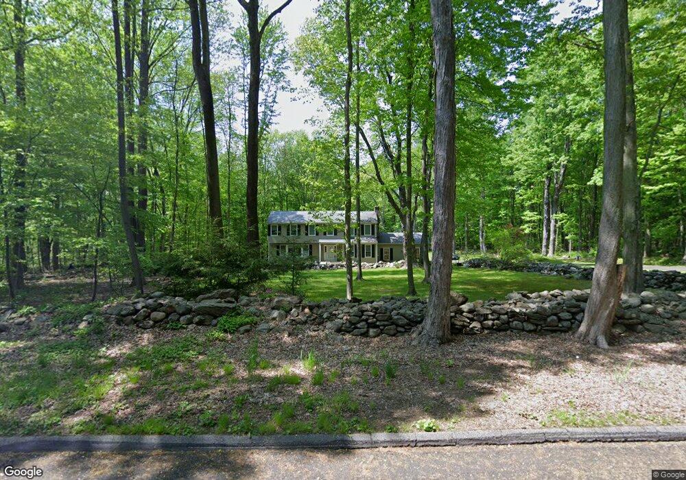
9 Andrews Rd Easton, CT 06612
Estimated Value: $827,287 - $999,000
4
Beds
3
Baths
2,648
Sq Ft
$345/Sq Ft
Est. Value
About This Home
This home is located at 9 Andrews Rd, Easton, CT 06612 and is currently estimated at $913,572, approximately $345 per square foot. 9 Andrews Rd is a home located in Fairfield County with nearby schools including Samuel Staples Elementary School, Helen Keller Middle School, and Joel Barlow High School.
Ownership History
Date
Name
Owned For
Owner Type
Purchase Details
Closed on
Aug 8, 2012
Sold by
Faustini Sebastian J and Corsi Tina A
Bought by
Faustini Sebastiano J and Corsi Tina A
Current Estimated Value
Home Financials for this Owner
Home Financials are based on the most recent Mortgage that was taken out on this home.
Original Mortgage
$337,000
Outstanding Balance
$51,873
Interest Rate
3.7%
Mortgage Type
New Conventional
Estimated Equity
$861,699
Purchase Details
Closed on
Aug 31, 2007
Sold by
Druga Eileen S and Druga John
Bought by
Faustini Sebastian and Corsi Tina A
Purchase Details
Closed on
Dec 2, 1996
Sold by
Zimmerman Raymond T and Zimmerman Dorothy P
Bought by
Druga John Edward and Druga Eileen S
Create a Home Valuation Report for This Property
The Home Valuation Report is an in-depth analysis detailing your home's value as well as a comparison with similar homes in the area
Home Values in the Area
Average Home Value in this Area
Purchase History
| Date | Buyer | Sale Price | Title Company |
|---|---|---|---|
| Faustini Sebastiano J | -- | -- | |
| Faustini Sebastiano J | -- | -- | |
| Faustini Sebastian | $702,500 | -- | |
| Faustini Sebastian | $702,500 | -- | |
| Druga John Edward | $365,000 | -- | |
| Druga John Edward | $365,000 | -- |
Source: Public Records
Mortgage History
| Date | Status | Borrower | Loan Amount |
|---|---|---|---|
| Open | Druga John Edward | $144,000 | |
| Open | Druga John Edward | $337,000 |
Source: Public Records
Tax History Compared to Growth
Tax History
| Year | Tax Paid | Tax Assessment Tax Assessment Total Assessment is a certain percentage of the fair market value that is determined by local assessors to be the total taxable value of land and additions on the property. | Land | Improvement |
|---|---|---|---|---|
| 2025 | $12,341 | $398,090 | $172,060 | $226,030 |
| 2024 | $11,760 | $398,090 | $172,060 | $226,030 |
| 2023 | $11,529 | $398,090 | $172,060 | $226,030 |
| 2022 | $11,322 | $398,090 | $172,060 | $226,030 |
| 2021 | $12,003 | $371,040 | $203,550 | $167,490 |
| 2020 | $11,502 | $371,040 | $203,550 | $167,490 |
| 2019 | $11,625 | $371,040 | $203,550 | $167,490 |
| 2018 | $11,643 | $371,040 | $203,550 | $167,490 |
| 2017 | $12,385 | $371,040 | $203,550 | $167,490 |
| 2016 | $12,988 | $421,540 | $263,050 | $158,490 |
| 2015 | $12,806 | $421,540 | $263,050 | $158,490 |
| 2014 | $12,604 | $421,540 | $263,050 | $158,490 |
Source: Public Records
Map
Nearby Homes
- 101 Northwood Dr
- 85 Westport Rd
- 34 Merrimac Dr
- 897 Sport Hill Rd
- 132 Merrimac Dr
- 63 Flat Rock Dr
- 67 Limerick Rd
- 305 Sport Hill Rd
- 5288 Madison Ave
- 83 Buck Hill Rd
- 68 High Ridge Rd
- 48 Sunset Rd
- 16 Manor Ln
- 39 Sunset Rd
- 100 Honeysuckle Hill Ln
- 211 Tanglewood Rd
- 275 Dayton Rd
- 35 Sturbridge Rd
- 38 Chester Rd
- 52 Autumn Dr
- 200 N Park Ave
- 165 N Park Ave
- 21 Andrews Rd
- 10 Andrews Rd
- 85 Stones Throw Rd
- 195 N Park Ave
- 76 Deepwood Rd
- 70 Deepwood Rd
- 161 N Park Ave
- 205 N Park Ave
- 150 N Park Ave
- 93 Deepwood Rd
- 65 Stones Throw Rd
- 90 Stones Throw Rd
- 66 Deepwood Rd
- 65A Stones Throw Rd
- 215 N Park Ave
- 215 N Park Ave Unit 6612
- 80 Stones Throw Rd
- 70 Stones Throw Rd