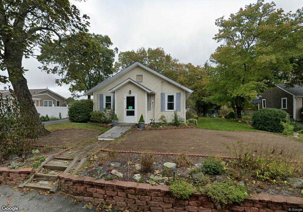
9 Apple St Wareham, MA 02571
Estimated Value: $422,000 - $565,000
3
Beds
1
Bath
1,125
Sq Ft
$433/Sq Ft
Est. Value
About This Home
This home is located at 9 Apple St, Wareham, MA 02571 and is currently estimated at $486,941, approximately $432 per square foot. 9 Apple St is a home located in Plymouth County.
Create a Home Valuation Report for This Property
The Home Valuation Report is an in-depth analysis detailing your home's value as well as a comparison with similar homes in the area
Tax History
| Year | Tax Paid | Tax Assessment Tax Assessment Total Assessment is a certain percentage of the fair market value that is determined by local assessors to be the total taxable value of land and additions on the property. | Land | Improvement |
|---|---|---|---|---|
| 2025 | $3,736 | $358,500 | $118,500 | $240,000 |
| 2024 | $3,708 | $330,200 | $89,100 | $241,100 |
| 2023 | $3,273 | $291,000 | $76,900 | $214,100 |
| 2022 | $3,273 | $248,300 | $76,900 | $171,400 |
| 2021 | $3,232 | $240,300 | $76,900 | $163,400 |
| 2020 | $3,009 | $226,900 | $76,900 | $150,000 |
| 2019 | $2,711 | $204,000 | $76,800 | $127,200 |
| 2018 | $2,560 | $187,800 | $76,800 | $111,000 |
| 2017 | $2,371 | $176,300 | $76,800 | $99,500 |
| 2016 | $2,197 | $162,400 | $76,800 | $85,600 |
| 2015 | $2,123 | $162,400 | $76,800 | $85,600 |
| 2014 | $2,008 | $156,300 | $72,000 | $84,300 |
Source: Public Records
Map
Nearby Homes
- 12 Oakdale St
- 2 Oakdale St
- 10 Oak St
- 2697 Cranberry Hwy Unit 21
- 2697 Cranberry Hwy Unit 28
- 156 Sandwich Rd
- 2743 Cranberry Hwy Unit 5D
- 45 Main St Unit 38
- 2711 Cranberry Hwy
- 2645 Cranberry Hwy Unit A
- 110 Mayflower Ridge Dr
- 1 Nimrod Way
- 12 Linwood Ave
- 437 Main St
- 124 Minot Ave Unit 1
- 7 Cranberry Ln
- 2838 Cranberry Hwy
- 10 Longmeadow Dr
- 15 Broadmarsh Ave
- 7 Knowles Ave
Your Personal Tour Guide
Ask me questions while you tour the home.