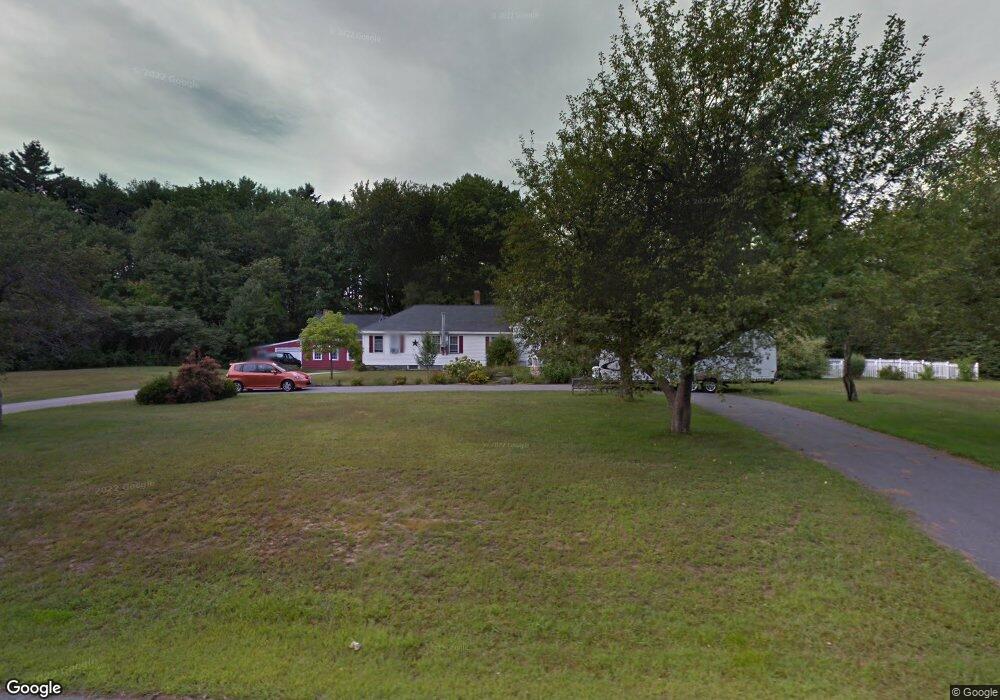
9 Appledor Rd Bedford, NH 03110
Bedford NeighborhoodEstimated Value: $649,698 - $680,000
3
Beds
3
Baths
2,256
Sq Ft
$295/Sq Ft
Est. Value
About This Home
This home is located at 9 Appledor Rd, Bedford, NH 03110 and is currently estimated at $665,425, approximately $294 per square foot. 9 Appledor Rd is a home located in Hillsborough County with nearby schools including Mckelvie Intermediate School, Ross A. Lurgio Middle School, and Bedford High School.
Ownership History
Date
Name
Owned For
Owner Type
Purchase Details
Closed on
Aug 4, 1999
Sold by
Saitas Michael and Saitas Christine T
Bought by
Shevenell Matthew D and Shevenell Robin W
Current Estimated Value
Create a Home Valuation Report for This Property
The Home Valuation Report is an in-depth analysis detailing your home's value as well as a comparison with similar homes in the area
Home Values in the Area
Average Home Value in this Area
Purchase History
| Date | Buyer | Sale Price | Title Company |
|---|---|---|---|
| Shevenell Matthew D | $170,000 | -- |
Source: Public Records
Mortgage History
| Date | Status | Borrower | Loan Amount |
|---|---|---|---|
| Open | Shevenell Matthew D | $241,789 | |
| Closed | Shevenell Matthew D | $256,000 | |
| Closed | Shevenell Matthew D | $40,000 | |
| Closed | Shevenell Matthew D | $195,000 |
Source: Public Records
Tax History Compared to Growth
Tax History
| Year | Tax Paid | Tax Assessment Tax Assessment Total Assessment is a certain percentage of the fair market value that is determined by local assessors to be the total taxable value of land and additions on the property. | Land | Improvement |
|---|---|---|---|---|
| 2024 | $8,321 | $526,300 | $226,300 | $300,000 |
| 2023 | $7,692 | $519,700 | $226,300 | $293,400 |
| 2022 | $7,073 | $401,900 | $167,600 | $234,300 |
| 2021 | $6,889 | $401,900 | $167,600 | $234,300 |
| 2020 | $6,581 | $328,700 | $122,000 | $206,700 |
| 2019 | $6,229 | $328,700 | $122,000 | $206,700 |
| 2018 | $6,271 | $307,400 | $122,000 | $185,400 |
| 2017 | $5,813 | $307,400 | $122,000 | $185,400 |
| 2016 | $6,073 | $271,500 | $97,600 | $173,900 |
| 2015 | $6,179 | $271,500 | $97,600 | $173,900 |
| 2014 | $6,109 | $271,500 | $97,600 | $173,900 |
| 2013 | $6,019 | $271,500 | $97,600 | $173,900 |
Source: Public Records
Map
Nearby Homes
- 7 Hamilton Way
- 116 Nashua Rd
- 197 Liberty Hill Rd
- 17-4-28 Boiling Kettle Way
- 17-4-28 Boiling Kettle Way Unit 28
- 10 Barrington Dr
- 20 Liberty Hill Rd
- 155 Wallace Rd
- 82 Pilgrim Dr
- 150 Wallace Rd
- 32 Puritan Dr
- 29 Pebble Beach Dr
- 15 Spyglass Point Cir
- 20 Pebble Beach Dr Unit 22-89-20
- 95 Hitching Post Ln
- 12 Knoll Crest Dr Unit Lot 5 - The Hannah
- 44-9 Olympus Way
- 18 Horizon Dr
- 60 Riddle Dr
- 80 Wendover Way
- 10 Appledor Rd
- 12 Appledor Rd
- 1 Appleleaf Dr
- 6 Appledor Rd
- 123 Liberty Hill Rd
- 26 New Merrimack Rd
- 17 Appledor Rd
- 121 Liberty Hill Rd
- 20 Appledor Rd
- 2 Appledor Rd
- 7 Appleleaf Dr
- 81 Appleleaf Dr
- 130 Liberty Hill Rd
- 126 Liberty Hill Rd
- 23 Appledor Rd
- 137 Liberty Hill Rd
- 24 Appledor Rd
- 27 New Merrimack Rd
- 113 Liberty Hill Rd
- 10 Appleleaf Dr