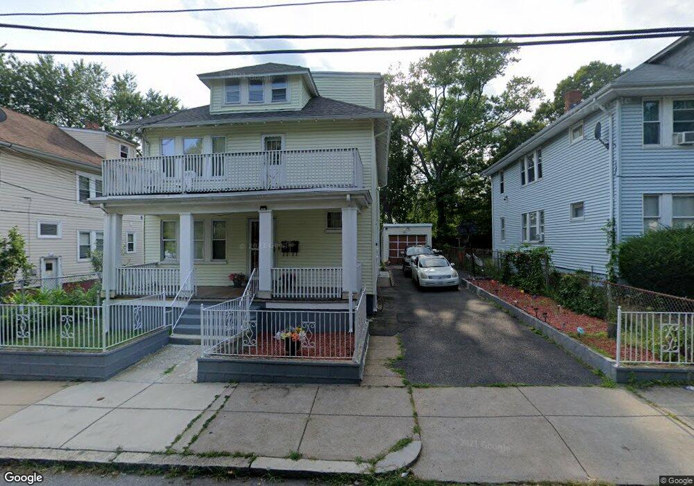
9 Belnel Rd Unit 11 Mattapan, MA 02126
Hyde Park NeighborhoodEstimated Value: $708,000 - $1,004,000
5
Beds
3
Baths
2,496
Sq Ft
$363/Sq Ft
Est. Value
About This Home
This home is located at 9 Belnel Rd Unit 11, Mattapan, MA 02126 and is currently estimated at $906,318, approximately $363 per square foot. 9 Belnel Rd Unit 11 is a home located in Suffolk County with nearby schools including KIPP Academy Boston Charter School and Boston Preparatory Charter Public School.
Ownership History
Date
Name
Owned For
Owner Type
Purchase Details
Closed on
Dec 20, 2024
Sold by
Smith David A
Bought by
Georges Marie L and Georges Willy
Current Estimated Value
Home Financials for this Owner
Home Financials are based on the most recent Mortgage that was taken out on this home.
Original Mortgage
$898,427
Outstanding Balance
$891,361
Interest Rate
6.79%
Mortgage Type
FHA
Estimated Equity
$14,957
Purchase Details
Closed on
Nov 9, 1993
Sold by
Chabot-Wilson Patricia E
Bought by
Smith David A
Purchase Details
Closed on
Jan 11, 1993
Sold by
Riebe Mary C and Boston 5 Cents Sb
Bought by
Boston 5 Cents Sb
Create a Home Valuation Report for This Property
The Home Valuation Report is an in-depth analysis detailing your home's value as well as a comparison with similar homes in the area
Home Values in the Area
Average Home Value in this Area
Purchase History
| Date | Buyer | Sale Price | Title Company |
|---|---|---|---|
| Georges Marie L | $915,000 | None Available | |
| Georges Marie L | $915,000 | None Available | |
| Smith David A | $110,000 | -- | |
| Smith David A | $110,000 | -- | |
| Boston 5 Cents Sb | $71,158 | -- | |
| Boston 5 Cents Sb | $71,158 | -- |
Source: Public Records
Mortgage History
| Date | Status | Borrower | Loan Amount |
|---|---|---|---|
| Open | Georges Marie L | $898,427 | |
| Closed | Georges Marie L | $898,427 | |
| Previous Owner | Boston 5 Cents Sb | $152,000 | |
| Previous Owner | Boston 5 Cents Sb | $129,200 |
Source: Public Records
Tax History Compared to Growth
Tax History
| Year | Tax Paid | Tax Assessment Tax Assessment Total Assessment is a certain percentage of the fair market value that is determined by local assessors to be the total taxable value of land and additions on the property. | Land | Improvement |
|---|---|---|---|---|
| 2025 | $7,847 | $677,600 | $167,600 | $510,000 |
| 2024 | $6,602 | $605,700 | $188,800 | $416,900 |
| 2023 | $6,081 | $566,200 | $176,500 | $389,700 |
| 2022 | $5,705 | $524,400 | $163,500 | $360,900 |
| 2021 | $5,329 | $499,400 | $155,700 | $343,700 |
| 2020 | $5,106 | $483,500 | $135,800 | $347,700 |
| 2019 | $4,703 | $446,200 | $106,400 | $339,800 |
| 2018 | $4,250 | $405,500 | $106,400 | $299,100 |
| 2017 | $3,941 | $372,100 | $106,400 | $265,700 |
| 2016 | $3,861 | $351,000 | $106,400 | $244,600 |
| 2015 | $3,724 | $307,500 | $106,200 | $201,300 |
| 2014 | $3,398 | $270,100 | $106,200 | $163,900 |
Source: Public Records
Map
Nearby Homes
- 42 Osceola St
- 7 Winborough St
- 39 Wachusett St
- 20 Massasoit St
- 30 Massasoit St
- 25 Alpine St Unit 7
- 23 Caton St
- 645 River St
- 112 Brush Hill Rd
- 90 Hollingsworth St
- 25 Malta St
- 55 Concord Ave
- 60 Concord Ave
- 70 Brush Hill Rd Unit 1
- 130 Greenfield Rd
- 46 Oakwood St
- 172-174 Blue Hill Ave Unit 174
- 0 Tina Ave
- 15 Belvoir Rd
- 96 Brook Rd