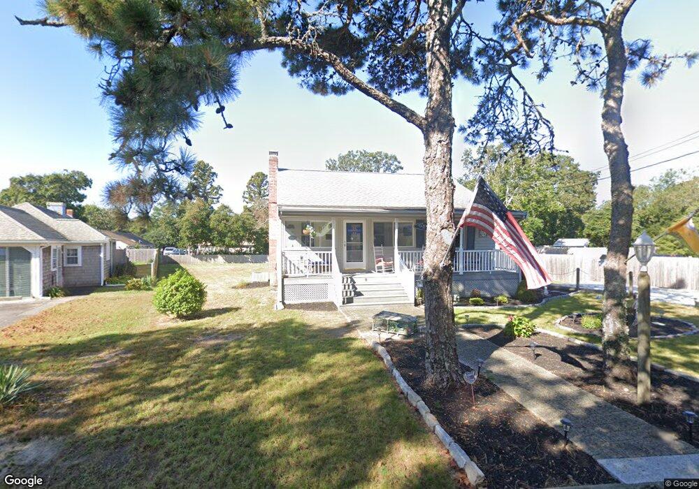
9 Briar Cir South Yarmouth, MA 02664
Estimated Value: $679,000 - $939,735
3
Beds
1
Bath
1,112
Sq Ft
$710/Sq Ft
Est. Value
About This Home
This home is located at 9 Briar Cir, South Yarmouth, MA 02664 and is currently estimated at $789,934, approximately $710 per square foot. 9 Briar Cir is a home located in Barnstable County with nearby schools including Dennis-Yarmouth Regional High School and St. Pius X. School.
Ownership History
Date
Name
Owned For
Owner Type
Purchase Details
Closed on
Nov 6, 2014
Sold by
Fishman Steven M and Fishman Judith A
Bought by
Fishman Ft
Current Estimated Value
Purchase Details
Closed on
Oct 10, 2003
Sold by
Fitton Jeanne V
Bought by
Fishman Judith A and Fishman Steven M
Home Financials for this Owner
Home Financials are based on the most recent Mortgage that was taken out on this home.
Original Mortgage
$230,000
Interest Rate
6.35%
Mortgage Type
Purchase Money Mortgage
Create a Home Valuation Report for This Property
The Home Valuation Report is an in-depth analysis detailing your home's value as well as a comparison with similar homes in the area
Home Values in the Area
Average Home Value in this Area
Purchase History
| Date | Buyer | Sale Price | Title Company |
|---|---|---|---|
| Fishman Ft | -- | -- | |
| Fishman Judith A | $350,000 | -- |
Source: Public Records
Mortgage History
| Date | Status | Borrower | Loan Amount |
|---|---|---|---|
| Previous Owner | Fishman Judith A | $50,000 | |
| Previous Owner | Fishman Judith A | $230,000 |
Source: Public Records
Tax History Compared to Growth
Tax History
| Year | Tax Paid | Tax Assessment Tax Assessment Total Assessment is a certain percentage of the fair market value that is determined by local assessors to be the total taxable value of land and additions on the property. | Land | Improvement |
|---|---|---|---|---|
| 2025 | $6,065 | $856,600 | $461,300 | $395,300 |
| 2024 | $5,640 | $764,200 | $401,400 | $362,800 |
| 2023 | $5,335 | $657,800 | $327,400 | $330,400 |
| 2022 | $5,107 | $556,300 | $294,100 | $262,200 |
| 2021 | $4,761 | $498,000 | $276,300 | $221,700 |
| 2020 | $4,615 | $461,500 | $264,100 | $197,400 |
| 2019 | $4,366 | $432,300 | $264,100 | $168,200 |
| 2018 | $4,313 | $419,100 | $250,900 | $168,200 |
| 2017 | $4,199 | $419,100 | $250,900 | $168,200 |
| 2016 | $3,937 | $394,500 | $250,900 | $143,600 |
| 2015 | $3,819 | $380,400 | $250,900 | $129,500 |
Source: Public Records
Map
Nearby Homes
- 135 S South Shore Dr Unit 17
- 135 S Shore Dr Unit 17
- 55 Aspinet Rd
- 21 Lyndale Rd
- 16 Peregrine Ln
- 55 Pawkannawkut Dr
- 30 Nauset Ln
- 31 Gardiner Ln
- 8 Holly Ln
- 27 Wilfin Rd
- 23 Holly Ln
- 51 Ocean Ave
- 26 Howes Rd
- 89 Acres Ave
- 8 Rogers Ave
- 69 Pine Grove Rd
- 2 Sachem Path
- 844 Route 28 Unit 1C
- 844 Route 28 Unit 1C
- 7 Briar Cir
- 15 Briar Cir
- 8 Briar Cir
- 190 Seaview Ave Unit 190
- 12 Briar Cir
- 186 Seaview Ave Unit 190
- 186-190 Seaview Ave Unit 4
- 186 Seaview Ave Unit 5
- 186-190 Seaview Ave Unit 2
- 186 Seaview Ave Unit 1
- 186 Seaview Ave Unit 2
- 186 Seaview Ave Unit 5
- 186 Seaview Ave Unit 1
- 186 Seaview Ave Unit 2
- 186-190 Seaview Ave
- 19 Briar Cir
- 180 Seaview Ave Unit 184
- 102 S Shore Dr
- 184 Seaview Ave
- 184 Seaview Ave Unit 2