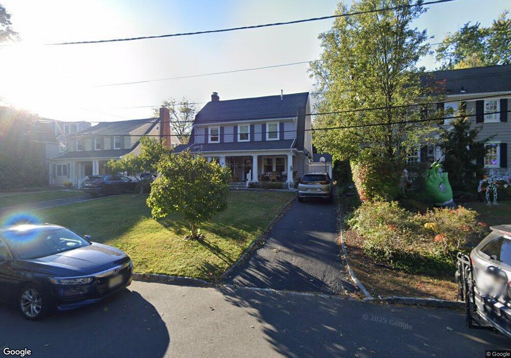
9 Brookside Rd Maplewood, NJ 07040
Estimated Value: $1,253,000 - $1,321,000
Studio
--
Bath
2,304
Sq Ft
$561/Sq Ft
Est. Value
About This Home
This home is located at 9 Brookside Rd, Maplewood, NJ 07040 and is currently estimated at $1,291,742, approximately $560 per square foot. 9 Brookside Rd is a home located in Essex County with nearby schools including Delia Bolden Elementary School, Maplewood Middle School, and Columbia Senior High School.
Ownership History
Date
Name
Owned For
Owner Type
Purchase Details
Closed on
Nov 13, 2007
Sold by
Hirschman Scott A and Hirschman Laura D
Bought by
Gordon Andrew C and Gordon Berit I
Current Estimated Value
Home Financials for this Owner
Home Financials are based on the most recent Mortgage that was taken out on this home.
Original Mortgage
$417,000
Outstanding Balance
$262,748
Interest Rate
6.3%
Mortgage Type
Purchase Money Mortgage
Estimated Equity
$1,028,994
Purchase Details
Closed on
Oct 25, 2004
Sold by
Zafiromitsos Spiro
Bought by
Hirschman Scott and Hirschman Laura
Home Financials for this Owner
Home Financials are based on the most recent Mortgage that was taken out on this home.
Original Mortgage
$600,000
Interest Rate
5.8%
Purchase Details
Closed on
Jun 25, 2004
Sold by
Caruba Alan
Bought by
Zafiromitsos Spiro and Zafiromitsos Demetra
Home Financials for this Owner
Home Financials are based on the most recent Mortgage that was taken out on this home.
Original Mortgage
$250,000
Interest Rate
6.32%
Create a Home Valuation Report for This Property
The Home Valuation Report is an in-depth analysis detailing your home's value as well as a comparison with similar homes in the area
Home Values in the Area
Average Home Value in this Area
Purchase History
| Date | Buyer | Sale Price | Title Company |
|---|---|---|---|
| Gordon Andrew C | $777,000 | Nrt Title Agency Llc | |
| Hirschman Scott | $750,000 | -- | |
| Zafiromitsos Spiro | $535,000 | -- |
Source: Public Records
Mortgage History
| Date | Status | Borrower | Loan Amount |
|---|---|---|---|
| Open | Gordon Andrew C | $417,000 | |
| Previous Owner | Hirschman Scott | $600,000 | |
| Previous Owner | Zafiromitsos Spiro | $250,000 |
Source: Public Records
Tax History
| Year | Tax Paid | Tax Assessment Tax Assessment Total Assessment is a certain percentage of the fair market value that is determined by local assessors to be the total taxable value of land and additions on the property. | Land | Improvement |
|---|---|---|---|---|
| 2025 | $22,741 | $1,134,100 | $585,900 | $548,200 |
| 2024 | $22,741 | $1,134,100 | $585,900 | $548,200 |
| 2022 | $22,175 | $628,900 | $347,200 | $281,700 |
| 2021 | $21,502 | $628,900 | $347,200 | $281,700 |
| 2020 | $20,892 | $628,900 | $347,200 | $281,700 |
| 2019 | $20,288 | $628,900 | $347,200 | $281,700 |
| 2018 | $19,766 | $628,900 | $347,200 | $281,700 |
| 2017 | $19,175 | $628,900 | $347,200 | $281,700 |
| 2016 | $20,330 | $551,700 | $297,200 | $254,500 |
| 2015 | $19,861 | $551,700 | $297,200 | $254,500 |
| 2014 | $19,442 | $551,700 | $297,200 | $254,500 |
Source: Public Records
Map
Nearby Homes
- 2 Hemlock Ct
- 17 Collinwood Rd
- 72 Maplewood Ave
- 134 Maplewood Ave
- 448 Ridgewood Rd
- 25 Ridgewood Terrace
- 26 Kensington Terrace
- 18 Kensington Terrace
- 112 Wyoming Ave
- 36 Oakview Ave
- 61 Arnold Terrace
- 616 S Orange Ave Skyhouse 4 Unit SH4
- 378 Valley St Unit A2
- 372 Valley St Unit G2
- 609 So Orange Ave West5q Unit 5Q
- 9 Harding Dr
- 448 Prospect St
- 33-35 Madison Ave
- 40 Harvard Ave
- 161 Church St
- 11 Brookside Rd
- 7 Brookside Rd
- 25 Virginia Rd
- 23 Virginia Rd
- 27 Virginia Rd
- 5 Brookside Rd
- 86 Jefferson Ave
- 88 Jefferson Ave
- 2 Brookside Rd
- 29 Virginia Rd
- 10 Brookside Rd
- 12 Brookside Rd
- 90 Jefferson Ave
- 14 Brookside Rd
- 8 Brookside Rd
- 31 Virginia Rd
- 74 Jefferson Ave
- 16 Brookside Rd
- 96 Jefferson Ave
- 72 Jefferson Ave
Your Personal Tour Guide
Ask me questions while you tour the home.