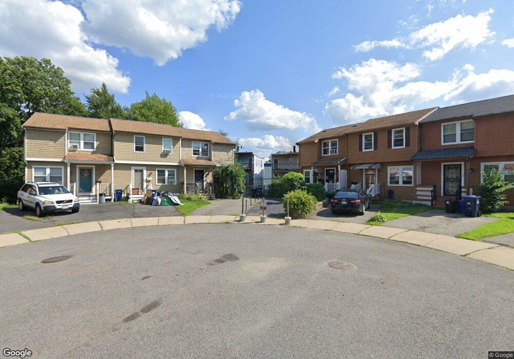
9 Champlain Cir Dorchester Center, MA 02124
Codman Square NeighborhoodEstimated Value: $447,000 - $513,000
3
Beds
2
Baths
926
Sq Ft
$522/Sq Ft
Est. Value
About This Home
This home is located at 9 Champlain Cir, Dorchester Center, MA 02124 and is currently estimated at $483,740, approximately $522 per square foot. 9 Champlain Cir is a home located in Suffolk County with nearby schools including UP Academy Charter School of Dorchester and Codman Academy Charter Public School.
Ownership History
Date
Name
Owned For
Owner Type
Purchase Details
Closed on
Mar 30, 2007
Sold by
Watford Zina
Bought by
Ellis Diane O
Current Estimated Value
Purchase Details
Closed on
Dec 24, 2002
Sold by
Phillips George H and Phillips Cynthia
Bought by
Watford Zina
Home Financials for this Owner
Home Financials are based on the most recent Mortgage that was taken out on this home.
Original Mortgage
$202,718
Interest Rate
6.16%
Mortgage Type
Purchase Money Mortgage
Purchase Details
Closed on
Oct 10, 1991
Sold by
Macdonald Robert L and Macdonald Jeanne R
Bought by
Phillips George H and Phillips Cynthia E
Home Financials for this Owner
Home Financials are based on the most recent Mortgage that was taken out on this home.
Original Mortgage
$72,200
Interest Rate
9.07%
Mortgage Type
Purchase Money Mortgage
Create a Home Valuation Report for This Property
The Home Valuation Report is an in-depth analysis detailing your home's value as well as a comparison with similar homes in the area
Home Values in the Area
Average Home Value in this Area
Purchase History
| Date | Buyer | Sale Price | Title Company |
|---|---|---|---|
| Ellis Diane O | $235,000 | -- | |
| Watford Zina | $205,900 | -- | |
| Phillips George H | $82,000 | -- |
Source: Public Records
Mortgage History
| Date | Status | Borrower | Loan Amount |
|---|---|---|---|
| Previous Owner | Phillips George H | $202,718 | |
| Previous Owner | Phillips George H | $10,000 | |
| Previous Owner | Phillips George H | $65,000 | |
| Previous Owner | Phillips George H | $72,200 |
Source: Public Records
Tax History Compared to Growth
Tax History
| Year | Tax Paid | Tax Assessment Tax Assessment Total Assessment is a certain percentage of the fair market value that is determined by local assessors to be the total taxable value of land and additions on the property. | Land | Improvement |
|---|---|---|---|---|
| 2025 | $4,799 | $414,400 | $124,400 | $290,000 |
| 2024 | $4,352 | $399,300 | $120,100 | $279,200 |
| 2023 | $4,083 | $380,200 | $114,300 | $265,900 |
| 2022 | $3,865 | $355,200 | $106,800 | $248,400 |
| 2021 | $3,597 | $337,100 | $102,700 | $234,400 |
| 2020 | $2,828 | $267,800 | $87,000 | $180,800 |
| 2019 | $2,638 | $250,300 | $73,800 | $176,500 |
| 2018 | $2,451 | $233,900 | $73,800 | $160,100 |
| 2017 | $2,477 | $233,900 | $73,800 | $160,100 |
| 2016 | $2,498 | $227,100 | $73,800 | $153,300 |
| 2015 | $2,275 | $187,900 | $73,100 | $114,800 |
| 2014 | $2,252 | $179,000 | $73,100 | $105,900 |
Source: Public Records
Map
Nearby Homes
- 33 Kenberma Rd Unit 3
- 10 School St
- 407 Washington St Unit 5
- 45-45A Spencer St
- 92 Spencer St
- 12 Spencer St
- 23 Dunlap St
- 10 Gaylord St
- 146 Spencer St
- 49 Alpha Rd
- 10 Westcott St Unit 3
- 10 Westcott St Unit 1
- 31 Tremlett St
- 28 Melville Ave
- 40 Elmont St Unit 2
- 24 Alpha Rd Unit 1
- 61 Lyndhurst St Unit A
- 15 Nightingale St
- 57 Mather St
- 64 Greenwood St
- 8 Champlain Cir
- 10 Champlain Cir
- 7 Champlain Cir
- 11 Champlain Cir
- 6 Champlain Cir
- 41 Kenberma Rd
- 5 Champlain Cir
- 39 Kenberma Rd
- 39 Kenberma Rd Unit 1
- 12 Champlain Cir
- 4 Champlain Cir
- 35 Kenberma Rd Unit 1
- 35 Kenberma Rd
- 35 Kenberma Rd Unit 2
- 35 Benberma Rd Unit 3
- 35 Kenberma Rd Unit 3
- 13 Champlain Cir
- 33 Kenberma Rd
- 20 Elwyn Rd
- 14 Champlain Cir