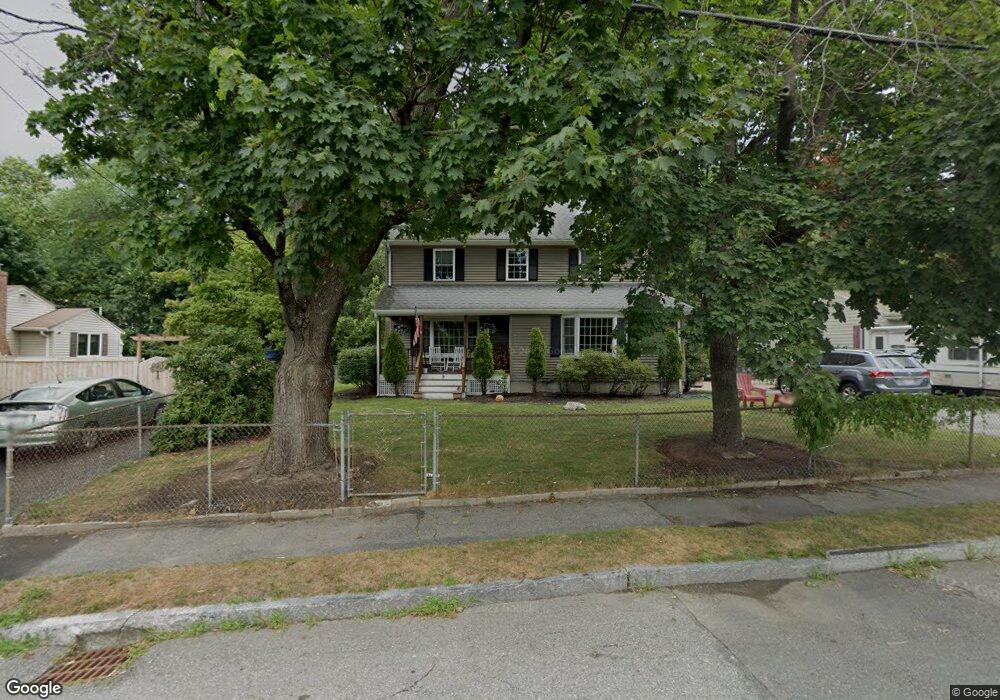
9 Copeland St Waltham, MA 02451
North Waltham NeighborhoodEstimated Value: $918,000 - $1,015,929
4
Beds
2
Baths
2,232
Sq Ft
$436/Sq Ft
Est. Value
About This Home
This home is located at 9 Copeland St, Waltham, MA 02451 and is currently estimated at $973,982, approximately $436 per square foot. 9 Copeland St is a home located in Middlesex County with nearby schools including Douglas Macarthur Elementary School, John F Kennedy Middle School, and Waltham Sr High School.
Ownership History
Date
Name
Owned For
Owner Type
Purchase Details
Closed on
Sep 20, 2023
Sold by
Dann Shaun G and Dann Marianne F
Bought by
Copeland Street Rt and Dann
Current Estimated Value
Purchase Details
Closed on
Dec 15, 2000
Sold by
Christino Theodore
Bought by
Dann Shaun G and Dann Marianne F
Home Financials for this Owner
Home Financials are based on the most recent Mortgage that was taken out on this home.
Original Mortgage
$188,000
Interest Rate
7.7%
Mortgage Type
Purchase Money Mortgage
Create a Home Valuation Report for This Property
The Home Valuation Report is an in-depth analysis detailing your home's value as well as a comparison with similar homes in the area
Home Values in the Area
Average Home Value in this Area
Purchase History
| Date | Buyer | Sale Price | Title Company |
|---|---|---|---|
| Copeland Street Rt | -- | None Available | |
| Dann Shaun G | $235,000 | -- |
Source: Public Records
Mortgage History
| Date | Status | Borrower | Loan Amount |
|---|---|---|---|
| Previous Owner | Dann Shaun G | $134,000 | |
| Previous Owner | Dann Shaun G | $188,000 |
Source: Public Records
Tax History Compared to Growth
Tax History
| Year | Tax Paid | Tax Assessment Tax Assessment Total Assessment is a certain percentage of the fair market value that is determined by local assessors to be the total taxable value of land and additions on the property. | Land | Improvement |
|---|---|---|---|---|
| 2025 | $8,753 | $891,300 | $446,800 | $444,500 |
| 2024 | $8,351 | $866,300 | $427,000 | $439,300 |
| 2023 | $8,251 | $799,500 | $387,500 | $412,000 |
| 2022 | $8,253 | $740,800 | $348,000 | $392,800 |
| 2021 | $8,163 | $721,100 | $348,000 | $373,100 |
| 2020 | $8,128 | $680,200 | $324,200 | $356,000 |
| 2019 | $7,806 | $616,600 | $320,300 | $296,300 |
| 2018 | $7,099 | $563,000 | $296,500 | $266,500 |
| 2017 | $6,725 | $535,400 | $268,900 | $266,500 |
| 2016 | $6,360 | $519,600 | $253,100 | $266,500 |
| 2015 | $6,212 | $473,100 | $221,400 | $251,700 |
Source: Public Records
Map
Nearby Homes
- 14 Benjamin Rd
- 1105 Lexington St Unit 102
- 15 Kings Way Unit 25
- 5 April Ln Unit 12
- 98 Seminole Ave
- 249 Lake St
- 234 Lake St
- 30 Wampum Ave
- 30 Jacqueline Rd Unit C
- 311 Concord Ave
- 129 Lake St
- 28 Goldencrest Ave
- 463 Lincoln St
- 102 Milner St
- 92 Milner St
- 28 Hillcrest St
- 14 Piedmont Ave
- 65 Montclair Ave
- 11 Autumn Ln
- 87 Clocktower Dr Unit 2207