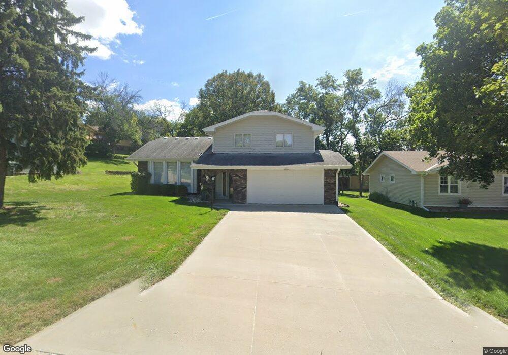
9 Cottner Dr Council Bluffs, IA 51503
Sherwood NeighborhoodEstimated Value: $272,000 - $365,000
3
Beds
3
Baths
2,186
Sq Ft
$140/Sq Ft
Est. Value
About This Home
This home is located at 9 Cottner Dr, Council Bluffs, IA 51503 and is currently estimated at $306,540, approximately $140 per square foot. 9 Cottner Dr is a home located in Pottawattamie County with nearby schools including College View Elementary School, Gerald W. Kirn Middle School, and Abraham Lincoln High School.
Ownership History
Date
Name
Owned For
Owner Type
Purchase Details
Closed on
Sep 29, 2020
Sold by
Drake James C and Drake Jane M
Bought by
Drake James C and Drake Jane M
Current Estimated Value
Purchase Details
Closed on
Aug 26, 2008
Sold by
Uncle Bubba Inc
Bought by
Drake Jane M
Purchase Details
Closed on
Jul 18, 2008
Sold by
Leaders Brian and Leaders Wendy
Bought by
Drake Jane M
Create a Home Valuation Report for This Property
The Home Valuation Report is an in-depth analysis detailing your home's value as well as a comparison with similar homes in the area
Home Values in the Area
Average Home Value in this Area
Purchase History
| Date | Buyer | Sale Price | Title Company |
|---|---|---|---|
| Drake James C | -- | None Available | |
| Drake Jane M | -- | None Available | |
| Drake Jane M | -- | None Available |
Source: Public Records
Tax History Compared to Growth
Tax History
| Year | Tax Paid | Tax Assessment Tax Assessment Total Assessment is a certain percentage of the fair market value that is determined by local assessors to be the total taxable value of land and additions on the property. | Land | Improvement |
|---|---|---|---|---|
| 2025 | $4,452 | $270,700 | $46,100 | $224,600 |
| 2024 | $4,452 | $245,000 | $40,100 | $204,900 |
| 2023 | $4,536 | $245,000 | $40,100 | $204,900 |
| 2022 | $4,524 | $201,800 | $40,400 | $161,400 |
| 2021 | $6,936 | $201,800 | $40,400 | $161,400 |
| 2020 | $4,464 | $201,800 | $40,400 | $161,400 |
| 2019 | $4,626 | $188,500 | $34,800 | $153,700 |
| 2018 | $4,082 | $188,500 | $34,800 | $153,700 |
| 2017 | $4,132 | $170,557 | $29,413 | $141,144 |
| 2015 | $4,036 | $170,557 | $29,413 | $141,144 |
| 2014 | $4,042 | $170,557 | $29,413 | $141,144 |
Source: Public Records
Map
Nearby Homes
- 23 Wenwood Cir
- 37 Indian Hills Rd
- 1426 Mcpherson Ave
- 102 Arbor Ridge Ln Unit 8
- 1109 Arbor Ridge Dr
- 206 Parkview Dr
- 103 Paige Ln
- 171 Wendover Dr
- 28 Cooper Ave
- 212 Woodcliff Cir
- 176 Bennett Ave
- 180 Bennett Ave
- 310 Wildwood Rd
- 200 Timber Dr
- 16090 Crystal Ln
- LOT 12 Mcpherson Ave
- 208 Red Bud Ln
- 52 Gould Ave
- 215 Wendy Heights Rd
- 216 Morningside Ave