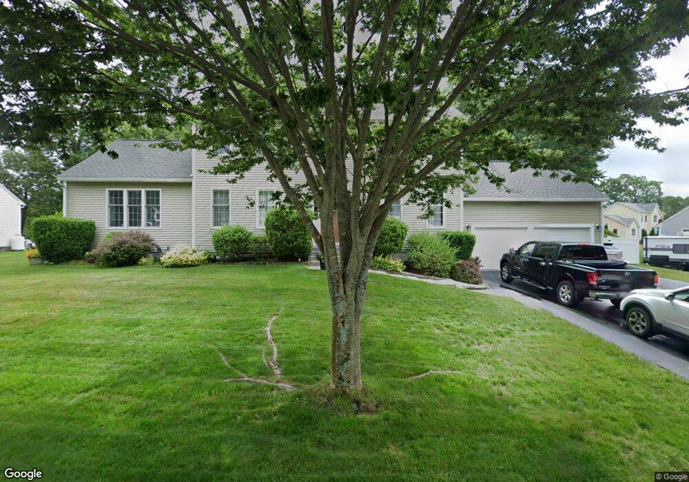
9 Cronin Brook Way Millbury, MA 01527
Estimated Value: $772,000 - $829,000
4
Beds
4
Baths
2,708
Sq Ft
$298/Sq Ft
Est. Value
About This Home
This home is located at 9 Cronin Brook Way, Millbury, MA 01527 and is currently estimated at $807,106, approximately $298 per square foot. 9 Cronin Brook Way is a home located in Worcester County with nearby schools including Elmwood Street Elementary School, Raymond E. Shaw Elementary School, and Millbury Junior/Senior High School.
Ownership History
Date
Name
Owned For
Owner Type
Purchase Details
Closed on
Jul 14, 2025
Sold by
Romaine Richard and Romaine Erin
Bought by
Romaine Ft-2025 and Romaine R
Current Estimated Value
Purchase Details
Closed on
Jan 31, 2006
Sold by
Platinum Bldg & Design I
Bought by
Romaine Erin and Romaine Richard
Home Financials for this Owner
Home Financials are based on the most recent Mortgage that was taken out on this home.
Original Mortgage
$323,000
Interest Rate
6.34%
Mortgage Type
Purchase Money Mortgage
Create a Home Valuation Report for This Property
The Home Valuation Report is an in-depth analysis detailing your home's value as well as a comparison with similar homes in the area
Home Values in the Area
Average Home Value in this Area
Purchase History
| Date | Buyer | Sale Price | Title Company |
|---|---|---|---|
| Romaine Ft-2025 | -- | -- | |
| Romaine Ft-2025 | -- | -- | |
| Romaine Erin | $571,526 | -- | |
| Romaine Erin | $571,526 | -- |
Source: Public Records
Mortgage History
| Date | Status | Borrower | Loan Amount |
|---|---|---|---|
| Previous Owner | Romaine Erin | $323,000 |
Source: Public Records
Tax History Compared to Growth
Tax History
| Year | Tax Paid | Tax Assessment Tax Assessment Total Assessment is a certain percentage of the fair market value that is determined by local assessors to be the total taxable value of land and additions on the property. | Land | Improvement |
|---|---|---|---|---|
| 2025 | $10,484 | $783,000 | $143,800 | $639,200 |
| 2024 | $9,626 | $727,600 | $133,100 | $594,500 |
| 2023 | $8,833 | $611,300 | $93,400 | $517,900 |
| 2022 | $7,748 | $516,500 | $89,600 | $426,900 |
| 2021 | $7,630 | $494,500 | $89,600 | $404,900 |
| 2020 | $7,410 | $487,200 | $89,600 | $397,600 |
| 2019 | $7,316 | $461,600 | $78,000 | $383,600 |
| 2018 | $7,462 | $456,700 | $91,600 | $365,100 |
| 2017 | $6,771 | $423,500 | $91,600 | $331,900 |
| 2016 | $7,002 | $425,400 | $91,600 | $333,800 |
| 2015 | $6,844 | $415,800 | $97,400 | $318,400 |
| 2014 | $6,401 | $374,300 | $93,800 | $280,500 |
Source: Public Records
Map
Nearby Homes
- 15 Rayburn Dr
- 20 Woodridge Rd
- 30 Lexington Rd
- Lot 1 Cooper Rd
- 8 Autumn Gate Cir
- 123 Riverlin St
- 64 Millbury Ave
- 90 Macarthur Dr
- 19 Rice Rd
- 73 Potter Hill Rd
- 16 Jackie Dr
- 19 Cortland Way
- 4 Thomas Hill Rd
- 17 Atwood Ave
- 5 Edward Dr
- 28 Lincoln Ln
- 156 Brigham Hill Rd
- 46 John Dr Unit 46
- 81 Ariel Cir
- 5 Lincoln Ln Unit 5
- 11 Cronin Brook Way
- 7 Cronin Brook Way
- 3 Cronin Brook Way
- 5 Cronin Brook Way
- 1 Cronin Brook Way
- 12 Cronin Brook Way
- 10 Cronin Brook Way
- 10 Cronin Brook Way Unit Lot 18
- 14 Cronin Brook Way
- 14 Cronin Brook Way Unit Lot 20
- 22 Cronin Brook Way
- 13 Cronin Brook Way
- 13 Cronin Brook Way Unit Lot 29
- 8 Cronin Brook Way
- 15 Cronin Brook Way
- 15 Cronin Brook Way Unit Lot 22
- 2 Cronin Brook Way
- 1 Diana Hill Dr
- 1 Diana Hill Dr Unit Lot 16
- 4 Cronin Brook Way