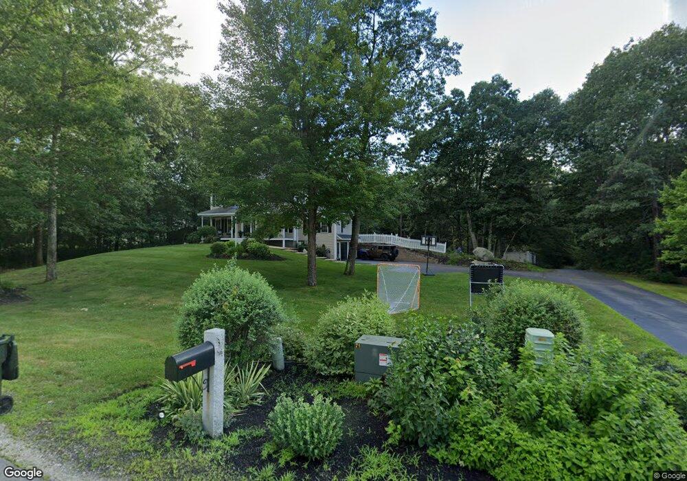
9 Danbury Ct Londonderry, NH 03053
Estimated Value: $810,818 - $934,000
4
Beds
3
Baths
2,622
Sq Ft
$332/Sq Ft
Est. Value
About This Home
This home is located at 9 Danbury Ct, Londonderry, NH 03053 and is currently estimated at $871,205, approximately $332 per square foot. 9 Danbury Ct is a home located in Rockingham County with nearby schools including North Londonderry Elementary School, Londonderry Middle School, and Londonderry Senior High School.
Ownership History
Date
Name
Owned For
Owner Type
Purchase Details
Closed on
Feb 20, 2014
Sold by
Steffen Christopher
Bought by
Stgelais Mathew R and Stgelais Faith C
Current Estimated Value
Home Financials for this Owner
Home Financials are based on the most recent Mortgage that was taken out on this home.
Original Mortgage
$381,562
Outstanding Balance
$289,020
Interest Rate
4.4%
Mortgage Type
FHA
Estimated Equity
$582,185
Purchase Details
Closed on
Mar 31, 2009
Sold by
Pulido Ken R and Pulido Laurie
Bought by
Steffen Christopher and Steffen Amy
Purchase Details
Closed on
Jun 17, 2003
Sold by
Finac Cendant Mobility
Bought by
Pulido Ken R and Pulido Laurie
Purchase Details
Closed on
Nov 1, 1999
Sold by
Hutter Const Corp
Bought by
Clifford Paul and Clifford Rosario M
Create a Home Valuation Report for This Property
The Home Valuation Report is an in-depth analysis detailing your home's value as well as a comparison with similar homes in the area
Home Values in the Area
Average Home Value in this Area
Purchase History
| Date | Buyer | Sale Price | Title Company |
|---|---|---|---|
| Stgelais Mathew R | $395,000 | -- | |
| Stgelais Mathew R | $395,000 | -- | |
| Steffen Christopher | $391,000 | -- | |
| Steffen Christopher | $391,000 | -- | |
| Pulido Ken R | $407,900 | -- | |
| Finan Cendant Mobility | $395,000 | -- | |
| Pulido Ken R | $407,900 | -- | |
| Clifford Paul | $274,500 | -- | |
| Clifford Paul | $274,500 | -- |
Source: Public Records
Mortgage History
| Date | Status | Borrower | Loan Amount |
|---|---|---|---|
| Open | Clifford Paul | $381,562 | |
| Closed | Clifford Paul | $381,562 |
Source: Public Records
Tax History Compared to Growth
Tax History
| Year | Tax Paid | Tax Assessment Tax Assessment Total Assessment is a certain percentage of the fair market value that is determined by local assessors to be the total taxable value of land and additions on the property. | Land | Improvement |
|---|---|---|---|---|
| 2024 | $11,295 | $699,800 | $256,400 | $443,400 |
| 2023 | $10,869 | $694,500 | $256,400 | $438,100 |
| 2022 | $10,116 | $547,400 | $193,000 | $354,400 |
| 2021 | $10,061 | $547,400 | $193,000 | $354,400 |
| 2020 | $10,280 | $511,200 | $156,100 | $355,100 |
| 2019 | $9,912 | $511,200 | $156,100 | $355,100 |
| 2018 | $9,457 | $433,800 | $132,200 | $301,600 |
| 2017 | $9,374 | $433,800 | $132,200 | $301,600 |
| 2016 | $9,327 | $433,800 | $132,200 | $301,600 |
| 2015 | $9,118 | $433,800 | $132,200 | $301,600 |
| 2014 | $9,149 | $433,800 | $132,200 | $301,600 |
| 2011 | -- | $462,300 | $132,200 | $330,100 |
Source: Public Records
Map
Nearby Homes
- 32 Noyes Rd
- 36 Perkins Rd
- 4 Crestview Cir Unit 119
- 50 Bartley Hill Rd
- 38 Bartley Hill Rd
- 17 Welch Rd
- 103 Rockingham Rd Unit 1
- 103 Rockingham Rd Unit 2
- 10 Auburn Rd
- 75 Rockingham Rd
- 19 Auburn Rd
- 27 Buckingham Dr
- 28 Barksdale Ave
- 8 Barksdale Ave
- 10 Judy Dr
- 118 Fieldstone Dr Unit 118
- 193 Fieldstone Dr
- 193 Fieldstone Dr Unit 193
- 57 Hardy Rd
- 169 Fieldstone Dr