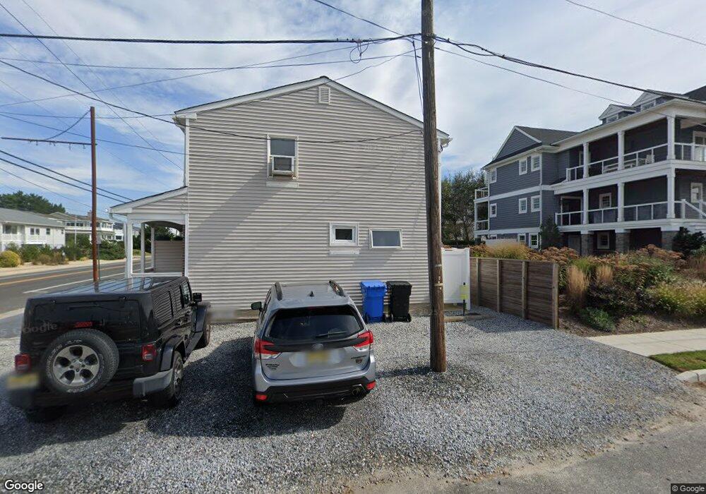
9 E Putnam Ave Strathmere, NJ 08248
Estimated Value: $1,903,600 - $2,498,000
Studio
--
Bath
2,512
Sq Ft
$928/Sq Ft
Est. Value
About This Home
This home is located at 9 E Putnam Ave, Strathmere, NJ 08248 and is currently estimated at $2,330,900, approximately $927 per square foot. 9 E Putnam Ave is a home with nearby schools including Ocean City Primary School, Ocean City Intermediate School, and Ocean City High School.
Ownership History
Date
Name
Owned For
Owner Type
Purchase Details
Closed on
Aug 1, 2024
Sold by
Rainear Donald H and Rainear Judith
Bought by
Rainear Donald H and Rainear Judith
Current Estimated Value
Purchase Details
Closed on
Mar 26, 1991
Sold by
Cousin Karen Lynne and Cousin Joseph J
Bought by
Cousin Karen Lynne
Create a Home Valuation Report for This Property
The Home Valuation Report is an in-depth analysis detailing your home's value as well as a comparison with similar homes in the area
Home Values in the Area
Average Home Value in this Area
Purchase History
| Date | Buyer | Sale Price | Title Company |
|---|---|---|---|
| Rainear Donald H | -- | None Listed On Document | |
| Cousin Karen Lynne | -- | -- |
Source: Public Records
Tax History
| Year | Tax Paid | Tax Assessment Tax Assessment Total Assessment is a certain percentage of the fair market value that is determined by local assessors to be the total taxable value of land and additions on the property. | Land | Improvement |
|---|---|---|---|---|
| 2025 | $18,867 | $929,500 | $610,000 | $319,500 |
| 2024 | $18,867 | $849,500 | $530,000 | $319,500 |
| 2023 | $17,916 | $849,500 | $530,000 | $319,500 |
| 2022 | $17,313 | $849,500 | $530,000 | $319,500 |
| 2021 | $12,350 | $849,500 | $530,000 | $319,500 |
| 2020 | $16,047 | $849,500 | $530,000 | $319,500 |
| 2019 | $15,656 | $849,500 | $530,000 | $319,500 |
| 2018 | $15,249 | $849,500 | $530,000 | $319,500 |
| 2017 | $15,079 | $849,500 | $530,000 | $319,500 |
| 2016 | $15,308 | $849,500 | $530,000 | $319,500 |
| 2015 | $14,900 | $849,500 | $530,000 | $319,500 |
| 2014 | $14,187 | $990,000 | $680,000 | $310,000 |
Source: Public Records
Map
Nearby Homes
- 18 E Randolph Ave
- 901 S Commonwealth Ave Unit SOUTH UNIT
- 901 S Commonwealth Ave Unit South
- 104 Prescott Ave
- 5 E Sumner Ave
- 10 E Winthrop Ave
- 18 E Winthrop Ave
- 117 Taylor Ave
- 118 2nd St Unit East
- 35 Asbury Ave Unit 2
- 35 Asbury Ave
- 5734 Central Ave Unit 5734
- 5647 Asbury Ave Unit 2nd Floor
- 1731 Route 9 Unit 28
- 1731 Route 9 Unit 25
- 5516 Asbury Ave Unit 18
- 157 Flinders Reef Unit First floor
- 400 E 55th St Unit E
- 400 E 55th St Unit D
- 5455 Asbury Ave Unit 3
- 13 E Putnam Ave
- 7 E Putnam Ave
- 17 E Putnam Ave
- 5 Putnam Ave
- 14 W Randolph Ave
- 10 W Randolph Ave
- 18 Randolph Ave
- 705 Commonwealth Dr
- 10 E Randolph Ave
- 6 W Randolph Ave
- 21 E Putnam Ave
- 22 Randolph Ave
- 4 E Putnam Ave
- 701 S Commonwealth Ave
- 401 S Commonwealth Ave
- 14 E Randolph Ave
- 2212-2214 S Commonwealth Ave Unit North Unit
- 301 S Commonwealth Ave
- 103 S Commonwealth Ave
- 2704 S Commonwealth Ave
Your Personal Tour Guide
Ask me questions while you tour the home.