Estimated Value: $335,096 - $384,000
4
Beds
2
Baths
1,536
Sq Ft
$237/Sq Ft
Est. Value
About This Home
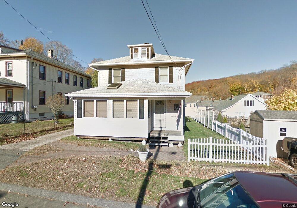
This home is located at 9 Elm St, Derby, CT 06418 and is currently estimated at $364,774, approximately $237 per square foot. 9 Elm St is a home located in New Haven County with nearby schools including Derby Middle School, Derby High School, and St Mary & St Michael School.
Ownership History
Date
Name
Owned For
Owner Type
Purchase Details
Closed on
Mar 31, 1986
Bought by
Koseski James C
Current Estimated Value
Create a Home Valuation Report for This Property
The Home Valuation Report is an in-depth analysis detailing your home's value as well as a comparison with similar homes in the area
Home Values in the Area
Average Home Value in this Area
Purchase History
| Date | Buyer | Sale Price | Title Company |
|---|---|---|---|
| Koseski James C | -- | -- |
Source: Public Records
Mortgage History
| Date | Status | Borrower | Loan Amount |
|---|---|---|---|
| Open | Koseski James C | $108,000 | |
| Closed | Koseski James C | $27,000 | |
| Closed | Koseski James C | $25,000 | |
| Closed | Koseski James C | $98,000 |
Source: Public Records
Tax History
| Year | Tax Paid | Tax Assessment Tax Assessment Total Assessment is a certain percentage of the fair market value that is determined by local assessors to be the total taxable value of land and additions on the property. | Land | Improvement |
|---|---|---|---|---|
| 2025 | $6,081 | $140,770 | $31,570 | $109,200 |
| 2024 | $6,081 | $140,770 | $31,570 | $109,200 |
| 2023 | $5,434 | $140,770 | $31,570 | $109,200 |
| 2022 | $5,434 | $140,770 | $31,570 | $109,200 |
| 2021 | $5,434 | $140,770 | $31,570 | $109,200 |
| 2020 | $4,591 | $104,650 | $31,570 | $73,080 |
| 2019 | $4,382 | $104,650 | $31,570 | $73,080 |
| 2018 | $4,120 | $104,650 | $31,570 | $73,080 |
| 2017 | $4,120 | $104,650 | $31,570 | $73,080 |
| 2016 | $4,120 | $104,650 | $31,570 | $73,080 |
| 2015 | $3,963 | $110,880 | $31,570 | $79,310 |
| 2014 | $3,963 | $110,880 | $31,570 | $79,310 |
Source: Public Records
Map
Nearby Homes
- 112 River Rd
- 1 Windward Way Unit 1
- 22 Jenyfer Ct
- 71 Sentinel Hill Rd
- 0 Harvard Ave
- 223 River Rd
- 126 Wells View Rd
- 83 Myrtle St Unit 83
- 27-29 Mclaughlin Terrace
- 28 Mclaughlin Terrace
- 11 Westminster Ave
- 1025 Willard Rd
- 30 Commodore Hull Dr
- 1 Hull St
- 1 Bank St
- 0 Wells Ave
- 63 Derby Ave
- 55 David Humphrey Rd
- 29 Toas St
- 26 King St
Your Personal Tour Guide
Ask me questions while you tour the home.