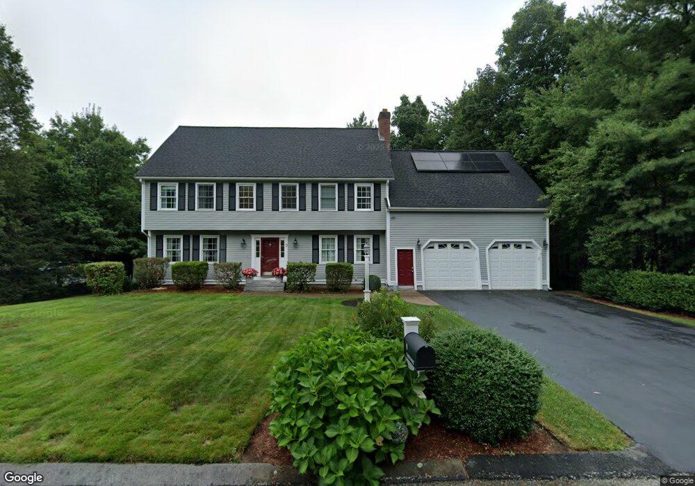
9 Gable Way Medway, MA 02053
Estimated Value: $853,456 - $1,044,000
4
Beds
3
Baths
2,891
Sq Ft
$318/Sq Ft
Est. Value
About This Home
This home is located at 9 Gable Way, Medway, MA 02053 and is currently estimated at $919,364, approximately $318 per square foot. 9 Gable Way is a home located in Norfolk County with nearby schools including John D. McGovern Elementary School, Burke-Memorial Elementary, and Medway Middle School.
Ownership History
Date
Name
Owned For
Owner Type
Purchase Details
Closed on
Jan 31, 2000
Sold by
Kings Ln Rt
Bought by
Stevenson Christopher and Stevenson Cynthia
Current Estimated Value
Create a Home Valuation Report for This Property
The Home Valuation Report is an in-depth analysis detailing your home's value as well as a comparison with similar homes in the area
Home Values in the Area
Average Home Value in this Area
Purchase History
| Date | Buyer | Sale Price | Title Company |
|---|---|---|---|
| Stevenson Christopher | $299,000 | -- |
Source: Public Records
Mortgage History
| Date | Status | Borrower | Loan Amount |
|---|---|---|---|
| Open | Stevenson Christopher | $331,000 | |
| Closed | Stevenson Christopher | $313,000 | |
| Closed | Stevenson Christopher | $260,000 | |
| Closed | Stevenson Christopher | $262,000 |
Source: Public Records
Tax History Compared to Growth
Tax History
| Year | Tax Paid | Tax Assessment Tax Assessment Total Assessment is a certain percentage of the fair market value that is determined by local assessors to be the total taxable value of land and additions on the property. | Land | Improvement |
|---|---|---|---|---|
| 2025 | $11,196 | $785,700 | $328,100 | $457,600 |
| 2024 | $11,314 | $785,700 | $328,100 | $457,600 |
| 2023 | $11,180 | $701,400 | $298,600 | $402,800 |
| 2022 | $10,393 | $613,900 | $220,800 | $393,100 |
| 2021 | $10,424 | $597,000 | $206,100 | $390,900 |
| 2020 | $10,045 | $574,000 | $206,100 | $367,900 |
| 2019 | $9,367 | $552,000 | $197,700 | $354,300 |
| 2018 | $9,448 | $535,000 | $189,300 | $345,700 |
| 2017 | $9,356 | $522,100 | $185,100 | $337,000 |
| 2016 | $8,974 | $495,500 | $170,300 | $325,200 |
| 2015 | $8,899 | $487,900 | $168,200 | $319,700 |
| 2014 | $8,614 | $457,200 | $168,200 | $289,000 |
Source: Public Records
Map
Nearby Homes
- 280 Village St Unit D2
- 4 Shaw St
- 22 Sunset Dr
- 28 Wellington St
- 176 Main St Unit 3
- 14 Heritage Dr
- 3 Meryl St
- 12 Lovering St
- 20 Broad St Unit 6
- 20 Broad St Unit A
- 20 Broad St Unit 4
- 36 Lovering St
- 50 Main St
- 106 Holliston St
- 14 Sanford St Unit 15
- 9 Sanford St
- 21 Riverside Rd
- 220 Main St Unit 220
- 0 Elm St
- 5 Fales St