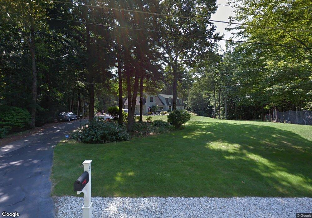
9 Hearthside Cir Bedford, NH 03110
Bedford NeighborhoodEstimated Value: $859,571 - $957,000
4
Beds
3
Baths
3,583
Sq Ft
$257/Sq Ft
Est. Value
About This Home
This home is located at 9 Hearthside Cir, Bedford, NH 03110 and is currently estimated at $920,893, approximately $257 per square foot. 9 Hearthside Cir is a home located in Hillsborough County with nearby schools including Mckelvie Intermediate School, Ross A. Lurgio Middle School, and Bedford High School.
Ownership History
Date
Name
Owned For
Owner Type
Purchase Details
Closed on
Sep 1, 2009
Sold by
Marian T Cunningham Re
Bought by
Toscano Paul P and Toscano Margaret A
Current Estimated Value
Create a Home Valuation Report for This Property
The Home Valuation Report is an in-depth analysis detailing your home's value as well as a comparison with similar homes in the area
Home Values in the Area
Average Home Value in this Area
Purchase History
| Date | Buyer | Sale Price | Title Company |
|---|---|---|---|
| Toscano Paul P | $407,000 | -- |
Source: Public Records
Mortgage History
| Date | Status | Borrower | Loan Amount |
|---|---|---|---|
| Open | Toscano Paul P | $91,750 | |
| Open | Toscano Paul P | $295,000 | |
| Closed | Toscano Paul P | $223,000 | |
| Closed | Toscano Paul P | $123,250 |
Source: Public Records
Tax History Compared to Growth
Tax History
| Year | Tax Paid | Tax Assessment Tax Assessment Total Assessment is a certain percentage of the fair market value that is determined by local assessors to be the total taxable value of land and additions on the property. | Land | Improvement |
|---|---|---|---|---|
| 2024 | $12,558 | $794,300 | $277,400 | $516,900 |
| 2023 | $11,719 | $791,800 | $277,400 | $514,400 |
| 2022 | $10,657 | $605,500 | $205,600 | $399,900 |
| 2021 | $10,378 | $605,500 | $205,600 | $399,900 |
| 2020 | $10,196 | $509,300 | $158,100 | $351,200 |
| 2019 | $9,651 | $509,300 | $158,100 | $351,200 |
| 2018 | $9,870 | $483,800 | $158,100 | $325,700 |
| 2017 | $9,149 | $483,800 | $158,100 | $325,700 |
| 2016 | $9,029 | $403,600 | $120,900 | $282,700 |
| 2015 | $9,186 | $403,600 | $120,900 | $282,700 |
| 2014 | $9,081 | $403,600 | $120,900 | $282,700 |
| 2013 | $8,866 | $399,900 | $120,900 | $279,000 |
Source: Public Records
Map
Nearby Homes
- 10 Winterberry Dr
- 58 Parkhurst Rd
- 301 N Amherst Rd
- 52 Hardy Rd
- 101 Horace Greeley Rd
- 258 N Amherst Rd Unit 34
- 7 Shepherd Hill Rd
- 58 Woodward Rd
- 68 Perry Rd
- 44 McQuade Brook Rd
- 4 Jenkins Rd Unit Lot 31-4 - The Hann
- 38 Christmas Tree Cir
- 20 Ledgewood Rd
- 29 Ledgewood Rd
- 3 Westview Rd Unit Lot 3 - The Saffron
- 4 Westview Rd Unit Lot 4 - Hannah Floor
- 21 West Rd
- 250 Joppa Hill Rd
- 24 Brook Rd
- 40 Seton Dr
- 15 Hearthside Cir
- 3 Hearthside Cir
- 12 Hearthside Cir
- 3 Old Stone Way
- 20 Hearthside Cir
- 4 Old Stone Way
- 19 Hearthside Cir
- 3 High Gate Rd
- 62 Hearthside Cir
- 28 Hearthside Cir
- 21 Hearthside Cir
- 8 Old Stone Way
- 2 Old Evergreen Rd
- 501 New Hampshire 101
- 4 Joppa Hill Rd
- 4-23-11 Joppa Hill Rd
- 4 Joppa Hill Rd
- 3 Old Evergreen Rd
- 25 Hearthside Cir
- 501 Route 101