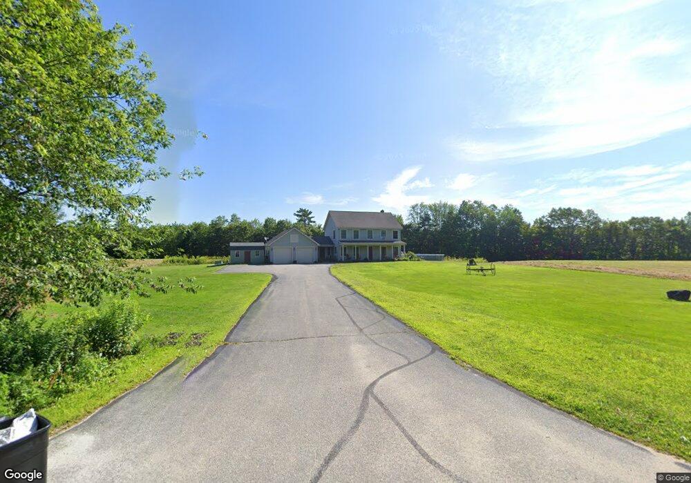
9 Holbrook Rd Turner, ME 04282
Estimated Value: $375,259 - $482,000
--
Bed
--
Bath
1,008
Sq Ft
$407/Sq Ft
Est. Value
About This Home
This home is located at 9 Holbrook Rd, Turner, ME 04282 and is currently estimated at $410,565, approximately $407 per square foot. 9 Holbrook Rd is a home with nearby schools including Tripp Middle School and Leavitt Area High School.
Ownership History
Date
Name
Owned For
Owner Type
Purchase Details
Closed on
Oct 18, 2010
Sold by
Mccormick Tina L and Mccormick Terrence S
Bought by
Mccormick Tina L and Mccormick Terrence S
Current Estimated Value
Home Financials for this Owner
Home Financials are based on the most recent Mortgage that was taken out on this home.
Original Mortgage
$174,150
Outstanding Balance
$1,305
Interest Rate
4.25%
Mortgage Type
FHA
Estimated Equity
$409,260
Create a Home Valuation Report for This Property
The Home Valuation Report is an in-depth analysis detailing your home's value as well as a comparison with similar homes in the area
Home Values in the Area
Average Home Value in this Area
Purchase History
| Date | Buyer | Sale Price | Title Company |
|---|---|---|---|
| Mccormick Tina L | -- | -- |
Source: Public Records
Mortgage History
| Date | Status | Borrower | Loan Amount |
|---|---|---|---|
| Open | Mccormick Tina L | $174,150 | |
| Previous Owner | Mccormick Tina L | $35,000 |
Source: Public Records
Tax History Compared to Growth
Tax History
| Year | Tax Paid | Tax Assessment Tax Assessment Total Assessment is a certain percentage of the fair market value that is determined by local assessors to be the total taxable value of land and additions on the property. | Land | Improvement |
|---|---|---|---|---|
| 2025 | $3,973 | $292,100 | $73,800 | $218,300 |
| 2024 | $3,724 | $292,100 | $73,800 | $218,300 |
| 2023 | $3,666 | $292,100 | $73,800 | $218,300 |
| 2022 | $3,330 | $292,100 | $73,800 | $218,300 |
| 2021 | $3,330 | $292,100 | $73,800 | $218,300 |
| 2020 | $4,049 | $226,200 | $44,800 | $181,400 |
| 2019 | $4,072 | $226,200 | $44,800 | $181,400 |
| 2018 | $4,015 | $226,200 | $44,800 | $181,400 |
| 2016 | $3,814 | $226,200 | $44,800 | $181,400 |
| 2015 | $3,597 | $226,200 | $44,800 | $181,400 |
| 2014 | $3,551 | $226,200 | $44,800 | $181,400 |
| 2013 | $3,388 | $226,200 | $44,800 | $181,400 |
Source: Public Records
Map
Nearby Homes
- 241 Allen Rd
- 291 Little Wilson Pond Rd
- 203 Little Wilson Pond Rd
- TBD Skillings Woods Rd
- 5 Deer Run
- 3 Sunset Ln
- 175 S Hill Rd
- 31 Sodom Rd
- 0 Beaver Rd
- 207 N Auburn Rd
- 89 Hebron Rd
- 37 Goldenrod Ln
- 101 Goodrich Rd
- 14 Shire
- Lot A Station Rd
- Lot 21B Station Rd
- 1269 Woodman Hill Rd
- 98 Auburn Rd
- 140 Main St
- 50 Magnum Dr
- 34 Holbrook Rd
- 0 Holbrook A
- 39 Holbrook Rd
- 2 Holbrook Rd
- 11 Red Oak Trail
- 566 Wilson Hill Rd
- 550 Wilson Hill Rd
- 590 Wilson Hill Rd
- 521 Wilson Hill Rd
- 531 Wilson Hill Rd
- 492 Wilson Hill Rd
- 589 Wilson Hill Rd
- 612 Wilson Hill Rd
- 120 Holbrook Rd
- 124 Holbrook Rd
- 567 Wilson Hill Rd
- 475 Wilson Hill Rd
- 623 Wilson Hill Rd
- 451 Wilson Hill Rd
- 7 Strawberry Ave