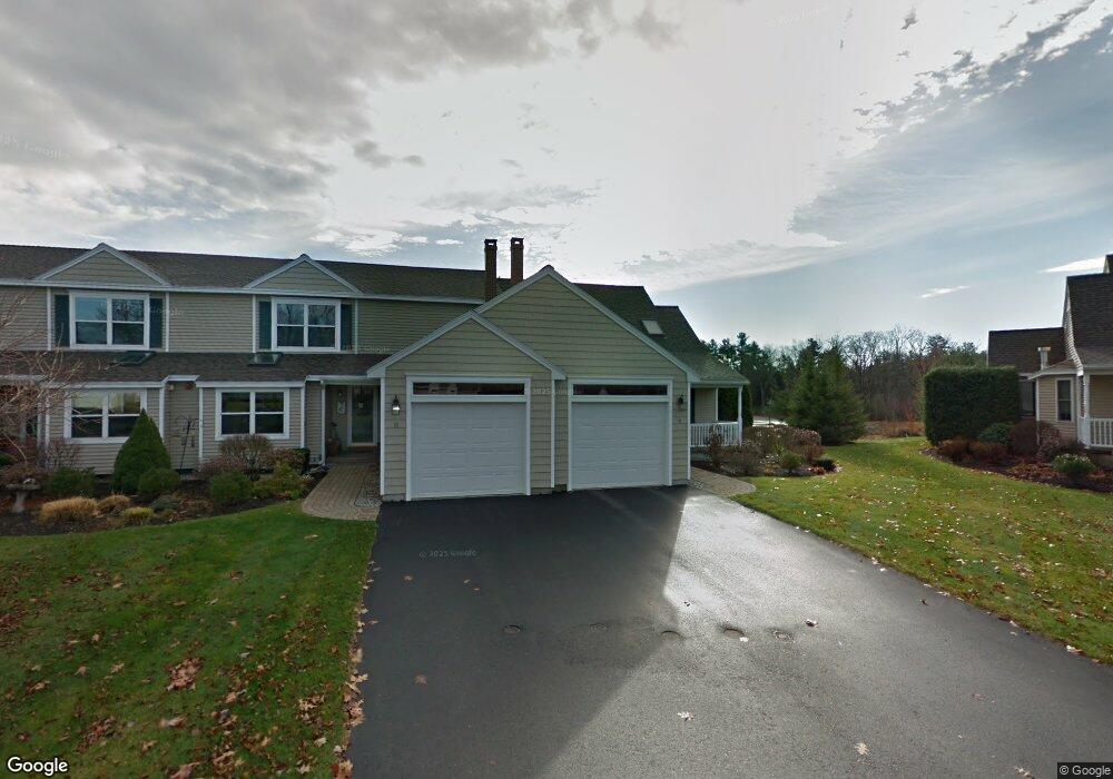
9 Kingfisher Ct Gorham, ME 04038
Estimated Value: $584,000 - $640,000
4
Beds
3
Baths
2,403
Sq Ft
$256/Sq Ft
Est. Value
About This Home
This home is located at 9 Kingfisher Ct, Gorham, ME 04038 and is currently estimated at $615,986, approximately $256 per square foot. 9 Kingfisher Ct is a home located in Cumberland County with nearby schools including Great Falls Elementary School, Gorham Middle School, and Gorham High School.
Ownership History
Date
Name
Owned For
Owner Type
Purchase Details
Closed on
Dec 23, 2025
Sold by
Ringo Judith K and Ringo Lischer D
Bought by
Lischer Linda and Lischer David K
Current Estimated Value
Purchase Details
Closed on
Sep 16, 2008
Sold by
Ringo Judith K
Bought by
Ringo Lischer Ft and Ringo
Purchase Details
Closed on
Jul 8, 2008
Sold by
Kasprzak Homes Inc
Bought by
Ringo Judith K
Create a Home Valuation Report for This Property
The Home Valuation Report is an in-depth analysis detailing your home's value as well as a comparison with similar homes in the area
Home Values in the Area
Average Home Value in this Area
Purchase History
| Date | Buyer | Sale Price | Title Company |
|---|---|---|---|
| Lischer Linda | -- | -- | |
| Ringo Judith K | -- | -- | |
| Ringo Lischer Ft | -- | -- | |
| Ringo Judith K | -- | -- |
Source: Public Records
Tax History
| Year | Tax Paid | Tax Assessment Tax Assessment Total Assessment is a certain percentage of the fair market value that is determined by local assessors to be the total taxable value of land and additions on the property. | Land | Improvement |
|---|---|---|---|---|
| 2025 | $6,451 | $435,900 | $31,800 | $404,100 |
| 2024 | $6,408 | $435,900 | $31,800 | $404,100 |
| 2023 | $5,994 | $435,900 | $31,800 | $404,100 |
| 2022 | $5,601 | $435,900 | $31,800 | $404,100 |
| 2021 | $5,219 | $269,000 | $140,200 | $128,800 |
| 2020 | $5,111 | $269,000 | $140,200 | $128,800 |
| 2019 | $5,098 | $269,000 | $140,200 | $128,800 |
| 2018 | $4,539 | $269,000 | $140,200 | $128,800 |
| 2017 | $4,600 | $269,000 | $140,200 | $128,800 |
| 2016 | $4,570 | $268,800 | $140,000 | $128,800 |
| 2015 | $4,381 | $268,800 | $140,000 | $128,800 |
| 2014 | $3,762 | $216,200 | $82,800 | $133,400 |
| 2013 | $3,740 | $216,200 | $82,800 | $133,400 |
Source: Public Records
Map
Nearby Homes
- 127 Falcon Crest Dr Unit 4
- 187 Falcon Crest Dr Unit 30
- 189 Falcon Crest Dr Unit 31
- 191 Falcon Crest Dr Unit 32
- 182 Falcon Crest Dr Unit 56
- 193 Falcon Crest Dr Unit 33
- 188 Falcon Crest Dr Unit 58
- 195 Falcon Crest Dr Unit 34
- 192 Falcon Crest Dr Unit 59
- 194 Falcon Crest Dr Unit 60
- 12 Strouts Way
- 15 Green St
- 49 Lochwood Dr
- TBD Lochwood Dr
- 91 South St
- 13 Lochwood Dr
- 17 Lochwood Dr
- 52 Morrill Ave
- 16 Laurel Pines Dr
- 25 Patio Park Ln
- 9 Kingfisher Ct Unit 48
- 11 Kingfisher Ct
- 11 Kingfisher Ct Unit 47
- 13 Kingfisher Ct
- 13 Kingfisher Ct Unit 46
- 15 Kingfisher Ct
- 15 Kingfisher Ct Unit 45
- 5 Kingfisher Ct
- 7 Kingfisher Ct
- 7 Kingfisher Ct Unit 49
- 5 King Fisher Ct Unit 50
- 5 Kingfisher Ct Unit 50
- 59 Ridgefield Unit 59
- 3 Kingfisher Ct
- 3 Kingfisher Ct Unit 51
- 35 Ridgefield Dr Unit 43
- 8 Fox Run Ct Unit 24
- 1 Kingfisher Ct
- 1 Kingfisher Ct Unit 52
- 33 Ridgefield Dr Unit 44
Your Personal Tour Guide
Ask me questions while you tour the home.