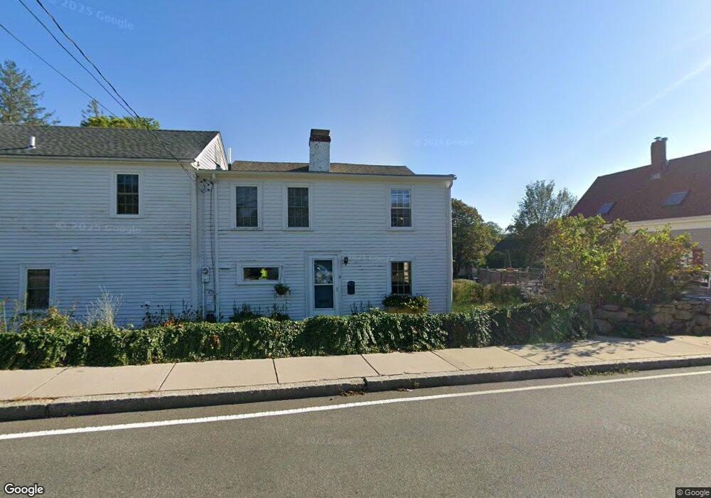
9 Langsford St Gloucester, MA 01930
Estimated Value: $854,000 - $1,068,000
4
Beds
2
Baths
2,410
Sq Ft
$401/Sq Ft
Est. Value
About This Home
This home is located at 9 Langsford St, Gloucester, MA 01930 and is currently estimated at $966,919, approximately $401 per square foot. 9 Langsford St is a home located in Essex County with nearby schools including Plum Cove School, Ralph B O'maley Middle School, and Gloucester High School.
Ownership History
Date
Name
Owned For
Owner Type
Purchase Details
Closed on
Sep 25, 2013
Sold by
Webster David and Webster Matthew
Bought by
Symonds Charles G and Symonds Regina D
Current Estimated Value
Home Financials for this Owner
Home Financials are based on the most recent Mortgage that was taken out on this home.
Original Mortgage
$275,000
Outstanding Balance
$140,721
Interest Rate
4.42%
Mortgage Type
New Conventional
Estimated Equity
$826,198
Purchase Details
Closed on
Dec 28, 2012
Sold by
Lucci Deborah E
Bought by
Perrone Frank S
Home Financials for this Owner
Home Financials are based on the most recent Mortgage that was taken out on this home.
Original Mortgage
$560,000
Interest Rate
3.38%
Mortgage Type
Purchase Money Mortgage
Purchase Details
Closed on
Jun 28, 2012
Sold by
Webster Harriet S Est
Bought by
Webster David and Webster Matthew
Create a Home Valuation Report for This Property
The Home Valuation Report is an in-depth analysis detailing your home's value as well as a comparison with similar homes in the area
Purchase History
| Date | Buyer | Sale Price | Title Company |
|---|---|---|---|
| Symonds Charles G | $375,000 | -- | |
| Perrone Frank S | $560,000 | -- | |
| Webster David | -- | -- |
Source: Public Records
Mortgage History
| Date | Status | Borrower | Loan Amount |
|---|---|---|---|
| Open | Webster David | $275,000 | |
| Previous Owner | Webster David | $560,000 | |
| Previous Owner | Webster David | $50,000 |
Source: Public Records
Tax History
| Year | Tax Paid | Tax Assessment Tax Assessment Total Assessment is a certain percentage of the fair market value that is determined by local assessors to be the total taxable value of land and additions on the property. | Land | Improvement |
|---|---|---|---|---|
| 2025 | $6,722 | $691,600 | $273,500 | $418,100 |
| 2024 | $6,602 | $678,500 | $260,400 | $418,100 |
| 2023 | $6,343 | $599,000 | $232,600 | $366,400 |
| 2022 | $6,097 | $519,800 | $197,700 | $322,100 |
| 2021 | $5,894 | $473,800 | $179,700 | $294,100 |
| 2020 | $5,875 | $476,500 | $179,700 | $296,800 |
| 2019 | $5,695 | $448,800 | $179,700 | $269,100 |
| 2018 | $5,560 | $430,000 | $179,700 | $250,300 |
| 2017 | $5,393 | $408,900 | $171,100 | $237,800 |
| 2016 | $5,278 | $387,800 | $171,600 | $216,200 |
| 2015 | $5,078 | $372,000 | $171,600 | $200,400 |
Source: Public Records
Map
Nearby Homes
- 10 Emerald St
- 43 High St Unit B
- 9 Hickory St
- 1030 Washington St
- 4 Ciaramitaro Ct
- 136 Leonard St
- 94 Phillips Ave
- 13 Phillips Ave
- 32 Haven Ave
- 5 Boulder Top
- 33 Quarry Ridge Ln Unit 33
- 13 Rowe Point
- 5 Smith St Unit R
- 672 Washington St
- 1 Charte Ct
- 1 Main St Unit R
- 1 Main St Unit C
- 1 Jewett St Unit 2
- 177 Main St
- 1 High St
- 13 Langsford St
- 7 Langsford St
- 15 Langsford St
- 1096 Washington St
- 1100 Washington St
- 1102 Washington St
- 8 Munsey Ln
- 6 Munsey Ln
- 1092 Washington St
- 8 Langsford St
- 16 Langsford St
- 1094 Washington St
- 5 Langsford St
- 19 Langsford St
- 1104 Washington St
- 9 Andrews St
- 20 Langsford St
- 1 Andrews St
- 4 Langsford St
- 21 Langsford St
Your Personal Tour Guide
Ask me questions while you tour the home.