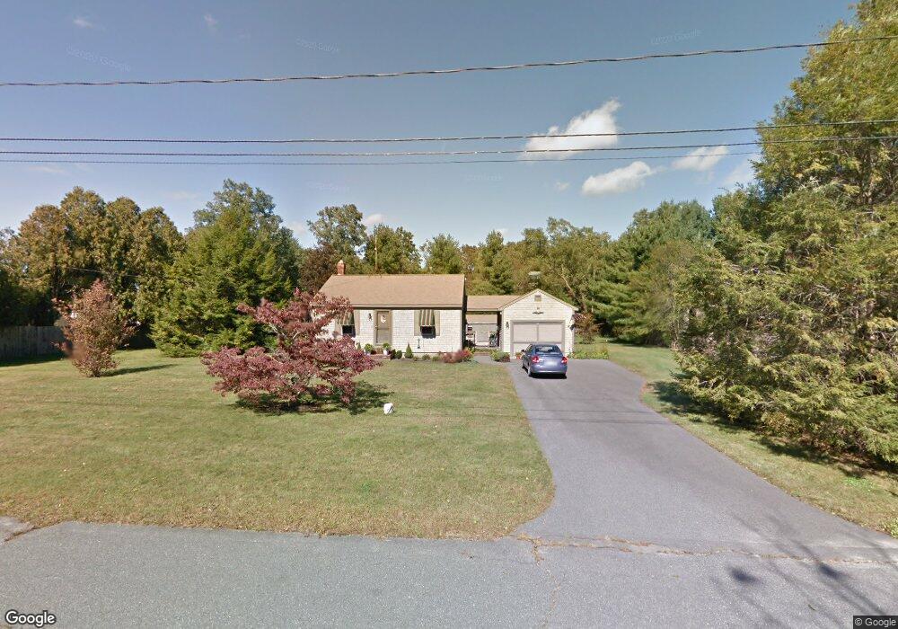
9 Lantern Ln Acushnet, MA 02743
Estimated Value: $413,379 - $629,000
Studio
1
Bath
672
Sq Ft
$741/Sq Ft
Est. Value
About This Home
This home is located at 9 Lantern Ln, Acushnet, MA 02743 and is currently estimated at $497,845, approximately $740 per square foot. 9 Lantern Ln is a home located in Bristol County with nearby schools including Acushnet Elementary School, Albert F Ford Middle School, and St Francis Xavier Elementary School.
Ownership History
Date
Name
Owned For
Owner Type
Purchase Details
Closed on
May 8, 2023
Sold by
Claire R Gronlud Irt
Bought by
Denault Doreen M
Current Estimated Value
Purchase Details
Closed on
May 27, 2010
Sold by
Gronlund Claire R and Denault Doreen M
Bought by
Claire R Gronlund Irt
Purchase Details
Closed on
Nov 15, 2004
Sold by
Gronlund Claire R
Bought by
Gronlund Claire R and Denault Doreen M
Create a Home Valuation Report for This Property
The Home Valuation Report is an in-depth analysis detailing your home's value as well as a comparison with similar homes in the area
Purchase History
| Date | Buyer | Sale Price | Title Company |
|---|---|---|---|
| Denault Doreen M | -- | None Available | |
| Claire R Gronlund Irt | -- | -- | |
| Gronlund Claire R | -- | -- |
Source: Public Records
Tax History
| Year | Tax Paid | Tax Assessment Tax Assessment Total Assessment is a certain percentage of the fair market value that is determined by local assessors to be the total taxable value of land and additions on the property. | Land | Improvement |
|---|---|---|---|---|
| 2025 | $35 | $327,100 | $154,100 | $173,000 |
| 2024 | $3,365 | $294,900 | $134,800 | $160,100 |
| 2023 | $3,301 | $275,100 | $122,800 | $152,300 |
| 2022 | $3,333 | $251,200 | $115,500 | $135,700 |
| 2021 | $3,225 | $233,200 | $115,500 | $117,700 |
| 2020 | $3,251 | $233,200 | $115,500 | $117,700 |
| 2019 | $3,256 | $229,600 | $115,500 | $114,100 |
| 2018 | $3,198 | $221,800 | $115,500 | $106,300 |
| 2017 | $3,090 | $214,000 | $115,500 | $98,500 |
| 2016 | $3,077 | $211,800 | $115,500 | $96,300 |
| 2015 | $2,953 | $206,800 | $115,500 | $91,300 |
Source: Public Records
Map
Nearby Homes
- 199 Quaker Ln
- 0 Keene Rd Unit 73459818
- 168 Keene Rd
- 0 Land Way Unit 73479153
- 898 Tobey St
- 247 Braley Hill Rd
- 125 Doctor Braley Rd
- 4597 Acushnet Ave
- 973 Pembroke St
- SS Charbonneau Ln
- 34 Poplar Rd
- 18 Wordell St
- 3 Abraham Ave
- 489 Main St
- 329 Middle Rd
- 145 Heritage Dr
- 134 Nyes Ln
- 1015 Forbes St
- 78 Greenbrier Dr
- 363 Main St
Your Personal Tour Guide
Ask me questions while you tour the home.