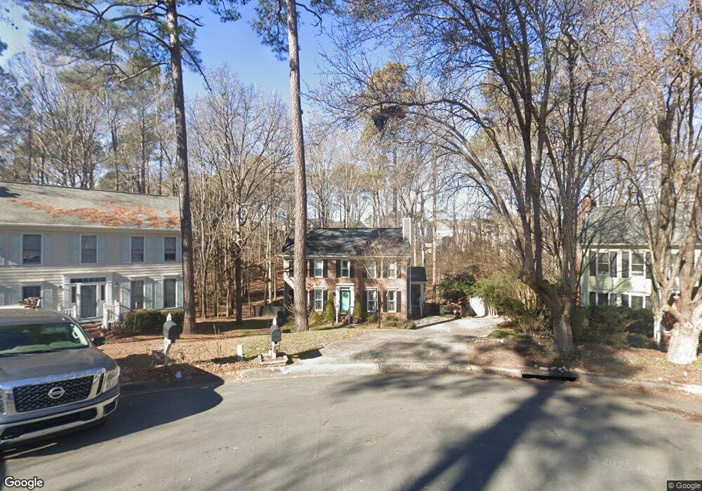
9 Leeward Ct Durham, NC 27713
Woodcroft NeighborhoodEstimated Value: $434,000 - $486,000
3
Beds
3
Baths
1,728
Sq Ft
$263/Sq Ft
Est. Value
About This Home
This home is located at 9 Leeward Ct, Durham, NC 27713 and is currently estimated at $455,210, approximately $263 per square foot. 9 Leeward Ct is a home located in Durham County with nearby schools including Southwest Elementary School, Morehead Montessori, and Sherwood Githens Middle.
Ownership History
Date
Name
Owned For
Owner Type
Purchase Details
Closed on
Feb 27, 2016
Sold by
English Monroe
Bought by
Pendergraft Michael D and Pendergraft Katherine L
Current Estimated Value
Home Financials for this Owner
Home Financials are based on the most recent Mortgage that was taken out on this home.
Original Mortgage
$193,410
Outstanding Balance
$151,399
Interest Rate
3.65%
Estimated Equity
$303,811
Create a Home Valuation Report for This Property
The Home Valuation Report is an in-depth analysis detailing your home's value as well as a comparison with similar homes in the area
Home Values in the Area
Average Home Value in this Area
Purchase History
| Date | Buyer | Sale Price | Title Company |
|---|---|---|---|
| Pendergraft Michael D | $215,000 | -- |
Source: Public Records
Mortgage History
| Date | Status | Borrower | Loan Amount |
|---|---|---|---|
| Open | Pendergraft Michael D | $193,410 |
Source: Public Records
Tax History
| Year | Tax Paid | Tax Assessment Tax Assessment Total Assessment is a certain percentage of the fair market value that is determined by local assessors to be the total taxable value of land and additions on the property. | Land | Improvement |
|---|---|---|---|---|
| 2025 | $4,313 | $435,097 | $137,500 | $297,597 |
| 2024 | $3,420 | $245,177 | $56,205 | $188,972 |
| 2023 | $3,212 | $245,177 | $56,205 | $188,972 |
| 2022 | $3,138 | $245,177 | $56,205 | $188,972 |
| 2021 | $3,123 | $245,177 | $56,205 | $188,972 |
| 2020 | $3,050 | $245,177 | $56,205 | $188,972 |
| 2019 | $3,050 | $245,177 | $56,205 | $188,972 |
| 2018 | $2,970 | $218,944 | $37,470 | $181,474 |
| 2017 | $2,948 | $218,944 | $37,470 | $181,474 |
| 2016 | $2,849 | $218,944 | $37,470 | $181,474 |
| 2015 | $2,717 | $196,304 | $40,409 | $155,895 |
| 2014 | $2,717 | $196,304 | $40,409 | $155,895 |
Source: Public Records
Map
Nearby Homes
- 4907 Fortunes Ridge Dr
- 233 Morningside Dr
- 64 Citation Dr
- 5500 Fortunes Ridge Dr Unit 80b
- 5500 Fortunes Ridge Dr Unit 89B
- 4000 Kettering Dr
- 200 W Woodcroft Pkwy Unit 60c
- 200 W Woodcroft Pkwy Unit 53b
- 2 Hurdle Ct
- 4908 Victoria Dr
- 4 Applewood Square
- 10 Hickorywood Square
- 3805 Chimney Ridge Place Unit 104
- 527 Woodwinds Dr
- 4731 Alderbrook Ln
- 3706 Chimney Ridge Place Unit 8
- 4727 Alderbrook Ln
- 5017 Tapestry Terrace
- 708 Sleepy Creek Dr
- 4908 Tapestry Terrace
- 7 Leeward Ct
- 10 Leeward Ct
- 5 Leeward Ct
- 8 Leeward Ct
- 504 Morningside Dr
- 1 Leeward Ct
- 506 Morningside Dr
- 6 Leeward Ct
- 5101 Fortunes Ridge Dr
- 131 Shadow Hawk Dr
- 4 Leeward Ct
- 133 Shadow Hawk Dr
- 512 Morningside Dr
- 129 Shadow Hawk Dr
- 5109 Fortunes Ridge Dr
- 5104 Fortunes Ridge Dr
- 5100 Fortunes Ridge Dr
- 137 Shadow Hawk Dr
- 514 Morningside Dr
- 5108 Fortunes Ridge Dr
Your Personal Tour Guide
Ask me questions while you tour the home.