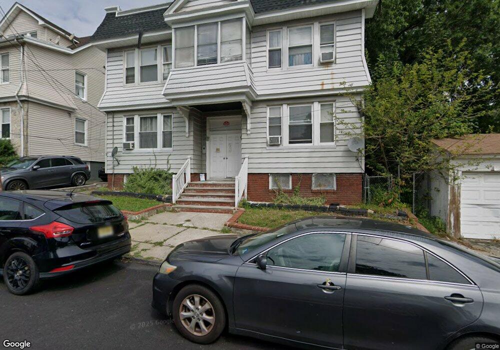
9 Lenox St Unit 11 Newark, NJ 07106
Lower Vailsburg NeighborhoodEstimated Value: $676,536 - $757,000
Studio
--
Bath
4,004
Sq Ft
$175/Sq Ft
Est. Value
About This Home
This home is located at 9 Lenox St Unit 11, Newark, NJ 07106 and is currently estimated at $700,134, approximately $174 per square foot. 9 Lenox St Unit 11 is a home located in Essex County with nearby schools including Lincoln Elementary School, Mt. Vernon School, and Hawthorne Avenue Elementary School.
Ownership History
Date
Name
Owned For
Owner Type
Purchase Details
Closed on
Apr 29, 2025
Sold by
Morris Michael and Morris Traci L
Bought by
Morris Living Trust and Morris
Current Estimated Value
Purchase Details
Closed on
Feb 1, 1999
Sold by
Knight Andrew
Bought by
Morris Michael and Morris Traci L
Home Financials for this Owner
Home Financials are based on the most recent Mortgage that was taken out on this home.
Original Mortgage
$137,700
Interest Rate
6.73%
Create a Home Valuation Report for This Property
The Home Valuation Report is an in-depth analysis detailing your home's value as well as a comparison with similar homes in the area
Home Values in the Area
Average Home Value in this Area
Purchase History
| Date | Buyer | Sale Price | Title Company |
|---|---|---|---|
| Morris Living Trust | -- | None Listed On Document | |
| Morris Michael | $135,000 | -- |
Source: Public Records
Mortgage History
| Date | Status | Borrower | Loan Amount |
|---|---|---|---|
| Previous Owner | Morris Michael | $137,700 |
Source: Public Records
Tax History
| Year | Tax Paid | Tax Assessment Tax Assessment Total Assessment is a certain percentage of the fair market value that is determined by local assessors to be the total taxable value of land and additions on the property. | Land | Improvement |
|---|---|---|---|---|
| 2025 | $8,943 | $239,900 | $26,900 | $213,000 |
| 2024 | $8,943 | $239,900 | $26,900 | $213,000 |
| 2022 | $8,963 | $239,900 | $26,900 | $213,000 |
| 2021 | $8,958 | $239,900 | $26,900 | $213,000 |
| 2020 | $9,116 | $239,900 | $26,900 | $213,000 |
| 2019 | $9,023 | $239,900 | $26,900 | $213,000 |
| 2018 | $8,860 | $239,900 | $26,900 | $213,000 |
| 2017 | $8,540 | $239,900 | $26,900 | $213,000 |
| 2016 | $8,253 | $239,900 | $26,900 | $213,000 |
| 2015 | $7,938 | $239,900 | $26,900 | $213,000 |
| 2014 | $7,439 | $239,900 | $26,900 | $213,000 |
Source: Public Records
Map
Nearby Homes
- 86 Mead St
- 1044 18th Ave
- 10 Lenox St
- 206-212 Brookdale Ave
- 50 Unity Ave
- 164 Stuyvesant Ave
- 153-157 Stuyvesant Ave
- 197-199 Sunset Ave
- 199 Sunset Ave
- 23 Valley St Unit 25
- 973-975 18th Ave
- 973 18th Ave Unit 975
- 15-17 Valley St
- 15 Valley St Unit 17
- 163-165 Brookdale Ave
- 34 Cleveland Ave
- 5 Colleen St
- 184 Sunset Ave
- 94 Lenox St Unit 98
- 71 Lindsley Ave
- 13 Lenox St Unit 15
- 15 Lenox St
- 229 Stuyvesant Ave Unit 231
- 227 Stuyvesant Ave
- 233 Stuyvesant Ave
- 17 Lenox St
- 223 Stuyvesant Ave Unit 225
- 14 Commonwealth Ave Unit 1
- 14 Commonwealth Ave
- 10 Commonwealth Ave Unit 12
- 10 Commonwealth Ave Unit 2
- 16 Commonwealth Ave
- 19 Lenox St Unit 21
- 239 Stuyvesant Ave Unit 241
- 239 Stuyvesant Ave
- 19 Lenox Ave
- 18 Commonwealth Ave
- 239-241 Stuyvesant Ave
- 219 Stuyvesant Ave
- 12 Lenox St
Your Personal Tour Guide
Ask me questions while you tour the home.