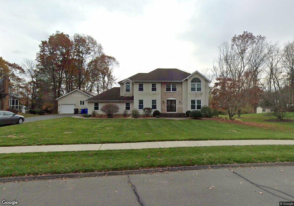
9 Majus Cir Ellington, CT 06029
Estimated Value: $709,233 - $837,000
5
Beds
4
Baths
3,350
Sq Ft
$231/Sq Ft
Est. Value
About This Home
This home is located at 9 Majus Cir, Ellington, CT 06029 and is currently estimated at $775,058, approximately $231 per square foot. 9 Majus Cir is a home located in Hartford County with nearby schools including Timothy Edwards School and South Windsor High School.
Ownership History
Date
Name
Owned For
Owner Type
Purchase Details
Closed on
Jan 29, 2018
Sold by
Schulman Natasha and Grishtaev Alex
Bought by
Schulman Natasha and Schulman David
Current Estimated Value
Purchase Details
Closed on
Oct 4, 1999
Sold by
Buscemi Anthony and Buscemi Angelina
Bought by
Grishtaev Alex and Grishtaev Bella
Purchase Details
Closed on
Dec 12, 1991
Sold by
Surrells Daniel and Surrells Sharon
Bought by
Buscemi Anthony and Buscemi Angelina
Purchase Details
Closed on
Jul 9, 1990
Sold by
Limberger John
Bought by
Surrells Daniel
Create a Home Valuation Report for This Property
The Home Valuation Report is an in-depth analysis detailing your home's value as well as a comparison with similar homes in the area
Home Values in the Area
Average Home Value in this Area
Purchase History
| Date | Buyer | Sale Price | Title Company |
|---|---|---|---|
| Schulman Natasha | -- | -- | |
| Grishtaev Alex | $268,000 | -- | |
| Buscemi Anthony | $230,000 | -- | |
| Surrells Daniel | $78,500 | -- |
Source: Public Records
Mortgage History
| Date | Status | Borrower | Loan Amount |
|---|---|---|---|
| Previous Owner | Surrells Daniel | $397,000 | |
| Previous Owner | Surrells Daniel | $263,000 | |
| Previous Owner | Surrells Daniel | $251,000 |
Source: Public Records
Tax History
| Year | Tax Paid | Tax Assessment Tax Assessment Total Assessment is a certain percentage of the fair market value that is determined by local assessors to be the total taxable value of land and additions on the property. | Land | Improvement |
|---|---|---|---|---|
| 2025 | $11,603 | $312,760 | $57,310 | $255,450 |
| 2024 | $11,259 | $312,760 | $57,310 | $255,450 |
| 2023 | $10,728 | $312,760 | $57,310 | $255,450 |
| 2022 | $10,165 | $312,760 | $57,310 | $255,450 |
| 2021 | $9,883 | $312,760 | $57,310 | $255,450 |
| 2020 | $10,907 | $334,560 | $57,440 | $277,120 |
| 2019 | $10,907 | $334,560 | $57,440 | $277,120 |
| 2016 | $10,204 | $334,560 | $57,440 | $277,120 |
| 2015 | $9,982 | $327,280 | $57,440 | $269,840 |
| 2014 | $9,393 | $327,280 | $57,440 | $269,840 |
Source: Public Records
Map
Nearby Homes
- 194 Lisa Dr
- 59 Wapping Wood Rd
- 57 Hayes Ave
- 35 Vincent Cir
- 12 Shady Brook Ln
- 14 Pinney St Unit 46
- 3 Brookmeadow Ln
- 37 Vista View Ln Unit 37
- 95 Meadowview Ln
- 85 Old Town Rd Unit 57
- 11 Settlers Way
- 610 Niederwerfer Rd
- 11 Mara Trail
- 343 Merline Rd
- 3 Standish Rd
- 36 Ellridge Place
- 73 Wilson Ln Unit 1
- 28 Tracy Dr
- 15 Terrace Dr
- 27 Grand Blvd
- 3 Majus Cir
- 15 Majus Cir
- 205 Natsisky Farm Rd
- 217 Natsisky Farm Rd
- 201 Natsisky Farm Rd
- 223 Natsisky Farm Rd
- 14 Majus Cir
- 6 Majus Cir
- 19 Majus Cir
- 191 Natsisky Farm Rd
- 20 Majus Cir
- 32 Grant Rd
- 25 Majus Cir
- 21 Grant Rd
- 185 Natsisky Farm Rd
- 5 Woodmar Cir
- 10 Grant Rd
- 214 Natsisky Farm Rd
- 206 Natsisky Farm Rd
- 220 Natsisky Farm Rd
Your Personal Tour Guide
Ask me questions while you tour the home.