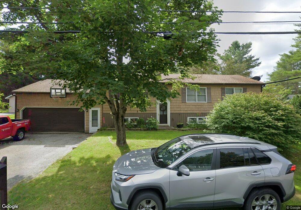
9 Mark St Lewiston, ME 04240
Estimated Value: $304,000 - $352,000
3
Beds
2
Baths
1,320
Sq Ft
$251/Sq Ft
Est. Value
About This Home
This home is located at 9 Mark St, Lewiston, ME 04240 and is currently estimated at $331,638, approximately $251 per square foot. 9 Mark St is a home located in Androscoggin County with nearby schools including Thomas J. McMahon Elementary School, Lewiston High School, and Trinity Catholic School.
Ownership History
Date
Name
Owned For
Owner Type
Purchase Details
Closed on
Jun 3, 2011
Sold by
Enman Jason A
Bought by
Pelletier Kristy
Current Estimated Value
Home Financials for this Owner
Home Financials are based on the most recent Mortgage that was taken out on this home.
Original Mortgage
$117,500
Interest Rate
4.85%
Mortgage Type
Purchase Money Mortgage
Create a Home Valuation Report for This Property
The Home Valuation Report is an in-depth analysis detailing your home's value as well as a comparison with similar homes in the area
Home Values in the Area
Average Home Value in this Area
Purchase History
| Date | Buyer | Sale Price | Title Company |
|---|---|---|---|
| Pelletier Kristy | -- | -- |
Source: Public Records
Mortgage History
| Date | Status | Borrower | Loan Amount |
|---|---|---|---|
| Closed | Pelletier Kristy | $117,500 |
Source: Public Records
Tax History Compared to Growth
Tax History
| Year | Tax Paid | Tax Assessment Tax Assessment Total Assessment is a certain percentage of the fair market value that is determined by local assessors to be the total taxable value of land and additions on the property. | Land | Improvement |
|---|---|---|---|---|
| 2025 | $3,723 | $113,570 | $23,760 | $89,810 |
| 2024 | $3,608 | $113,570 | $23,760 | $89,810 |
| 2023 | $3,407 | $113,570 | $23,760 | $89,810 |
| 2022 | $3,237 | $113,570 | $23,760 | $89,810 |
| 2021 | $3,209 | $113,570 | $23,760 | $89,810 |
| 2020 | $3,256 | $113,570 | $23,760 | $89,810 |
| 2019 | $3,283 | $113,570 | $23,760 | $89,810 |
| 2018 | $3,256 | $113,570 | $23,760 | $89,810 |
| 2017 | $3,182 | $113,570 | $23,760 | $89,810 |
| 2016 | $3,109 | $112,880 | $23,760 | $89,120 |
| 2015 | $3,090 | $112,880 | $23,760 | $89,120 |
| 2014 | $3,001 | $112,880 | $23,760 | $89,120 |
| 2013 | $2,985 | $112,880 | $23,760 | $89,120 |
Source: Public Records
Map
Nearby Homes