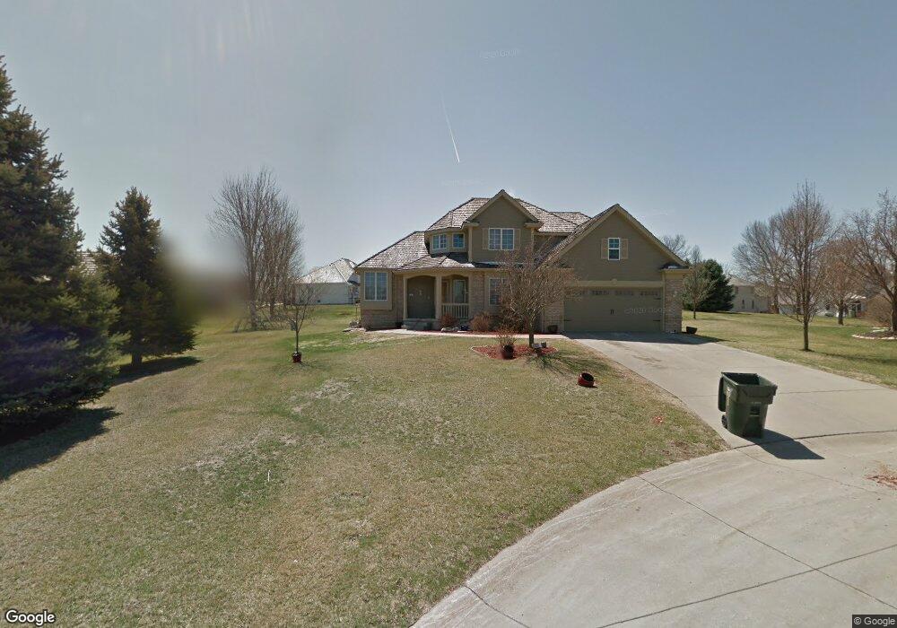
9 Maywood Cir Council Bluffs, IA 51503
Eastern Council Bluffs NeighborhoodEstimated Value: $474,026 - $593,000
4
Beds
5
Baths
3,154
Sq Ft
$166/Sq Ft
Est. Value
About This Home
This home is located at 9 Maywood Cir, Council Bluffs, IA 51503 and is currently estimated at $524,507, approximately $166 per square foot. 9 Maywood Cir is a home located in Pottawattamie County with nearby schools including E.A. Kreft Primary School, Titan Hill Intermediate School, and Lewis Central Middle School.
Ownership History
Date
Name
Owned For
Owner Type
Purchase Details
Closed on
Oct 26, 2021
Sold by
Western Iowa Land Development Llc
Bought by
Crouch Curtis W and Crouch Diane M
Current Estimated Value
Home Financials for this Owner
Home Financials are based on the most recent Mortgage that was taken out on this home.
Original Mortgage
$285,000
Outstanding Balance
$260,457
Interest Rate
2.8%
Mortgage Type
New Conventional
Estimated Equity
$264,050
Purchase Details
Closed on
Sep 1, 2021
Sold by
Goss Corey L and Goss Kelli
Bought by
Western Iowa Land Development Llc
Home Financials for this Owner
Home Financials are based on the most recent Mortgage that was taken out on this home.
Original Mortgage
$285,000
Outstanding Balance
$260,457
Interest Rate
2.8%
Mortgage Type
New Conventional
Estimated Equity
$264,050
Purchase Details
Closed on
May 23, 2005
Sold by
Anstey Jeffrey John and Anstey Kimberly K
Bought by
Goss Corey L
Home Financials for this Owner
Home Financials are based on the most recent Mortgage that was taken out on this home.
Original Mortgage
$240,000
Interest Rate
7.5%
Mortgage Type
Adjustable Rate Mortgage/ARM
Create a Home Valuation Report for This Property
The Home Valuation Report is an in-depth analysis detailing your home's value as well as a comparison with similar homes in the area
Home Values in the Area
Average Home Value in this Area
Purchase History
| Date | Buyer | Sale Price | Title Company |
|---|---|---|---|
| Crouch Curtis W | $365,000 | None Available | |
| Western Iowa Land Development Llc | $350,000 | None Available | |
| Goss Corey L | $300,000 | Mrt |
Source: Public Records
Mortgage History
| Date | Status | Borrower | Loan Amount |
|---|---|---|---|
| Open | Crouch Curtis W | $285,000 | |
| Previous Owner | Goss Corey L | $240,000 |
Source: Public Records
Tax History Compared to Growth
Tax History
| Year | Tax Paid | Tax Assessment Tax Assessment Total Assessment is a certain percentage of the fair market value that is determined by local assessors to be the total taxable value of land and additions on the property. | Land | Improvement |
|---|---|---|---|---|
| 2025 | $8,026 | $480,100 | $58,100 | $422,000 |
| 2024 | $8,026 | $459,300 | $50,500 | $408,800 |
| 2023 | $7,766 | $459,300 | $50,500 | $408,800 |
| 2022 | $6,826 | $337,800 | $56,600 | $281,200 |
| 2021 | $10,418 | $337,800 | $56,600 | $281,200 |
| 2020 | $7,154 | $337,800 | $56,600 | $281,200 |
| 2019 | $7,436 | $323,600 | $43,800 | $279,800 |
| 2018 | $7,270 | $323,600 | $43,800 | $279,800 |
| 2017 | $7,394 | $323,600 | $43,800 | $279,800 |
| 2015 | $7,270 | $323,600 | $43,800 | $279,800 |
| 2014 | $7,648 | $323,600 | $43,800 | $279,800 |
Source: Public Records
Map
Nearby Homes
- 131 Norwood Dr
- 411 Redwood Dr
- 128 Charles Park Dr
- 1759 Blackthorn St
- 1780 Blackthorn St
- 1768 Blackthorn St
- 1843 Sycamore St
- 1800 Sycamore St
- 208 Red Bud Ln
- 1742 Blackthorn St
- 1715 Blackthorn St
- 1711 Blackthorn St
- 20425 Greenview Rd
- 2526 Franklin Ave
- 31 Balsam Cir
- 23 Balsam Cir
- 20.57 AC. M L State Orchard Rd
- 200 Timber Dr
- 19 Balsam Cir
- 4 Balsam Cir
- 9 Maywood Ct
- 15 Maywood Cir
- 15 Maywood Ct
- 339 Golden Oaks Dr
- 335 Golden Oaks Dr
- 4 Aspen Ct
- 12 Maywood Cir
- 12 Maywood Ct
- 8 Aspen Ct
- 327 Golden Oaks Dr
- 139 Norwood Dr
- 143 Norwood Dr
- 8 Maywood Ct
- 135 Norwood Dr
- 147 Norwood Dr
- 12 Aspen Ct
- 323 Golden Oaks Dr
- 338 Golden Oaks Dr
- 127 Norwood Dr
- 330 Golden Oaks Dr